1970s Maps of Cherokee County, Kansas
Explore 7 historic maps of Cherokee County from the 1970s. These maps offer a rare glimpse into what life looked like during the 1970s — showing old roads, neighborhoods, homes, and landmarks that have changed or disappeared over time.
Whether you're researching your family's past, planning a metal detecting trip, or studying how Cherokee County's landscape evolved across the 1970s, these high-resolution maps are a powerful tool for exploring the history of this region.
- Focus on a specific era: All maps on this page are from the 1970s, giving you a focused view of this time period.
- See what’s changed: Compare century-old streets, trails, and buildings to today's modern landscape using overlays and satellite layers.
- Research with precision: Use these maps for genealogy, historical research, land use analysis, or educational projects.
- View, download, or print: Maps are fully viewable online in high resolution, and can be downloaded or printed for your own records.
Start exploring Cherokee County's history through authentic maps from the 1970s. This is your window into the past.
Cherokee County, KS maps
(7)- 1971 Map of Welch North, 1973 Print
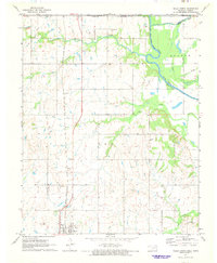 1971 Welch North1973 Print · USGSNortheastern Oklahoma and the Kansas borderlands appear in the early 1970s as a landscape of rural rail towns and prairie creek valleys. Trace the Missouri - Kansas - Texas rail line through Welch or locate family history at Russell Creek Cem and Maybelle Ch.
 - 1973 Map of West Mineral, 1975 Print
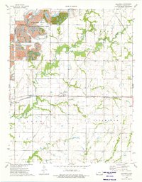
 1973 West Mineral1975 Print · USGSCherokee County’s coal mining landscape is on full display in the 1970s as industrial excavations reshape the Kansas plains. Genealogists and historians can locate family plots at Star Cem and Bowen Cem or trace the busy Missouri Pacific rail line.
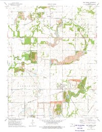
 - 1973 Map of Mc Cune, 1975 Print
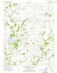 1973 Mc Cune1975 Print · USGSSoutheast Kansas in the early 1970s reveals a landscape shaped by the Neosho River and the industrial reach of the St Louis - San Francisco railroad. Researchers can locate the rural Service Valley Sch, several family cemeteries, and old mining sites like the southern Strip Mine.
 - 1974 Map of Melrose, 1975 Print
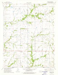 1974 Melrose1975 Print · USGSCherokee County at the Oklahoma border is shown here in the mid-1970s, where the Old Indian Treaty Boundary still defines the local geography. Researchers can trace the rural infrastructure of Melrose and Keelville, identifying long-standing sites like Greenlawn Sch and Fly Creek Cem.
 - 1974 Map of Hallowell, 1975 Print
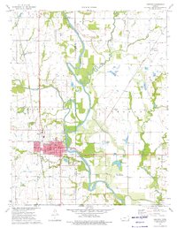
 1974 Hallowell1975 Print · USGSCherokee County at the height of the 1970s shows a landscape shaped by coal extraction and a transitioning rural economy. Local historians can trace the rail junction at Sherwin, the settlement of Hallowell, and family sites like Dove Cem and Edgmand Cem.
 - 1974 Map of Chetopa, 1976 Print
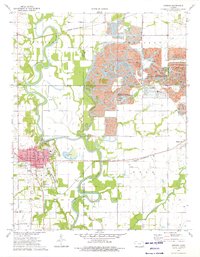
 1974 Chetopa1976 Print · USGSSoutheast Kansas in the mid-1970s reveals a landscape defined by the winding Neosho River and the industrial hub of Chetopa. Genealogists and historians can trace the Indian Treaty Boundary and locate historic burial grounds like Oak Hill Cem and St Rose Cem.
 - 1974 Map of Oswego, 1976 Print
 1974 Oswego1976 Print · USGSOswego and the eastern Kansas plains are captured in the mid-1970s at a time of transition for the local landscape. Genealogists can locate several rural landmarks including Tibbetts Cem, Sunnyview Sch, and the old Strip Pits State Wildlife Management Area mines.
End of results
Showing maps 1-7 of 7
Top cities of Cherokee County
- Baxter Springs historical maps
- Columbus historical maps
- Galena historical maps
- Weir historical maps
- Lowell historical maps
- Scammon historical maps
See more
Frequently asked questions
- What are the different types of historical maps available for Cherokee County?
- What is the oldest map of Cherokee County?
- Where can I purchase historical maps of Cherokee County for my home or office?
- Where can I download high-res historical maps of Cherokee County?
- Are there historical topographic maps available for Cherokee County?
- Is there historical aerial imagery available for Cherokee County?
- Where are historical maps of Cherokee County sourced from?