1900s (20th Century) Maps of Comanche County, Kansas
Explore 31 historic maps of Comanche County from the 1900s (20th Century). These maps offer a rare glimpse into what life looked like during the 1900s — showing old roads, neighborhoods, homes, and landmarks that have changed or disappeared over time.
Whether you're researching your family's past, planning a metal detecting trip, or studying how Comanche County's landscape evolved across the 1900s, these high-resolution maps are a powerful tool for exploring the history of this region.
- Focus on a specific era: All maps on this page are from the 1900s, giving you a focused view of this time period.
- See what’s changed: Compare century-old streets, trails, and buildings to today's modern landscape using overlays and satellite layers.
- Research with precision: Use these maps for genealogy, historical research, land use analysis, or educational projects.
- View, download, or print: Maps are fully viewable online in high resolution, and can be downloaded or printed for your own records.
Start exploring Comanche County's history through authentic maps from the 1900s. This is your window into the past.
Comanche County, KS maps
(31)- 1955 Map of Woodward, 1967 Print
 1955 Woodward1967 Print · USGSNorthwest Oklahoma and the bordering plains are captured during the mid-sixties, showing a landscape defined by river valleys and massive water projects. Researchers can trace family roots in towns like Woodward and Alva or locate landmarks such as the Western Oklahoma State Hospital and Kegelman AF.3 unique versions available
 - 1955 Map of Pratt, 1968 Print
 1955 Pratt1968 Print · USGSSouth-central Kansas during the mid-fifties presents a landscape of sprawling oil fields and critical rail junctions. Researchers can trace the paths of the Atchison Topeka and Santa Fe railroad or locate local landmarks like the Blue Ridge Community House and Camp Carlisle.3 unique versions available
 - 1958 Map of Woodward
 1958 Woodward1958 Print · USGSNorthwest Oklahoma and the neighboring panhandle borders are shown here during a period of steady mid-century growth. Researchers can trace the rail networks of the Atchison Topeka and Santa Fe and locate landmarks like the Western Oklahoma State Hospital and Port Supply Reservoir.2 unique versions available
 - 1959 Map of Pratt
 1959 Pratt1959 Print · USGSSouth-central Kansas thrived as a rail and agricultural hub in the late fifties, where the Arkansas River meets a vast grid of section roads. Researchers can trace the path of the Missouri Pacific railroad through settlements like Turon and Stafford, or locate family landmarks like the Prairie Oak School.2 unique versions available
 - 1968 Map of Wilmore SE, 1970 Print
 1968 Wilmore SE1970 Print · USGSComanche County was a landscape of active energy extraction and winding prairie streams in the late sixties. Genealogists and researchers can trace the drainage of Mule Creek and locate early infrastructure like the Glick Oil and Gas Field and Baker Canyon.
 - 1968 Map of Belvidere, 1970 Print
 1968 Belvidere1970 Print · USGSThe rail-and-river corridor of southeastern Kiowa County comes alive in the late sixties, centered on the settlement of Belvidere. Local historians can trace the Atchison Topeka and Santa Fe line as it follows the Medicine Lodge River past the Belvidere Cem and into the Glick Oil and Gas Field.
 - 1970 Map of Lookout, 1972 Print
 1970 Lookout1972 Print · USGSThe Oklahoma-Kansas borderlands in the early 1970s reveal a landscape shaped by the energy industry and rural community life. Researchers can trace the sprawling Patterson Oil and Gas Field and locate landmarks like Lookout Ch and the Coy Community Hall.
 - 1970 Map of Freedom NE, 1972 Print
 1970 Freedom NE1972 Print · USGSThe Oklahoma-Kansas state line area in the early seventies shows a landscape of drainage creeks and rural industry. Researchers can trace the development of the plains via local landmarks like Yellowstone Creek, several Gas Wells, and the Landing Strip.
 - 1970 Map of Freedom NW, 1972 Print
 1970 Freedom NW1972 Print · USGSThe Oklahoma-Kansas borderlands in the early 1970s are captured here, showing the rural townships of Patterson and Obryan. Genealogists and historians can trace local landmarks like Cowboy Cem and the drainage of Moccasin Creek.
 - 1970 Map of Selman NW, 1973 Print
 1970 Selman NW1973 Print · USGSThe Oklahoma-Kansas borderlands come into focus in the early 1970s as industrial exploration meets traditional ranching. Local researchers can locate the Lutheran Cem, the rural settlement of Lodge, and numerous Gas Wells along the Cimarron River.
 - 1970 Map of Buffalo NE, 1973 Print
 1970 Buffalo NE1973 Print · USGSThe Oklahoma-Kansas state line north of Buffalo is documented here during the early 1970s, showcasing a rural landscape of ranching and oil extraction. Researchers can locate community centers like the Paruna Community Hall and trace family sites at Willow Creek Cem.
 - 1979 Map of Sugarloaf, 1980 Print
 1979 Sugarloaf1980 Print · USGSThe Kansas borderlands between Sitka and Protection come into focus during the late seventies, showing a landscape shaped by rail and energy. Trace the path of the Atchison Topeka and Santa Fe or explore the local Gas Field and the distinctive Sugarloaf rise.2 unique versions available
 - 1979 Map of Turkey Creek, 1980 Print
 1979 Turkey Creek1980 Print · USGSSouthwest Kansas prairie land is captured here in the late seventies, showing the intersection of several historic townships and county lines. Researchers can trace the Old Indian Treaty Boundary and locate early energy infrastructure like the Gas Well sites near West Kiowa Creek.
 - 1979 Map of Coldwater, 1980 Print
 1979 Coldwater1980 Print · USGSColdwater and the surrounding Comanche County prairie are shown here in the late seventies, centered on a thriving rail-and-ranching hub. Genealogists and local historians can locate Crown Hill Cemetery, the High Sch, and the winding path of Cavalry Creek.
 - 1979 Map of East Kiowa Creek South, 1980 Print
 1979 East Kiowa Creek South1980 Print · USGSComanche County is shown in the mid-1970s as a landscape shaped by the drainage of East Kiowa Creek and Middle Kiowa Creek. Researchers can trace old section lines and infrastructure between Protection and Coldwater, including the paths of several pipelines.
 - 1979 Map of East Kiowa Creek North, 1980 Print
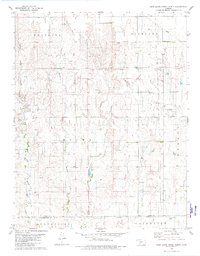 1979 East Kiowa Creek North1980 Print · USGSSouthern Kansas ranching and energy land is captured here in the late seventies, centered on the Old Indian Treaty Boundary. Researchers can trace early infrastructure through an active Oil Field and creek networks like Mule Creek.
 - 1979 Map of Lexington, 1980 Print
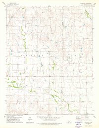 1979 Lexington1980 Print · USGSThe Kansas prairie at the Clark and Comanche county line comes to life in this late-seventies survey. Genealogists and researchers can trace local family landmarks and rural infrastructure near Lexington, including the Lexington Cem and Community Hall.2 unique versions available
 - 1979 Map of Protection NE, 1980 Print
 1979 Protection NE1980 Print · USGSComanche County's rural townships and water features are documented here in the late seventies. Genealogists and land researchers can trace property boundaries and landmarks like Avilla Cem, Camp Lark, and the Gas Wells north of Nescatunga Creek.
 - 1979 Map of Nescatunga Creek South, 1980 Print
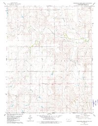 1979 Nescatunga Creek South1980 Print · USGSThe Kansas and Oklahoma borderlands are captured here in the late seventies, showing a landscape defined by the Old Indian Treaty Boundary. Trace the paths of the Salt Fork Arkansas River and Nescatunga Creek through these rural ranges.
 - 1979 Map of Trout Creek, 1980 Print
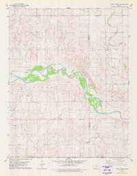 1979 Trout Creek1980 Print · USGSThe southern Kansas plains meet the winding Cimarron River in the late seventies. Researchers can locate specific energy infrastructure like the Oil and Gas Field and Gas Well or trace local landmarks like Slupe Landing Field.
 - 1980 Map of Nescatunga Creek North
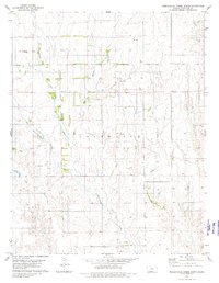 1980 Nescatunga Creek North1980 Print · USGSComanche County during the late 1970s is shown here as a landscape of deep creek drainages and quiet prairie settlements. Researchers can locate the Nescatunga Cem, an isolated Grave, and numerous rural energy markers like a Gas Well or Drill Hole.
 - 1980 Map of Protection SW
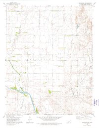 1980 Protection SW1980 Print · USGSComanche County during the late 1970s reveals a prairie landscape shaped by historic demarcations and river systems. Genealogists and historians can trace the Old Indian Treaty Boundary and locate the Mennonite Cem near the banks of Cavalry Creek.
 - 1980 Map of Protection
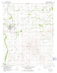 1980 Protection1980 Print · USGSThe town of Protection was a well-established rail and prairie hub when this survey was completed in the late 1970s. Researchers can trace the local infrastructure from the Protection Cem and Municipal Airport to the southern Oil Field and the Atchison Topeka and Santa Fe line.
 - 1980 Map of Wilmore
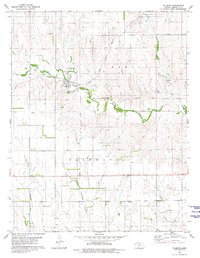 1980 Wilmore1980 Print · USGSWilmore and the surrounding Comanche County prairies are captured here during the late twentieth century, showing a landscape defined by ranching and energy. Genealogists can locate the Township Cem and follow the Atchison Topeka and Santa Fe rail line through Wilmore.
 - 1980 Map of Coldwater NE
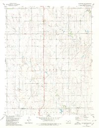 1980 Coldwater NE1980 Print · USGSThe high plains of south-central Kansas are captured here as the energy economy and old frontier lines intersect in the early 1980s. Researchers can trace the Old Indian Treaty Boundary and locate small landmarks like the settlement at Harold or several Gas Well sites.
Showing maps 1-25 of 31
Top cities of Comanche County
Frequently asked questions
- What are the different types of historical maps available for Comanche County?
- What is the oldest map of Comanche County?
- Where can I purchase historical maps of Comanche County for my home or office?
- Where can I download high-res historical maps of Comanche County?
- Are there historical topographic maps available for Comanche County?
- Is there historical aerial imagery available for Comanche County?
- Where are historical maps of Comanche County sourced from?