1800s (19th Century) Maps of Gray County, Kansas
Explore 3 historic maps of Gray County from the 1800s (19th Century). These maps offer a rare glimpse into what life looked like during the 1800s — showing old roads, neighborhoods, homes, and landmarks that have changed or disappeared over time.
Whether you're researching your family's past, planning a metal detecting trip, or studying how Gray County's landscape evolved across the 1800s, these high-resolution maps are a powerful tool for exploring the history of this region.
- Focus on a specific era: All maps on this page are from the 1800s, giving you a focused view of this time period.
- See what’s changed: Compare century-old streets, trails, and buildings to today's modern landscape using overlays and satellite layers.
- Research with precision: Use these maps for genealogy, historical research, land use analysis, or educational projects.
- View, download, or print: Maps are fully viewable online in high resolution, and can be downloaded or printed for your own records.
Start exploring Gray County's history through authentic maps from the 1800s. This is your window into the past.
Gray County, KS maps
(3)- 1892 Map of Meade
 1892 Meade1892 Print · USGSSouthwestern Kansas at the end of the nineteenth century centers on the growing rail hub of Meade. Genealogists and historians can trace early prairie settlements and rail stops like Fowler, Minneola, and the riverside site of Odee.5 unique versions available
 - 1892 Map of Dodge
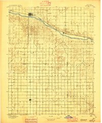
 1892 Dodge1892 Print · USGSWestern Kansas at the close of the nineteenth century centers on the vital Arkansas River valley and its competing rail lines. Genealogists and historians can trace early prairie settlements like Montezuma, Ensign, and Cimarron alongside the namesake hub of Dodge.4 unique versions available
 - 1896 Map of Garden
 1896 Garden1896 Print · USGSFinney and Haskell counties come into focus during the late nineteenth century as the railroad transformed the High Plains. Genealogists and researchers can trace the early footprints of Garden and Santa Fe or locate prairie outposts like Ivanhoe and Pierceville.4 unique versions available
End of results
Showing maps 1-3 of 3
Top cities of Gray County
- Cimarron historical maps
- Montezuma historical maps
- Copeland historical maps
- Ingalls historical maps
- Ensign historical maps
Frequently asked questions
- What are the different types of historical maps available for Gray County?
- What is the oldest map of Gray County?
- Where can I purchase historical maps of Gray County for my home or office?
- Where can I download high-res historical maps of Gray County?
- Are there historical topographic maps available for Gray County?
- Is there historical aerial imagery available for Gray County?
- Where are historical maps of Gray County sourced from?