1970s Maps of Gray County, Kansas
Explore 5 historic maps of Gray County from the 1970s. These maps offer a rare glimpse into what life looked like during the 1970s — showing old roads, neighborhoods, homes, and landmarks that have changed or disappeared over time.
Whether you're researching your family's past, planning a metal detecting trip, or studying how Gray County's landscape evolved across the 1970s, these high-resolution maps are a powerful tool for exploring the history of this region.
- Focus on a specific era: All maps on this page are from the 1970s, giving you a focused view of this time period.
- See what’s changed: Compare century-old streets, trails, and buildings to today's modern landscape using overlays and satellite layers.
- Research with precision: Use these maps for genealogy, historical research, land use analysis, or educational projects.
- View, download, or print: Maps are fully viewable online in high resolution, and can be downloaded or printed for your own records.
Start exploring Gray County's history through authentic maps from the 1970s. This is your window into the past.
Gray County, KS maps
(5)- 1974 Map of Horse Thief Canyon SW, 1976 Print
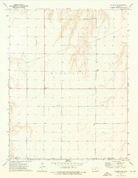
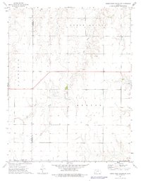 1974 Horse Thief Canyon SW1976 Print · USGSWestern Kansas at the height of the 1970s reveals a quiet landscape of prairie townships and resource extraction. Researchers can trace land use through a network of Gravel Pits and wells located near Sand Creek and North Roscoe.
 - 1974 Map of Kalvesta, 1976 Print
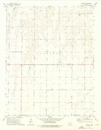 1974 Kalvesta1976 Print · USGSFinney and Gray counties are documented here in the mid-1970s, showcasing a rural landscape defined by prairie crossroads and seasonal waterways. Genealogists and historians can trace local landmarks like Kalvesta, the extraction at Caliche Pit, and the course of Sand Creek.
 - 1974 Map of Scott City 4 SW, 1976 Print
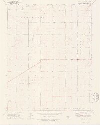 1974 Scott City 4 SW1976 Print · USGSFinney and Gray counties in the mid-1970s reveal a landscape of sparse prairie and growing energy extraction. Researchers can trace the layout of Pleasant Valley and Pierceville townships, punctuated by an Oil Field and scattered Gas Wells.2 unique versions available
 - 1974 Map of Scott City 4 SE, 1976 Print
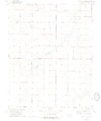 1974 Scott City 4 SE1976 Print · USGSThe high plains of western Kansas are captured here during the mid-1970s, showing the rural landscape along the Pawnee River. Genealogists and local researchers can locate the Theoni Sch and numerous water sources such as a Spring and several Wells.2 unique versions available
 - 1974 Map of Kalvesta SW, 1976 Print
 1974 Kalvesta SW1976 Print · USGSFinney and Gray Counties during the mid-1970s show a landscape of quiet utility where the High Plains meet the Pawnee River. Researchers can trace the path of a cross-country Pipeline or locate local landmarks like Bond and the Pawnee Acres Community Hall.
End of results
Showing maps 1-5 of 5
Top cities of Gray County
- Cimarron historical maps
- Montezuma historical maps
- Copeland historical maps
- Ingalls historical maps
- Ensign historical maps
Frequently asked questions
- What are the different types of historical maps available for Gray County?
- What is the oldest map of Gray County?
- Where can I purchase historical maps of Gray County for my home or office?
- Where can I download high-res historical maps of Gray County?
- Are there historical topographic maps available for Gray County?
- Is there historical aerial imagery available for Gray County?
- Where are historical maps of Gray County sourced from?