Old Maps of Gray County, Kansas for Metal Detecting
Plan your next treasure hunt with 191 historic maps of Gray County. Find old homesites, ghost towns, trails, and gathering spots that may be lost to time — perfect for identifying promising metal detecting locations.
- Locate forgotten sites: Uncover places like long-lost settlements, abandoned rail lines, or gathering spots.
- Plan better hunts: Use map overlays combined with LiDAR or satellite views to narrow in on historically rich areas.
- Made for detectorists: Thousands of hobbyists use these maps to discover relics, coins, and hidden history.
Use these historic maps to boost your research and find new opportunities beneath the surface of Gray County.
Gray County, KS maps
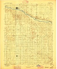
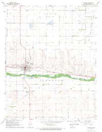
(191)- 1892 Map of Meade
 1892 Meade1892 Print · USGSSouthwestern Kansas at the end of the nineteenth century centers on the growing rail hub of Meade. Genealogists and historians can trace early prairie settlements and rail stops like Fowler, Minneola, and the riverside site of Odee.5 unique versions available
 - 1892 Map of Dodge
 1892 Dodge1892 Print · USGSWestern Kansas at the close of the nineteenth century centers on the vital Arkansas River valley and its competing rail lines. Genealogists and historians can trace early prairie settlements like Montezuma, Ensign, and Cimarron alongside the namesake hub of Dodge.4 unique versions available
 - 1896 Map of Garden
 1896 Garden1896 Print · USGSFinney and Haskell counties come into focus during the late nineteenth century as the railroad transformed the High Plains. Genealogists and researchers can trace the early footprints of Garden and Santa Fe or locate prairie outposts like Ivanhoe and Pierceville.4 unique versions available
 - 1955 Map of Dodge City, 1968 Print
 1955 Dodge City1968 Print · USGSSouthwest Kansas in the mid-fifties reveals an expansive landscape of cattle towns, early gas fields, and prairie outposts. Researchers can trace rural school districts like Moundview and Good Luck or locate the Kansas State Game Farm near Lakin.3 unique versions available
 - 1955 Map of Scott City, 1969 Print
 1955 Scott City1969 Print · USGSWestern Kansas in the mid-fifties is captured here as a landscape of rural schoolhouses and significant rail corridors. Family historians can trace the locations of Skyline and Beaver Creek Schools or follow the Union Pacific line through Oakley and Sharon Springs.4 unique versions available
 - 1958 Map of Dodge City
 1958 Dodge City1958 Print · USGSSouthwest Kansas in the late fifties shows a landscape of river-valley agriculture and burgeoning energy infrastructure. Genealogists can trace rural life through numerous landmarks like Fairview Cemetery, the Goodwell School, and Concord Church.
 - 1958 Map of Scott City
 1958 Scott City1958 Print · USGSWestern Kansas at the peak of the post-war era reveals a landscape of high-plains agriculture and vital rail junctions. Genealogists and historians can trace old country school sites like Prairie Bell School, the landmark Chalk Pyramids, and small stops along the Union Pacific and Missouri Pacific.
 - 1959 Map of Dodge City
 1959 Dodge City1959 Print · USGSSouthwest Kansas in the mid-fifties is captured at its agricultural height, centered on the vital rail and river hubs of Dodge City and Garden City. Genealogists and local historians can trace rural school districts like Shockey School and Hickok School or locate the Fairview Cemetery.
 - 1967 Map of Pierceville SW, 1969 Print
 1967 Pierceville SW1969 Print · USGSThe Kansas high plains meet the winding Arkansas River in the late 1960s, capturing a moment of agricultural and industrial expansion. Researchers can trace the path of the Atchison Topeka and Santa Fe railroad or locate numerous Gas Wells across the prairie.
 - 1967 Map of Pierceville, 1969 Print
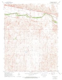
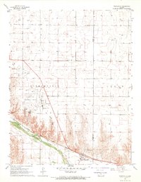 1967 Pierceville1969 Print · USGSThe Arkansas River valley in the mid-1960s serves as a hub for transport and energy between Finney and Gray counties. Researchers can trace the rail corridor of the Atchison Topeka and Santa Fe through Pierceville and locate the Pierceville Cem.
 - 1967 Map of Plains NE, 1969 Print
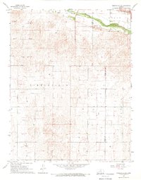
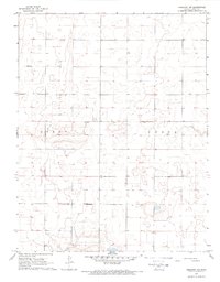
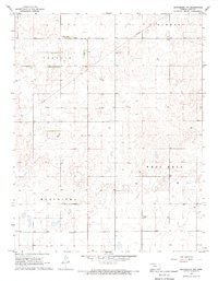
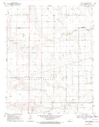
 1967 Plains NE1969 Print · USGSThe High Plains of Meade and Gray Counties are captured here in the late sixties, a landscape of section lines and deep-well agriculture. Researchers can locate the Mertilla Cem and trace the drainage patterns around Wildhorse Lake and Spring Cr.
 - 1968 Map of Cimarron NW, 1969 Print
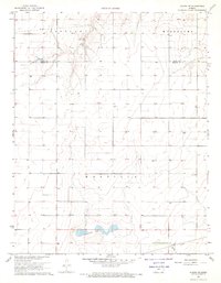
 1968 Cimarron NW1969 Print · USGSWestern Kansas agricultural lands are captured in the late sixties as the grid of Logan and Foote townships took shape. Researchers can trace the distribution of rural water sources through numerous mapped wells across this prairie landscape.
 - 1968 Map of Montezuma, 1969 Print
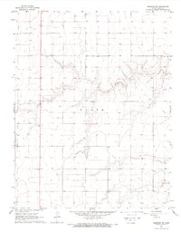
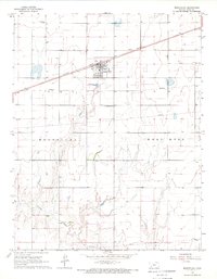 1968 Montezuma1969 Print · USGSMontezuma and the surrounding Gray County plains are shown here in the late sixties, centered on the Atchison Topeka and Santa Fe rail line. Researchers can trace local heritage at the Evans Cem or locate the Silica Pit and Gospel Fellowship Ch.
 - 1968 Map of Ingalls, 1969 Print
 1968 Ingalls1969 Print · USGSGray County life in the late sixties centers on the riverfront town of Ingalls, where the railroad and water meet. Trace local history through the Ingalls-Logan Cem or examine the local industry at the Gravel Pit and Feed Lot.
 - 1968 Map of Dodge City NW, 1969 Print
 1968 Dodge City NW1969 Print · USGSThe High Plains of Western Kansas appear in the late sixties at the intersection of Gray, Hodgeman, and Ford counties. Genealogists and researchers can trace the rural landscape across South Roscoe and Royal, following Buckner Creek and its South Fork.2 unique versions available
 - 1968 Map of Montezuma NW, 1969 Print
 1968 Montezuma NW1969 Print · USGSGray County was defined by its agricultural layout in the late sixties, where township lines like Ingalls and Montezuma met. Researchers can trace land tracts through a web of field lines, finding landmarks like Gray Center and Fairview Cem.
 - 1968 Map of Cimarron, 1969 Print
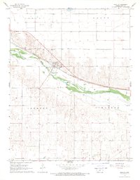
 1968 Cimarron1969 Print · USGSCimarron and the surrounding plains of Gray County are shown in detail during the late sixties, centered on the river and rail corridors. Researchers can find local landmarks like the Cimarron townsite, the Ch of God in Christ, and the historic Cimarron Crossing Park.
 - 1968 Map of Cimarron NE, 1969 Print
 1968 Cimarron NE1969 Print · USGSWestern Kansas agricultural lands in the late sixties are captured here in high detail across the township of Foote. Genealogists and researchers can trace local water sources like Buckner Creek and identify property landmarks such as a rural Landing Strip.
 - 1968 Map of Charleston, 1969 Print
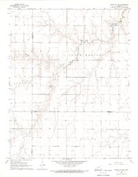
 1968 Charleston1969 Print · USGSThe Arkansas River valley in western Kansas is captured here during the late sixties as the region's agricultural and transit networks matured. Genealogists and historians can trace the settlement at Charleston and the path of the Atchison Topeka and Santa Fe railroad.
 - 1968 Map of Pierceville NE, 1969 Print
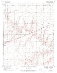
 1968 Pierceville NE1969 Print · USGSGray County, Kansas, is captured in the late sixties when a quiet agricultural grid defined the local landscape. Genealogists and historians can trace old property lines and water sources through numerous Wells and sites like the Ingalls Landing Strip.
 - 1968 Map of Plains NW, 1969 Print
 1968 Plains NW1969 Print · USGSThe high plains at the corner of Haskell, Meade, and Seward counties are captured here in the late sixties during a period of expanding energy infrastructure. Researchers can locate family-named landmarks like Ellsaesser Pond and trace township boundaries from Lockport to Morris.2 unique versions available
 - 1968 Map of Meade NW, 1969 Print
 1968 Meade NW1969 Print · USGSSouthwestern Kansas during the late 1960s reveals a quiet landscape of agricultural sections and energy development. Researchers can trace the winding path of Crooked Creek and locate numerous resource wells scattered across Meridilla and West Hess.
 - 1968 Map of Dodge City SW, 1969 Print
 1968 Dodge City SW1969 Print · USGSThe Arkansas River valley west of Dodge City is shown here in the late sixties, where the Atchison Topeka and Santa Fe railroad defines the corridor. Researchers can locate the Ridenour Cem, the Townhall at Howell, and traces of an Abandoned Canal along the river bank.2 unique versions available
 - 1969 Map of Meade NE, 1971 Print
 1969 Meade NE1971 Print · USGSMeade and Gray counties are captured here in the late sixties, showcasing a landscape of High Plains industry and drainage. Genealogists and historians can trace industrial landmarks like the Cudahay Mine, the Silica Pit, and the winding course of Crooked Creek.
 - 1969 Map of Copeland SE, 1971 Print
 1969 Copeland SE1971 Print · USGSGray County, Kansas, is captured in the late sixties as a landscape defined by industrial transit and prairie drainage. Genealogists and historians can trace the diagonal path of the Atchison Topeka and Santa Fe railroad near Copeland and the course of Crooked Creek.
Showing maps 1-25 of 191
Top cities of Gray County
- Cimarron historical maps
- Montezuma historical maps
- Copeland historical maps
- Ingalls historical maps
- Ensign historical maps
Frequently asked questions
- What are the different types of historical maps available for Gray County?
- What is the oldest map of Gray County?
- Where can I purchase historical maps of Gray County for my home or office?
- Where can I download high-res historical maps of Gray County?
- Are there historical topographic maps available for Gray County?
- Is there historical aerial imagery available for Gray County?
- Where are historical maps of Gray County sourced from?