
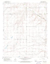
1969 Map of Meade NE
USGS Topo · Published 1971About this map
Crooked Creek meanders through this portion of the High Plains, carving a distinct path across a landscape defined by broad upland flats and wide valley floors. In the late 1960s, the region's economy is clearly anchored in both its geology and its infrastructure. To the south, the industrial extraction of resources is evident at the Cudahay Mine and a nearby Silica Pit, located where the terrain transitions into the Artesian Valley. This map captures a moment when traditional land use is increasingly intersected by modern utilities, as multiple pipelines cut straight paths across the natural contours of West Hess and East Hess. The surveyor's notes reveal a land of subtle relief, where the agricultural and industrial potential of Fowler Valley is supported by numerous wells scattered across the open plains.
Find a feature on this map
11 named features on this map. Tap any name to fly to it.
Don’t see what you’re looking for? This feature index may not catch every label — zoom into the map to look around manually.
Map Details
Editions of this 1969 Meade NE Map
This is the sole edition of this map. No revisions or reprints were ever made.
Other maps of this area

1892 · Meade
USGS Topo · 1:125,000

1892 · Dodge
USGS Topo · 1:125,000

1955 · Dodge City
USGS Topo · 1:250,000

1958 · Dodge City
USGS Topo · 1:250,000

1959 · Dodge City
USGS Topo · 1:250,000

1963 · Meade
USGS Topo · 1:24,000

1963 · Missler
USGS Topo · 1:24,000

1967 · Fowler SW
USGS Topo · 1:24,000

1968 · Montezuma
USGS Topo · 1:24,000
1968 · Meade NW
USGS Topo · 1:24,000