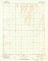
1974 Map of Kalvesta SW
USGS Topo · Published 1976About this map
The Pawnee River winds through this rural section of Finney and Gray Counties in the mid-1970s, defining a landscape marked by agricultural infrastructure and energy transport. A massive Pipeline cuts diagonally across the northern terrain, reflecting the region's role in the industrial network of Western Kansas. Settlement is sparse, with local life centered around points like the Pawnee Acres Community Hall and the small landmark of Bond. Local aviation and communication needs are evident through the inclusion of a private Landing Strip and a prominent Radio Tower. The intersection of state history and modern utility is further highlighted by the presence of a Rest Area along the main transit route and a Gravel Pit near the southern border, indicating local extraction and road maintenance in this quiet stretch of the High Plains.
Find a feature on this map
13 named features on this map. Tap any name to fly to it.
Don’t see what you’re looking for? This feature index may not catch every label — zoom into the map to look around manually.
Map Details
Editions of this 1974 Kalvesta SW Map
This is the sole edition of this map. No revisions or reprints were ever made.
Other maps of this area

1892 · Dodge
USGS Topo · 1:125,000

1896 · Garden
USGS Topo · 1:125,000

1955 · Dodge City
USGS Topo · 1:250,000

1955 · Scott City
USGS Topo · 1:250,000

1958 · Dodge City
USGS Topo · 1:250,000

1958 · Scott City
USGS Topo · 1:250,000

1959 · Dodge City
USGS Topo · 1:250,000

1968 · Cimarron NW
USGS Topo · 1:24,000

1968 · Cimarron NE
USGS Topo · 1:24,000
1968 · Pierceville NE
USGS Topo · 1:24,000