1900s (20th Century) Maps of Greenwood County, Kansas
Explore 60 historic maps of Greenwood County from the 1900s (20th Century). These maps offer a rare glimpse into what life looked like during the 1900s — showing old roads, neighborhoods, homes, and landmarks that have changed or disappeared over time.
Whether you're researching your family's past, planning a metal detecting trip, or studying how Greenwood County's landscape evolved across the 1900s, these high-resolution maps are a powerful tool for exploring the history of this region.
- Focus on a specific era: All maps on this page are from the 1900s, giving you a focused view of this time period.
- See what’s changed: Compare century-old streets, trails, and buildings to today's modern landscape using overlays and satellite layers.
- Research with precision: Use these maps for genealogy, historical research, land use analysis, or educational projects.
- View, download, or print: Maps are fully viewable online in high resolution, and can be downloaded or printed for your own records.
Start exploring Greenwood County's history through authentic maps from the 1900s. This is your window into the past.
Greenwood County, KS maps
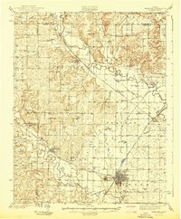
(60)- 1938 Map of Fredonia, 1965 Print
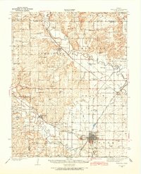 1938 Fredonia1965 Print · USGSSoutheast Kansas in the late thirties is revealed here as a bustling network of rail-side towns and rural school districts. Genealogists can trace family roots through dozens of local landmarks like Caley Cem, Leeper Bridge, and the St Francis Ch.2 unique versions available
 - 1939 Map of Fredonia
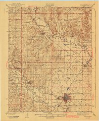
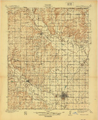 1939 Fredonia1939 Print · USGSThe river valleys of Wilson and Woodson counties are captured here in the late 1930s, showing a landscape defined by agriculture and rail. Genealogists can trace rural family roots through dozens of local school sites like Forty Four Sch and Ten Penny Sch, or the streets of Fredonia and Coyville.2 unique versions available
 - 1939 Map of Severy, 1966 Print
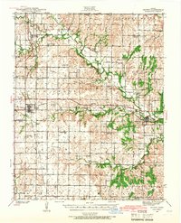 1939 Severy1966 Print · USGSSoutheast Kansas at the close of the 1930s reveals a landscape of rural schoolhouses and busy rail junctions. Genealogists and historians can trace the foundations of Severy or locate family plots at Twin Grove Cem and South Lawn Cem.2 unique versions available
 - 1941 Map of Severy
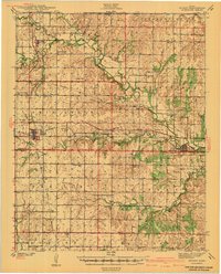 1941 Severy1941 Print · USGSGreenwood and Elk Counties are shown here just before the Second World War, centered on the busy rail junction at Severy. Researchers can trace dozens of rural schoolhouses and cemeteries, including the Lone Star Cem, Antioch Ch, and the vanished settlement at Ashley.3 unique versions available
 - 1942 Map of Fredonia
 1942 Fredonia1942 Print · USGSThe rail crossroads at Fredonia and the winding river valleys of Wilson County are captured here just before the mid-century. Genealogists can trace rural life through dozens of local landmarks like Old Taylor Cem, Coyville, and the Needmore Sch.
 - 1943 Map of Fredonia
 1943 Fredonia1943 Print · USGSSoutheast Kansas at the dawn of the 1940s reveals a landscape of river-valley towns and dozens of rural school districts. Genealogists can trace family footprints through numerous country schools like Ten Penny Sch and the Jackson Cem near New Albany.2 unique versions available
 - 1947 Map of Lawrence, 1954 Print
 1947 Lawrence1954 Print · USGSEastern Kansas and western Missouri thrive in the late 1940s, showing a landscape defined by major river valleys and a dense railway network. Genealogists can trace family settlements from Lawrence to Greenwood and locate landmarks like Olathe Navy and Lake Lotawana.
 - 1947 Map of Joplin, 1954 Print
 1947 Joplin1954 Print · USGSThe borderlands of Missouri, Kansas, and Oklahoma are shown here during the late 1940s, a period of heavy industrial and military activity. Researchers can trace the extensive Tri-State Mining District, the layout of Camp Crowder, and local landmarks like Mount Hope Cem.
 - 1949 Map of Joplin
 1949 Joplin1949 Print · USGSThe Kansas-Missouri borderlands thrive in the late 1940s, showing a robust network of railroad towns and river valleys. Researchers can trace historic rail lines like the Missouri Pacific RR and locate rural centers such as Chanute, Iola, and Fort Scott.
 - 1950 Map of Lawrence
 1950 Lawrence1950 Print · USGSMid-century Kansas and Missouri come alive in this map of the river-valley corridors just as the interstate era was beginning. Researchers can trace the legacy of major rail lines like the Union Pacific RR and locate ancestral roots in towns from Lawrence to Harrisonville.
 - 1954 Map of Joplin, 1967 Print
 1954 Joplin1967 Print · USGSThe tri-state border region of Kansas, Missouri, and Oklahoma is captured here during a peak era of mid-century industrial and agricultural activity. Researchers can trace family history through dozens of rural cemeteries or locate landmarks like the Kansas Army Ammunition Plant and Pittsburg State University.3 unique versions available
 - 1955 Map of Wichita, 1959 Print
 1955 Wichita1959 Print · USGSSouth-central Kansas comes alive in the mid-1950s as Wichita grows into its role as a regional industrial and military powerhouse. Trace the rail-and-river network connecting El Dorado and Arkansas City through the Atchison Topeka and Santa Fe lines.3 unique versions available
 - 1955 Map of Hutchinson, 1967 Print
 1955 Hutchinson1967 Print · USGSCentral Kansas in the mid-sixties reveals a landscape of growing reservoirs and evolving transportation corridors. Trace the development of towns like Hutchinson and Abilene alongside the Union Pacific Railroad and the expanding Interstate 70.3 unique versions available
 - 1956 Map of Lawrence, 1967 Print
 1956 Lawrence1967 Print · USGSEastern Kansas and the Missouri border country are captured here during the mid-century transition to the interstate era. Genealogists and local historians can trace family-named terrain like Summers Mound and the footprint of Sunflower Ordnance Works near Baldwin City.4 unique versions available
 - 1958 Map of Wichita
 1958 Wichita1958 Print · USGSSouth Central Kansas in the late fifties was a landscape of aviation industry, oil exploration, and expanding turnpikes. Researchers can trace mid-century growth through McConnell Air Force Base, major facilities for Cessna Aircraft Company, and the active El Dorado Oil Field.
 - 1958 Map of Joplin
 1958 Joplin1958 Print · USGSThe tri-state border region of Missouri, Kansas, and Oklahoma is shown during the late fifties, a time of heavy rail traffic and mining activity. Local historians can trace the industrial landscape through the Joplin & Pittsburg Ry or locate family sites like Zion Ch and Bender Mounds.
 - 1959 Map of Hutchinson
 1959 Hutchinson1959 Print · USGSCentral Kansas thrives at the intersection of rail and river in the mid-1950s, as post-war aviation infrastructure reshapes the prairie. Genealogists and historians can trace the paths of the AT&SF RR through Newton and Hutchinson, or locate military sites like Smoky Hill Air Force Base.2 unique versions available
 - 1959 Map of Joplin
 1959 Joplin1959 Print · USGSThe Tri-State region’s mining and rail-driven economy is on full display in the late fifties. Genealogists can locate Lead and Zinc Mines near Joplin, family markers at Oak Hill Cem, and military history at Camp Clark.
 - 1961 Map of Lawrence
 1961 Lawrence1961 Print · USGSThe Kansas-Missouri borderland shows its mid-century transition from a rail-dependent agricultural region to a suburbanizing landscape. Genealogists can trace family footprints through numerous Cem sites and distinctive terrain landmarks like Graves Mound and Summers Mound.
 - 1961 Map of Rosalia NE, 1962 Print
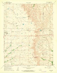
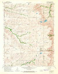
 1961 Rosalia NE1962 Print · USGSThe Flint Hills landscape at the start of the sixties reveals a transition between the Butler and Greenwood county line. Trace the Old Indian Boundary and early infrastructure like the Pumping Station along the headwaters of the Fall River.
 - 1961 Map of Rosalia, 1962 Print
 1961 Rosalia1962 Print · USGSThe Butler and Greenwood County line in the early sixties reveals a landscape of prairie rail towns and active petroleum drilling. Trace family history at Blankinship Cem or locate old operations in the Sallyards Oil Field and Jackson Oil Field.2 unique versions available
 - 1964 Map of Piedmont SW, 1965 Print
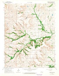
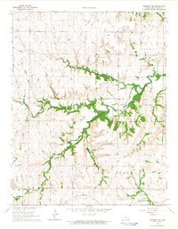
 1964 Piedmont SW1965 Print · USGSThe borderlands of Greenwood and Elk County come into focus during the mid-sixties, showing a landscape shaped by the Elk River and early energy production. Researchers can trace the path of the St Louis San Francisco railroad or locate the Roby Oil Field and Forest Cem.
 - 1964 Map of Piedmont NW, 1965 Print
 1964 Piedmont NW1965 Print · USGSGreenwood County’s mid-century landscape is defined here by its oil production and rural rail connections. Researchers can trace the St Louis San Francisco railroad and locate family landmarks like Star Cem and the Beaumont Oil Field.2 unique versions available
 - 1964 Map of Beaumont, 1965 Print
 1964 Beaumont1965 Print · USGSThe railroad town of Beaumont and the surrounding Kansas prairie are captured here in the mid-1960s, showing a landscape defined by rail and river. Genealogists can trace family sites at Little Walnut Ch or locate the old Landing Field and Butts Cem.
 - 1964 Map of Piedmont NE, 1965 Print
 1964 Piedmont NE1965 Print · USGSGreenwood County at the height of the mid-sixties reveals a landscape shaped by the ST LOUIS SAN FRANCISCO rail line and the winding Fall River. Researchers can trace old family burial sites at Pleasant View Cem or locate the active Quarries of the era.
Showing maps 1-25 of 60
Top cities of Greenwood County
- Eureka historical maps
- Madison historical maps
- Severy historical maps
- Hamilton historical maps
- Quincy historical maps
- Fall River historical maps
See more
Frequently asked questions
- What are the different types of historical maps available for Greenwood County?
- What is the oldest map of Greenwood County?
- Where can I purchase historical maps of Greenwood County for my home or office?
- Where can I download high-res historical maps of Greenwood County?
- Are there historical topographic maps available for Greenwood County?
- Is there historical aerial imagery available for Greenwood County?
- Where are historical maps of Greenwood County sourced from?