Old Maps of Greenwood County, Kansas
Explore 71 old maps of Greenwood County, spanning from 1885 to today. These high-resolution historic maps reveal how streets, neighborhoods, landmarks, and natural features evolved over time — perfect for genealogy, metal detecting, research, and local history exploration.
What you can do with these maps:
- See how Greenwood County changed over time: Compare historical maps to modern-day views to trace roads, homesites, rail lines & more.
- View detailed metadata: Each map includes creators, publishers, year, scale, and archive source.
- Overlay maps with satellite & LiDAR: Visualize the past alongside modern tools to explore terrain & human change.
- Trusted historical sources: Maps sourced from the USGS, Library of Congress, and other archives.
- Access maps your way: View online, download high-res files, or order prints for personal or research use.
Start exploring old maps of Greenwood County to uncover forgotten places, hidden landmarks, and the deep history beneath your feet.
Greenwood County, KS maps
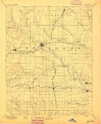
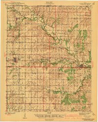
(71)- 1885 Map of Burlington
 1885 Burlington1885 Print · USGSCovers Greenwood County, including Burlington, Lebo, and other nearby areas
 - 1885 Map of Eureka
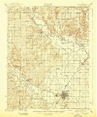
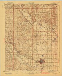
 1885 Eureka1885 Print · USGSCovers Greenwood County, including Eureka, Severy, and other nearby areas
 - 1886 Map of Fredonia
 1886 Fredonia1886 Print · USGSCovers Greenwood County, including Fredonia, Yates Center, and other nearby areas
 - 1888 Map of Emporia
 1888 Emporia1888 Print · USGSCovers Greenwood County, including Emporia, Americus, and other nearby areas
 - 1888 Map of Eureka
 1888 Eureka1888 Print · USGSCovers Greenwood County, including Eureka, Severy, and other nearby areas
 - 1888 Map of Eldorado
 1888 Eldorado1888 Print · USGSCovers Greenwood County, including El Dorado, Augusta, and other nearby areas6 unique versions available
 - 1894 Map of Emporia
 1894 Emporia1894 Print · USGSCovers Greenwood County, including Emporia, Americus, and other nearby areas8 unique versions available
 - 1894 Map of Fredonia
 1894 Fredonia1894 Print · USGSCovers Greenwood County, including Fredonia, Yates Center, and other nearby areas6 unique versions available
 - 1894 Map of Burlington
 1894 Burlington1894 Print · USGSCovers Greenwood County, including Burlington, Lebo, and other nearby areas6 unique versions available
 - 1894 Map of Eureka
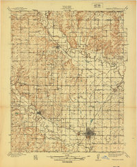
 1894 Eureka1894 Print · USGSCovers Greenwood County, including Eureka, Severy, and other nearby areas5 unique versions available
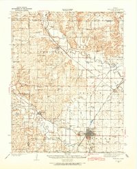
 - 1898 Map of Cottonwood Falls
 1898 Cottonwood Falls1898 Print · USGSCovers Greenwood County, including Marion, Cottonwood Falls, and other nearby areas4 unique versions available
 - 1938 Map of Fredonia, 1965 Print
 1938 Fredonia1965 Print · USGSCovers Greenwood County, including Fredonia, Benedict, and other nearby areas2 unique versions available
 - 1939 Map of Fredonia
 1939 Fredonia1939 Print · USGSCovers Greenwood County, including Fredonia, Benedict, and other nearby areas2 unique versions available
 - 1939 Map of Severy, 1966 Print
 1939 Severy1966 Print · USGSCovers Greenwood County, including Severy, Fall River, and other nearby areas2 unique versions available
 - 1941 Map of Severy
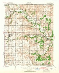
 1941 Severy1941 Print · USGSCovers Greenwood County, including Severy, Fall River, and other nearby areas3 unique versions available
 - 1942 Map of Fredonia
 1942 Fredonia1942 Print · USGSCovers Greenwood County, including Fredonia, Benedict, and other nearby areas
 - 1943 Map of Fredonia
 1943 Fredonia1943 Print · USGSCovers Greenwood County, including Fredonia, Benedict, and other nearby areas2 unique versions available
 - 1947 Map of Lawrence, 1954 Print
 1947 Lawrence1954 Print · USGSCovers Greenwood County, including Kansas City, Overland Park, and other nearby areas
 - 1947 Map of Joplin, 1954 Print
 1947 Joplin1954 Print · USGSCovers Greenwood County, including Joplin, Pittsburg, and other nearby areas
 - 1949 Map of Joplin
 1949 Joplin1949 Print · USGSCovers Greenwood County, including Joplin, Pittsburg, and other nearby areas
 - 1950 Map of Lawrence
 1950 Lawrence1950 Print · USGSCovers Greenwood County, including Kansas City, Overland Park, and other nearby areas
 - 1954 Map of Joplin, 1967 Print
 1954 Joplin1967 Print · USGSCovers Greenwood County, including Joplin, Pittsburg, and other nearby areas3 unique versions available
 - 1955 Map of Wichita, 1959 Print
 1955 Wichita1959 Print · USGSCovers Greenwood County, including Wichita, Derby, and other nearby areas3 unique versions available
 - 1955 Map of Hutchinson, 1967 Print
 1955 Hutchinson1967 Print · USGSCovers Greenwood County, including Salina, Hutchinson, and other nearby areas3 unique versions available
 - 1956 Map of Lawrence, 1967 Print
 1956 Lawrence1967 Print · USGSCovers Greenwood County, including Kansas City, Overland Park, and other nearby areas4 unique versions available
Showing maps 1-25 of 71
Top cities of Greenwood County
- Eureka historical maps
- Madison historical maps
- Severy historical maps
- Hamilton historical maps
- Quincy historical maps
- Fall River historical maps
See more
Frequently asked questions
- What are the different types of historical maps available for Greenwood County?
- What is the oldest map of Greenwood County?
- Where can I purchase historical maps of Greenwood County for my home or office?
- Where can I download high-res historical maps of Greenwood County?
- Are there historical topographic maps available for Greenwood County?
- Is there historical aerial imagery available for Greenwood County?
- Where are historical maps of Greenwood County sourced from?