Old Maps of Haskell County, Kansas for Hiking & Exploration
Hike through history with 85 historic maps of Haskell County. Explore old trails, ghost towns, and forgotten backroads — perfect for outdoor adventurers and local explorers.
- Rediscover forgotten places: Map out old mining camps, roads, and footpaths that no longer exist on modern maps.
- Layer with modern tools: Combine with LiDAR or satellite views to plan hikes through historical terrain.
- Made for exploration: Popular among hikers, overlanders, and local history lovers.
Use these maps to find adventure and explore the hidden past of Haskell County.
Haskell County, KS maps
(85)- 1891 Map of Larned, 1921 Print
 1891 Larned1921 Print · USGSThe Arkansas River valley at the close of the nineteenth century shows a landscape being rapidly transformed by rail and irrigation. Genealogists and historians can trace early prairie life through rail stops like Rush Centre, Garfield, and the hub at Larned.
 - 1896 Map of Garden
 1896 Garden1896 Print · USGSFinney and Haskell counties come into focus during the late nineteenth century as the railroad transformed the High Plains. Genealogists and researchers can trace the early footprints of Garden and Santa Fe or locate prairie outposts like Ivanhoe and Pierceville.4 unique versions available
 - 1900 Map of Lakin
 1900 Lakin1900 Print · USGSSouthwestern Kansas at the close of the nineteenth century is defined by the rail corridor along the Arkansas River and the early grid of prairie townships. Genealogists can trace pioneer-era locations like Ulysses and Shockey, or the remote station at Conductor.5 unique versions available
 - 1944 Map of Moscow
 1944 Moscow1944 Print · USGSThe high plains of southwest Kansas are documented here in the mid-1940s, showing a landscape defined by the Cimarron River and the rail line. Researchers can trace the network of local schoolhouses like Riverview Sch and Golden Plains Sch that once anchored these rural townships.
 - 1945 Map of Moscow
 1945 Moscow1945 Print · USGSStevens County in the early 1940s is captured here as a landscape of rural schoolhouses and high plains rail traffic. Genealogists can locate family-named sites like Vanceville Sch and Ethelton Sch or trace the Atchison Topeka and Santa Fe through Moscow.
 - 1955 Map of Dodge City, 1968 Print
 1955 Dodge City1968 Print · USGSSouthwest Kansas in the mid-fifties reveals an expansive landscape of cattle towns, early gas fields, and prairie outposts. Researchers can trace rural school districts like Moundview and Good Luck or locate the Kansas State Game Farm near Lakin.3 unique versions available
 - 1958 Map of Dodge City
 1958 Dodge City1958 Print · USGSSouthwest Kansas in the late fifties shows a landscape of river-valley agriculture and burgeoning energy infrastructure. Genealogists can trace rural life through numerous landmarks like Fairview Cemetery, the Goodwell School, and Concord Church.
 - 1959 Map of Dodge City
 1959 Dodge City1959 Print · USGSSouthwest Kansas in the mid-fifties is captured at its agricultural height, centered on the vital rail and river hubs of Dodge City and Garden City. Genealogists and local historians can trace rural school districts like Shockey School and Hickok School or locate the Fairview Cemetery.
 - 1959 Map of Garden City 3 NW, 1961 Print
 1959 Garden City 3 NW1961 Print · USGSHaskell County and Finney County are captured during a period of significant energy development in the late fifties. Genealogists and historians can trace rural infrastructure through locations like Valley Sch and a vast network of Gas Well sites.3 unique versions available
 - 1959 Map of Hickok NE, 1961 Print
 1959 Hickok NE1961 Print · USGSHaskell County and its neighbors are seen here in the late fifties, during a period of significant growth for the regional energy industry. Genealogists and researchers can locate rural landmarks such as Pleasant Prairie Ch, Pleasant Prairie Sch, and scores of Gas Wells.2 unique versions available
 - 1959 Map of Garden City 3 NE, 1961 Print
 1959 Garden City 3 NE1961 Print · USGSHaskell County prairie life in the late fifties is captured here through its network of one-room schools and emerging gas fields. Genealogists and local historians can locate the Ivanhoe Cem and trace the rural districts around Lake View Sch and Independence Sch.3 unique versions available
 - 1960 Map of Hickok SE, 1961 Print
 1960 Hickok SE1961 Print · USGSHaskell and Grant Counties are captured here at the start of the 1960s as energy infrastructure transformed the landscape. Researchers can trace the densification of Gas Wells across Dudley and Sullivan townships and locate the Canaan Cem.2 unique versions available
 - 1960 Map of Garden City 3 SW, 1961 Print
 1960 Garden City 3 SW1961 Print · USGSHaskell County at the dawn of the 1960s reveals a prairie landscape transformed by the energy industry. Genealogists and historians can trace the grid of the Hugoton Gas Area through dozens of Gas Well sites and locate the Haskell Cem.3 unique versions available
 - 1960 Map of Garden City 3 SE, 1961 Print
 1960 Garden City 3 SE1961 Print · USGSHaskell County's high plains are captured in the early sixties during a period of intense energy development and railroad transport. Researchers can trace the Atchison Topeka and Santa Fe rail line and locate the historic Haskell Cem or the remnants of an Abandoned Canal.3 unique versions available
 - 1968 Map of Plains NW, 1969 Print
 1968 Plains NW1969 Print · USGSThe high plains at the corner of Haskell, Meade, and Seward counties are captured here in the late sixties during a period of expanding energy infrastructure. Researchers can locate family-named landmarks like Ellsaesser Pond and trace township boundaries from Lockport to Morris.2 unique versions available
 - 1968 Map of Satanta, 1970 Print
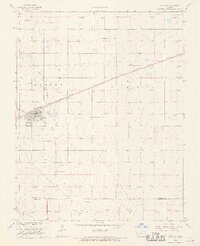 1968 Satanta1970 Print · USGSHaskell County underwent a significant industrial shift in the late sixties as the energy sector expanded across the high plains. Genealogists and historians can locate the Satanta townsite, the Dudley Cem, and the massive Victory and Gas Field network.
 - 1968 Map of Sublette, 1970 Print
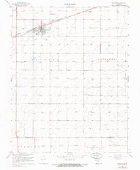 1968 Sublette1970 Print · USGSSublette and the surrounding Kansas prairie are captured here in the late sixties, showing a landscape defined by energy and rail. Genealogists and local historians can trace the town's footprint including the High Sch, the Atchison Topeka and Santa Fe railroad, and the Sublette Flying Club Landing Strip.2 unique versions available
 - 1969 Map of Copeland, 1971 Print
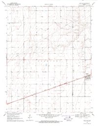 1969 Copeland1971 Print · USGSGray and Haskell counties show their agricultural foundations in the late sixties as the railroad drives local commerce. Genealogists and researchers can trace property lines through Lockport and locate features like the Cem and the siding at Tice.
 - 1969 Map of Copeland NW, 1971 Print
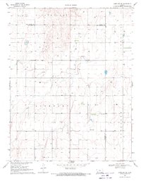 1969 Copeland NW1971 Print · USGSHaskell and Gray counties come together in the Kansas high plains during the late sixties, showing a landscape defined by industrial agriculture and mineral wells. Genealogists and historians can locate Colusa Cem, the Salem Ch, and the Radio Tower (KUPK-TV).
 - 1975 Map of Ryus, 1976 Print
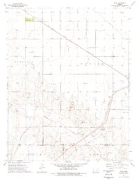 1975 Ryus1976 Print · USGSHaskell County's high plains landscape is captured in the mid-seventies, showing a region where the energy industry meets the Cimarron River. Researchers can trace the industrial footprint of the era through the Ryus settlement, the Oil and Gas Field, and the Atchison Topeka and Santa Fe railroad.
 - 1983 Map of Hugoton, 1984 Print
 1983 Hugoton1984 Print · USGSSouthwestern Kansas during the early 1980s reveals a landscape shaped by the energy industry and deep western history. Researchers can trace the Old Santa Fe Trail and explore the Gas Field surrounding Hugoton and Rolla.
 - 1985 Map of Dodge City
 1985 Dodge City1985 Print · USGSSouthwest Kansas in the mid-1980s was a landscape defined by the Arkansas River and the legacy of the rail. Researchers can trace the layout of Dodge City, find the Finney County State Game Refuge, and locate rural hubs like Montezuma and Cimarron.2 unique versions available
 - 1985 Map of Liberal
 1985 Liberal1985 Print · USGSThe High Plains of Southwest Kansas and the Oklahoma panhandle come alive in the mid-eighties, centered on the growing city of Liberal. Genealogists and historians can trace the paths of the Atchison Topeka and Santa Fe through settlements like Kismet and Arkalon.2 unique versions available
 - 1985 Map of Ulysses
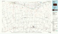 1985 Ulysses1985 Print · USGSSouthwestern Kansas in the mid-1980s reveals a landscape shaped by massive gas fields and the life-giving waters of the Arkansas River. Genealogists and researchers can trace the rail towns of the Atchison Topeka and Santa Fe, locate the Syracuse Cem, or explore the rural routes of Sullivans Track and Columbian Track.
 - 1987 Map of Ulysses, 1988 Print
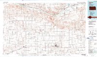 1987 Ulysses1988 Print · USGSWestern Kansas at the end of the Cold War was a landscape defined by natural gas production and rail-fed agriculture. Trace the energy and transport networks connecting Ulysses, Big Bow, and the Arkansas River corridor along the Atchison Topeka and Santa Fe railroad.
Showing maps 1-25 of 85
Top cities of Haskell County
Frequently asked questions
- What are the different types of historical maps available for Haskell County?
- What is the oldest map of Haskell County?
- Where can I purchase historical maps of Haskell County for my home or office?
- Where can I download high-res historical maps of Haskell County?
- Are there historical topographic maps available for Haskell County?
- Is there historical aerial imagery available for Haskell County?
- Where are historical maps of Haskell County sourced from?