Old Maps of Lincoln County, Kansas for Hiking & Exploration
Hike through history with 140 historic maps of Lincoln County. Explore old trails, ghost towns, and forgotten backroads — perfect for outdoor adventurers and local explorers.
- Rediscover forgotten places: Map out old mining camps, roads, and footpaths that no longer exist on modern maps.
- Layer with modern tools: Combine with LiDAR or satellite views to plan hikes through historical terrain.
- Made for exploration: Popular among hikers, overlanders, and local history lovers.
Use these maps to find adventure and explore the hidden past of Lincoln County.
Lincoln County, KS maps
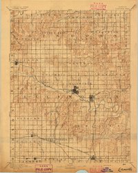
(140)- 1892 Map of Salina
 1892 Salina1892 Print · USGSCentral Kansas at the close of the nineteenth century centers on the booming rail junctions and river valleys of the Smoky Hill region. Genealogists can trace family footprints in riverside settlements like Lindsborg and Assaria or the rail stops of Bavaria and Terra Cotta.6 unique versions available
 - 1892 Map of Minneapolis
 1892 Minneapolis1892 Print · USGSOttawa and Cloud counties appear here in the 1890s as the railroad and river networks solidified the region's agricultural layout. Genealogists and researchers can trace early homesteads and town sites along the Solomon River and railroads serving Minneapolis, Delphos, and Glasco.5 unique versions available
 - 1894 Map of Ellsworth
 1894 Ellsworth1894 Print · USGSCentral Kansas was undergoing a period of rapid railway expansion in the late nineteenth century, transforming the prairie into a network of grid-organized townships. Genealogists and historians can trace early town sites and rail junctions like Ellsworth, Holyrood, and the path of the Union Pacific Railway.4 unique versions available
 - 1894 Map of Beloit
 1894 Beloit1894 Print · USGSMitchell and Lincoln counties come alive in the 1890s as the railroad and river systems began to shape these Kansas prairie towns. Genealogists and researchers can trace early homesteads and rail-stop settlements like Denmark, Tipton, and the Rocky Hill Mill.3 unique versions available
 - 1942 Map of Salina
 1942 Salina1942 Print · USGSCentral Kansas during the early 1940s reveals a landscape transitioning between its deep agricultural roots and a massive new wartime footing. Researchers can trace the development of the Military Reservation and locate small rail-side settlements like Terra Cotta and Smolan.
 - 1955 Map of Manhattan, 1964 Print
 1955 Manhattan1964 Print · USGSNorth Central Kansas is captured here in the mid-fifties, just as major flood control projects began reshaping the river valleys. Genealogists can locate family sites near St. Joseph Church, Sunset Cemetery, or along the busy tracks of the Rock Island RR.4 unique versions available
 - 1955 Map of Great Bend, 1966 Print
 1955 Great Bend1966 Print · USGSCentral Kansas during the mid-sixties transition reveals a landscape defined by new reservoirs and enduring rail corridors. Researchers can trace the development of towns like Hays and Great Bend or locate natural landmarks such as Round Mound and the wetlands of the Quivira National Wildlife Refuge.3 unique versions available
 - 1955 Map of Hutchinson, 1967 Print
 1955 Hutchinson1967 Print · USGSCentral Kansas in the mid-sixties reveals a landscape of growing reservoirs and evolving transportation corridors. Trace the development of towns like Hutchinson and Abilene alongside the Union Pacific Railroad and the expanding Interstate 70.3 unique versions available
 - 1955 Map of Beloit, 1971 Print
 1955 Beloit1971 Print · USGSNorth Central Kansas in the mid-fifties shows a landscape of river-valley agriculture and expanding water infrastructure. Genealogists can trace the rail lines of the Union Pacific through towns like Nicodemus, Cawker City, and the State Sanatorium.3 unique versions available
 - 1956 Map of Manhattan
 1956 Manhattan1956 Print · USGSNorth-central Kansas in the mid-fifties reveals a landscape defined by the convergence of the Republican River and Smoky Hill River. Historians can trace the rail corridors of the Union Pacific RR and Missouri Pacific RR through towns like Manhattan and Clay Center.
 - 1956 Map of Wilson, 1958 Print
 1956 Wilson1958 Print · USGSWilson at the mid-point of the twentieth century remains a vibrant rail town defined by its place on the Union Pacific line. Genealogists can locate family markers at Wilson Cem or the Old Wilson Cem, and trace rural life at Sunrise Sch.2 unique versions available
 - 1957 Map of Manhattan
 1957 Manhattan1957 Print · USGSNortheast Kansas in the mid-1950s reveals a landscape of expanding military installations and new water projects. Genealogists and historians can trace the rail-to-river economy through the Union Pacific RR and old settlements like Clay Center or Marysville.
 - 1957 Map of Great Bend
 1957 Great Bend1957 Print · USGSCentral Kansas at the peak of the postwar era shows a landscape of growing rail hubs and massive new water projects. Trace the routes of the Union Pacific through Hays or locate the newly formed shorelines of Cedar Bluff Reservoir and Kanopolis Reservoir.
 - 1957 Map of Westfall SW, 1958 Print
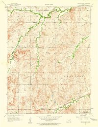
 1957 Westfall SW1958 Print · USGSThe rural landscapes of Ellsworth and Lincoln Counties are captured here in the late fifties, during a period of steady agricultural tradition. Researchers can locate the Oak Creek Sch and follow the winding courses of East Elkhorn Creek and Spring Creek through the prairie.2 unique versions available
 - 1957 Map of Brookville SW, 1958 Print
 1957 Brookville SW1958 Print · USGSThe rural landscape of central Kansas in the mid-fifties shows a transition from traditional farming communities to Cold War military use. Genealogists and historians can trace local roots at Mulberry Cem or follow the Union Pacific rails past Arcola.3 unique versions available
 - 1957 Map of Westfall SE, 1958 Print
 1957 Westfall SE1958 Print · USGSMid-century Ellsworth County is captured here during a period of steady agricultural life in central Kansas. Genealogists and local historians can trace family land via Clear Creek Cem or locate the site of School No 79 near Table Rock.3 unique versions available
 - 1957 Map of Black Wolf, 1958 Print
 1957 Black Wolf1958 Print · USGSThe rural landscape of Ellsworth and Lincoln counties comes into focus in the late 1950s as the rail-and-river economy centers on the Smoky Hill River. Researchers can trace the legacy of local townships through landmarks like Black Wolf, Excelsior Ch, and numerous country schoolhouses.2 unique versions available
 - 1958 Map of Great Bend
 1958 Great Bend1958 Print · USGSCentral Kansas in the late fifties reveals a landscape of high-plains agriculture and vital river crossings. Researchers can trace the development of regional hubs like Hays and Russell, or locate historic sites such as Fort Larned and the Cheyenne Bottoms wildlife area.2 unique versions available
 - 1959 Map of Beloit
 1959 Beloit1959 Print · USGSNorth Central Kansas at mid-century reveals a landscape shaped by river valleys and the expansion of massive water reservoirs. Genealogists and historians can trace the rail-town connections of Beloit and Norton or locate the site of the new Webster Dam.3 unique versions available
 - 1959 Map of Hutchinson
 1959 Hutchinson1959 Print · USGSCentral Kansas thrives at the intersection of rail and river in the mid-1950s, as post-war aviation infrastructure reshapes the prairie. Genealogists and historians can trace the paths of the AT&SF RR through Newton and Hutchinson, or locate military sites like Smoky Hill Air Force Base.2 unique versions available
 - 1962 Map of Vesper, 1964 Print
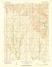
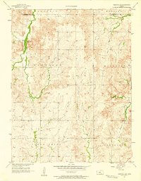
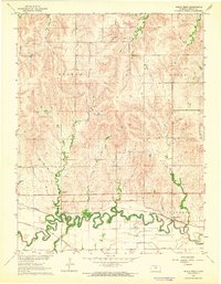
 1962 Vesper1964 Print · USGSLincoln County’s river valleys and prairie uplands are captured here in the early sixties, showing a landscape defined by rail lines and rural townships. Genealogists and local historians can locate family sites at Vesper Cem, Pottersburg Cem, and the settlement of Denmark.
 - 1962 Map of Lincoln, 1964 Print
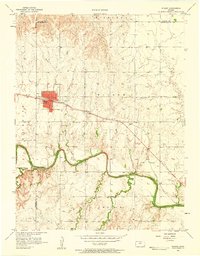
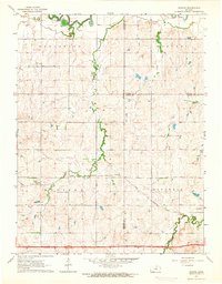
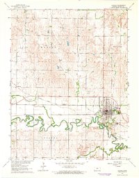 1962 Lincoln1964 Print · USGSLincoln, Kansas, flourished as a dual-railroad hub in the early sixties at the confluence of the Saline River and several key creeks. Researchers can trace the layout of the town and find rural landmarks like Goldenrod, Lincoln Cemetery, and the Lincoln Airfield.
 - 1963 Map of Shady Bend, 1964 Print
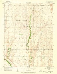
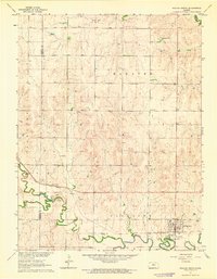
 1963 Shady Bend1964 Print · USGSLincoln County, Kansas, was a hub of river-valley rail activity in the early 1960s as the Saline River flowed past competing rail lines. Genealogists can locate Shady Bend Cem and Sunnyside Cem while tracing the Union Pacific tracks.
 - 1963 Map of Juniata, 1964 Print
 1963 Juniata1964 Print · USGSCentral Kansas at the start of the 1960s shows a landscape defined by the convergence of three counties and steady rail traffic. Genealogists and local historians can trace the paths of the Atchison Topeka and Santa Fe through Juniata and find the rural Monroe Cem.2 unique versions available
 - 1963 Map of Sylvan Grove, 1964 Print
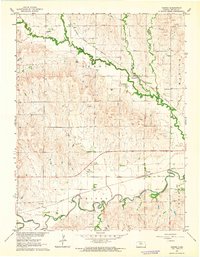
 1963 Sylvan Grove1964 Print · USGSThe rural agricultural landscape of Lincoln and Russell counties comes to life in the early 1960s, centered on the riverfront town of Sylvan Grove. Researchers can locate the Union Pacific rail lines, family-history sites like Rosette Cem, and the Vonada Landing Field.
Showing maps 1-25 of 140
Top cities of Lincoln County
- Sylvan Grove historical maps
- Beverly historical maps
- Barnard historical maps
- Vesper historical maps
- Grant historical maps
Frequently asked questions
- What are the different types of historical maps available for Lincoln County?
- What is the oldest map of Lincoln County?
- Where can I purchase historical maps of Lincoln County for my home or office?
- Where can I download high-res historical maps of Lincoln County?
- Are there historical topographic maps available for Lincoln County?
- Is there historical aerial imagery available for Lincoln County?
- Where are historical maps of Lincoln County sourced from?