2020s Maps of Axtell, Kansas
Explore 3 historic maps of Axtell from the 2020s. These maps offer a rare glimpse into what life looked like during the 2020s — showing old roads, neighborhoods, homes, and landmarks that have changed or disappeared over time.
Whether you're researching your family's past, planning a metal detecting trip, or studying how Axtell's landscape evolved across the 2020s, these high-resolution maps are a powerful tool for exploring the history of this region.
- Focus on a specific era: All maps on this page are from the 2020s, giving you a focused view of this time period.
- See what’s changed: Compare century-old streets, trails, and buildings to today's modern landscape using overlays and satellite layers.
- Research with precision: Use these maps for genealogy, historical research, land use analysis, or educational projects.
- View, download, or print: Maps are fully viewable online in high resolution, and can be downloaded or printed for your own records.
Start exploring Axtell's history through authentic maps from the 2020s. This is your window into the past.
Axtell, KS maps
(3)- 2022 Map of Summerfield, 2022 Print
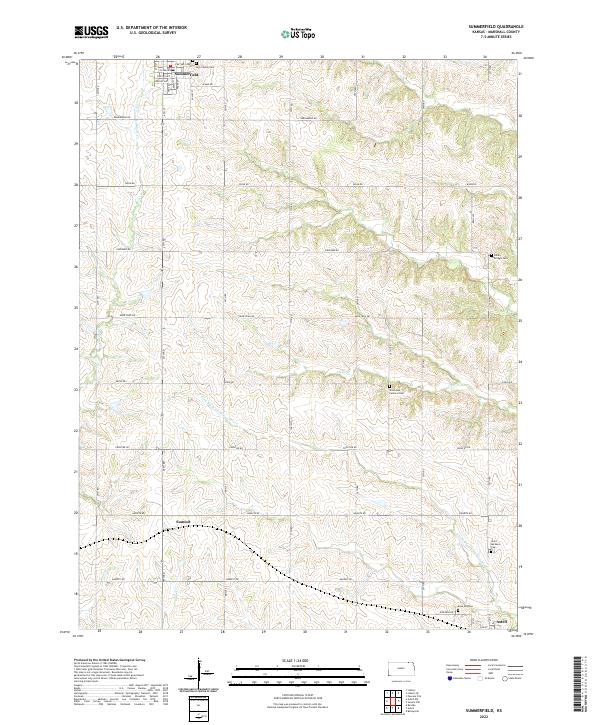 2022 Summerfield2022 Print · USGSMarshall County agricultural lands and rural settlements are captured here in the early twenty-first century. Researchers can trace family history through numerous local burial sites like Saint Bridget Cem, Holy Family Cem, and Rose Hill Cem.
 - 2022 Map of Baileyville, 2022 Print
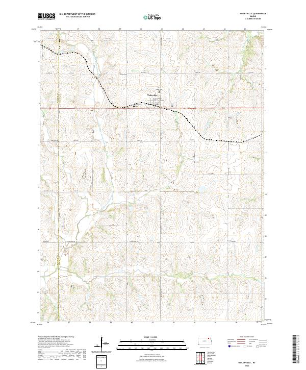 2022 Baileyville2022 Print · USGSBaileyville and the surrounding agricultural lands of Nemaha County are shown here in modern detail. Genealogists and local historians can trace family plots at Sacred Heart Cem or follow the course of the N Fork Black Vermillion River.
 - 2022 Map of Axtell, 2022 Print
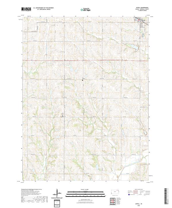 2022 Axtell2022 Print · USGSAxtell and the surrounding Marshall County prairie are captured here in the early twenty-first century, showing a landscape defined by agriculture and small-town roots. Genealogists can locate family sites near Salem Lutheran Cem and Mission Covenant Cem or trace the N Fork Black Vermillion River.
End of results
Showing maps 1-3 of 3
Top cities near Axtell
- Seneca historical maps
- Frankfort historical maps
- Centralia historical maps
- Beattie historical maps
- Summerfield historical maps
- Corning historical maps
See more
Frequently asked questions
- What are the different types of historical maps available for Axtell?
- What is the oldest map of Axtell?
- Where can I purchase historical maps of Axtell for my home or office?
- Where can I download high-res historical maps of Axtell?
- Are there historical topographic maps available for Axtell?
- Is there historical aerial imagery available for Axtell?
- Where are historical maps of Axtell sourced from?