1950s Maps of Montgomery County, Kansas
Explore 11 historic maps of Montgomery County from the 1950s. These maps offer a rare glimpse into what life looked like during the 1950s — showing old roads, neighborhoods, homes, and landmarks that have changed or disappeared over time.
Whether you're researching your family's past, planning a metal detecting trip, or studying how Montgomery County's landscape evolved across the 1950s, these high-resolution maps are a powerful tool for exploring the history of this region.
- Focus on a specific era: All maps on this page are from the 1950s, giving you a focused view of this time period.
- See what’s changed: Compare century-old streets, trails, and buildings to today's modern landscape using overlays and satellite layers.
- Research with precision: Use these maps for genealogy, historical research, land use analysis, or educational projects.
- View, download, or print: Maps are fully viewable online in high resolution, and can be downloaded or printed for your own records.
Start exploring Montgomery County's history through authentic maps from the 1950s. This is your window into the past.
Montgomery County, KS maps
(11)- 1954 Map of Tulsa
 1954 Tulsa1954 Print · USGSNortheast Oklahoma and the Ozark border are shown here during a period of massive industrial and infrastructure growth. Researchers can trace the legacy of the Tri-State Mining District and the development of major reservoirs like Grand Lake O' The Cherokees.2 unique versions available
 - 1954 Map of Joplin, 1967 Print
 1954 Joplin1967 Print · USGSThe tri-state border region of Kansas, Missouri, and Oklahoma is captured here during a peak era of mid-century industrial and agricultural activity. Researchers can trace family history through dozens of rural cemeteries or locate landmarks like the Kansas Army Ammunition Plant and Pittsburg State University.3 unique versions available
 - 1958 Map of Joplin
 1958 Joplin1958 Print · USGSThe tri-state border region of Missouri, Kansas, and Oklahoma is shown during the late fifties, a time of heavy rail traffic and mining activity. Local historians can trace the industrial landscape through the Joplin & Pittsburg Ry or locate family sites like Zion Ch and Bender Mounds.
 - 1958 Map of Tulsa, 1968 Print
 1958 Tulsa1968 Print · USGSNortheast Oklahoma and the Ozark borderlands are captured here during a massive era of reservoir construction and highway expansion. Researchers can trace the mid-century footprints of Tulsa, the sprawling Lake O' the Cherokees, and historical sites like Pea Ridge National Military Park.3 unique versions available
 - 1959 Map of Tyro
 1959 Tyro1959 Print · USGSSouthern Kansas at the close of the 1950s reveals a landscape defined by the intersection of the Missouri Pacific railroad and early petroleum production. You can trace old property and tribal lines along the Old Indian Boundary and locate vanished rural schools like Springdale Sch and Ringo Sch.2 unique versions available
 - 1959 Map of Joplin
 1959 Joplin1959 Print · USGSThe Tri-State region’s mining and rail-driven economy is on full display in the late fifties. Genealogists can locate Lead and Zinc Mines near Joplin, family markers at Oak Hill Cem, and military history at Camp Clark.
 - 1959 Map of Bolton
 1959 Bolton1959 Print · USGSSoutheast Kansas in the late fifties was a landscape defined by its petroleum wealth and deep-rooted rural communities. Researchers can trace the oil fields of Rutland, locate family plots at Highland Center Cem, or find old school sites like Oak Ridge Sch.3 unique versions available
 - 1959 Map of Neodesha, 1960 Print
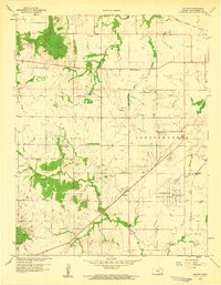
 1959 Neodesha1960 Print · USGSSoutheast Kansas at the close of the fifties reveals a bustling rail and river hub centered on Neodesha. Genealogists and researchers can trace the industrial footprint of the Oil Refinery or locate rural landmarks like Bumgardner Sch and Ross Cem.2 unique versions available
 - 1959 Map of Sycamore, 1960 Print
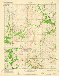
 1959 Sycamore1960 Print · USGSMontgomery County was a hive of rail traffic and river activity at the close of the 1950s. Researchers can trace rural life through the locations of the Chateau Chapel, numerous local cemeteries like Radical Cem, and old schoolhouses including Gravel Hill Sch.3 unique versions available
 - 1959 Map of Coffeyville West, 1960 Print
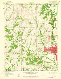 1959 Coffeyville West1960 Print · USGSMontgomery County was a hub of rail and energy development during the late fifties as the town of COFFEYVILLE pushed toward its western limits. Genealogists and local historians can trace family locations near landmarks like Indian Village, Restlawn Cemetery, and numerous rural schoolhouses such as Robbins Sch.2 unique versions available
 - 1959 Map of Independence, 1960 Print
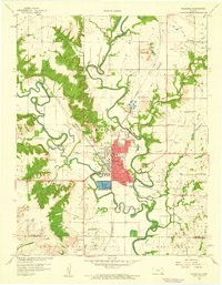
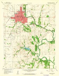 1959 Independence1960 Print · USGSIndependence and the surrounding Montgomery County countryside are shown here at the close of the 1950s as a thriving rail and agricultural hub. Researchers can locate numerous vanished country schools like Morgantown Sch and family landmarks near the Verdigris River.2 unique versions available
End of results
Showing maps 1-11 of 11
Top cities of Montgomery County
- Coffeyville historical maps
- Independence historical maps
- Cherryvale historical maps
- Caney historical maps
- Sycamore historical maps
- Dearing historical maps
See more
Frequently asked questions
- What are the different types of historical maps available for Montgomery County?
- What is the oldest map of Montgomery County?
- Where can I purchase historical maps of Montgomery County for my home or office?
- Where can I download high-res historical maps of Montgomery County?
- Are there historical topographic maps available for Montgomery County?
- Is there historical aerial imagery available for Montgomery County?
- Where are historical maps of Montgomery County sourced from?