Old Maps of Montgomery County, Kansas for Metal Detecting
Plan your next treasure hunt with 136 historic maps of Montgomery County. Find old homesites, ghost towns, trails, and gathering spots that may be lost to time — perfect for identifying promising metal detecting locations.
- Locate forgotten sites: Uncover places like long-lost settlements, abandoned rail lines, or gathering spots.
- Plan better hunts: Use map overlays combined with LiDAR or satellite views to narrow in on historically rich areas.
- Made for detectorists: Thousands of hobbyists use these maps to discover relics, coins, and hidden history.
Use these historic maps to boost your research and find new opportunities beneath the surface of Montgomery County.
Montgomery County, KS maps
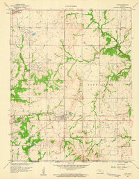
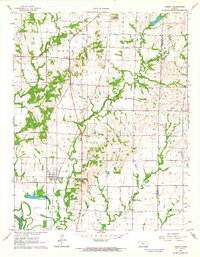
(136)- 1886 Map of Independence
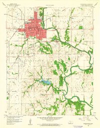
 1886 Independence1886 Print · USGSSoutheastern Kansas is captured here in the mid-1880s as the railroad network began to reshape the prairie landscape. Genealogists and researchers can trace the early foundations of Independence, Cherryvale, and Coffeyville, or locate smaller places like Radical City and La Fontaine.
 - 1894 Map of Independence
 1894 Independence1894 Print · USGSSoutheast Kansas comes alive in the late nineteenth century as a major railroad junction before the turn of the century. Genealogists and historians can trace early settlements like Radical City, Sternerton, and Harrisonville, or locate family sites near Table Mound.
 - 1901 Map of Nowata
 1901 Nowata1901 Print · USGSThe Cherokee Nation in Indian Territory is captured here at the start of the twentieth century, showing the lands that would soon become northeast Oklahoma. Researchers can trace early rail-town growth in Nowata and Bartlesville or locate smaller settlements like Alluwe and Coodys Bluff.2 unique versions available
 - 1905 Map of Independence
 1905 Independence1905 Print · USGSSoutheastern Kansas at the turn of the century is a landscape of expanding rail-hubs and river commerce. Genealogists can trace early homesteads and rail-stops like Lafontaine, Havana, and Sycamore, or locate family landmarks near Table Mound and the Verdigris River.4 unique versions available
 - 1914 Map of Nowata
 1914 Nowata1914 Print · USGSNortheastern Oklahoma at the height of its early statehood growth is documented here as the railroad network expanded across the Verdigris River valley. Genealogists can locate dozens of country schools like Go-back School and vanished post offices such as Avelia Wayside PO.5 unique versions available
 - 1947 Map of Joplin, 1954 Print
 1947 Joplin1954 Print · USGSThe borderlands of Missouri, Kansas, and Oklahoma are shown here during the late 1940s, a period of heavy industrial and military activity. Researchers can trace the extensive Tri-State Mining District, the layout of Camp Crowder, and local landmarks like Mount Hope Cem.
 - 1949 Map of Joplin
 1949 Joplin1949 Print · USGSThe Kansas-Missouri borderlands thrive in the late 1940s, showing a robust network of railroad towns and river valleys. Researchers can trace historic rail lines like the Missouri Pacific RR and locate rural centers such as Chanute, Iola, and Fort Scott.
 - 1954 Map of Tulsa
 1954 Tulsa1954 Print · USGSNortheast Oklahoma and the Ozark border are shown here during a period of massive industrial and infrastructure growth. Researchers can trace the legacy of the Tri-State Mining District and the development of major reservoirs like Grand Lake O' The Cherokees.2 unique versions available
 - 1954 Map of Joplin, 1967 Print
 1954 Joplin1967 Print · USGSThe tri-state border region of Kansas, Missouri, and Oklahoma is captured here during a peak era of mid-century industrial and agricultural activity. Researchers can trace family history through dozens of rural cemeteries or locate landmarks like the Kansas Army Ammunition Plant and Pittsburg State University.3 unique versions available
 - 1958 Map of Joplin
 1958 Joplin1958 Print · USGSThe tri-state border region of Missouri, Kansas, and Oklahoma is shown during the late fifties, a time of heavy rail traffic and mining activity. Local historians can trace the industrial landscape through the Joplin & Pittsburg Ry or locate family sites like Zion Ch and Bender Mounds.
 - 1958 Map of Tulsa, 1968 Print
 1958 Tulsa1968 Print · USGSNortheast Oklahoma and the Ozark borderlands are captured here during a massive era of reservoir construction and highway expansion. Researchers can trace the mid-century footprints of Tulsa, the sprawling Lake O' the Cherokees, and historical sites like Pea Ridge National Military Park.3 unique versions available
 - 1959 Map of Tyro
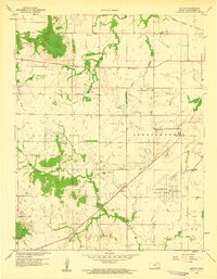
 1959 Tyro1959 Print · USGSSouthern Kansas at the close of the 1950s reveals a landscape defined by the intersection of the Missouri Pacific railroad and early petroleum production. You can trace old property and tribal lines along the Old Indian Boundary and locate vanished rural schools like Springdale Sch and Ringo Sch.2 unique versions available
 - 1959 Map of Joplin
 1959 Joplin1959 Print · USGSThe Tri-State region’s mining and rail-driven economy is on full display in the late fifties. Genealogists can locate Lead and Zinc Mines near Joplin, family markers at Oak Hill Cem, and military history at Camp Clark.
 - 1959 Map of Bolton
 1959 Bolton1959 Print · USGSSoutheast Kansas in the late fifties was a landscape defined by its petroleum wealth and deep-rooted rural communities. Researchers can trace the oil fields of Rutland, locate family plots at Highland Center Cem, or find old school sites like Oak Ridge Sch.3 unique versions available
 - 1959 Map of Neodesha, 1960 Print
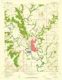 1959 Neodesha1960 Print · USGSSoutheast Kansas at the close of the fifties reveals a bustling rail and river hub centered on Neodesha. Genealogists and researchers can trace the industrial footprint of the Oil Refinery or locate rural landmarks like Bumgardner Sch and Ross Cem.2 unique versions available
 - 1959 Map of Sycamore, 1960 Print
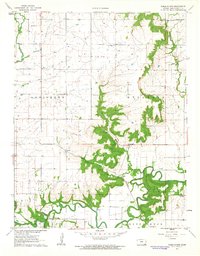
 1959 Sycamore1960 Print · USGSMontgomery County was a hive of rail traffic and river activity at the close of the 1950s. Researchers can trace rural life through the locations of the Chateau Chapel, numerous local cemeteries like Radical Cem, and old schoolhouses including Gravel Hill Sch.3 unique versions available
 - 1959 Map of Coffeyville West, 1960 Print
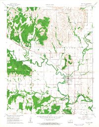
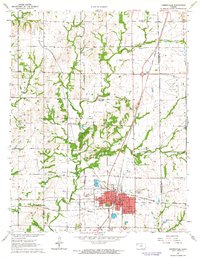
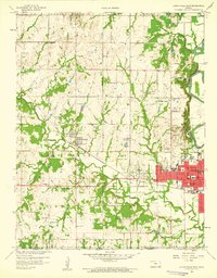 1959 Coffeyville West1960 Print · USGSMontgomery County was a hub of rail and energy development during the late fifties as the town of COFFEYVILLE pushed toward its western limits. Genealogists and local historians can trace family locations near landmarks like Indian Village, Restlawn Cemetery, and numerous rural schoolhouses such as Robbins Sch.2 unique versions available
 - 1959 Map of Independence, 1960 Print
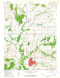
 1959 Independence1960 Print · USGSIndependence and the surrounding Montgomery County countryside are shown here at the close of the 1950s as a thriving rail and agricultural hub. Researchers can locate numerous vanished country schools like Morgantown Sch and family landmarks near the Verdigris River.2 unique versions available
 - 1961 Map of Table Mound, 1963 Print
 1961 Table Mound1963 Print · USGSMontgomery County in the early sixties remains a landscape of river-valley agriculture and scattered rural industry. Genealogists and historians can trace family locations near White Cem, the schoolhouse at Lone Elm Sch, or the settlement of Le Hunt.2 unique versions available
 - 1961 Map of Caney, 1963 Print
 1961 Caney1963 Print · USGSMontgomery County was a landscape of rail-driven commerce and emerging industry in the early sixties. Genealogists and local historians can trace the Old Indian Treaty Boundary, the Sunny Side Cem, and mid-century relics like the Drive-in Theater.3 unique versions available
 - 1962 Map of Caney NW, 1963 Print
 1962 Caney NW1963 Print · USGSThe rural border of Montgomery and Chautauqua counties is captured here in the early sixties, showing a landscape of timbered ridges and creek valleys. Researchers can trace family sites like Burton Cem, Lone Cherry Ch, and the Sunny Side Sch.
 - 1962 Map of Elk City, 1963 Print
 1962 Elk City1963 Print · USGSElk City and the surrounding rural townships are caught in detail during the early sixties, showing the town's original street grid and rail ties. Genealogists and local historians can locate Oak Hill Cemetery, follow the Atchison Topeka and Santa Fe tracks, and trace the winding Elk River.
 - 1962 Map of Liberty, 1964 Print
 1962 Liberty1964 Print · USGSIn the early sixties, the town of Liberty was a vital stop along the Atchison Topeka and Santa Fe railroad corridor. Family historians can trace local roots through the Old Indian Treaty Boundary and landmarks like Billings Sch and Harmony Cem.2 unique versions available
 - 1962 Map of Cherryvale, 1964 Print
 1962 Cherryvale1964 Print · USGSSoutheast Kansas in the early sixties is defined by the busy rail junction at Cherryvale and the surrounding oil and shale works. Researchers can trace the Old Indian Treaty Boundary or locate family roots at Hiltz Cem and Pleasant Dale Sch.2 unique versions available
 - 1962 Map of Coffeyville East, 1964 Print
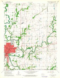 1962 Coffeyville East1964 Print · USGSCoffeyville and its surrounding townships show a thriving mid-century mix of oil production and local education just north of the Oklahoma border. Researchers can trace the OLD INDIAN TREATY BOUNDARY or locate family roots at Elmwood Cemetery and Walter Johnson Sch.2 unique versions available
Showing maps 1-25 of 136
Top cities of Montgomery County
- Coffeyville historical maps
- Independence historical maps
- Cherryvale historical maps
- Caney historical maps
- Sycamore historical maps
- Dearing historical maps
See more
Frequently asked questions
- What are the different types of historical maps available for Montgomery County?
- What is the oldest map of Montgomery County?
- Where can I purchase historical maps of Montgomery County for my home or office?
- Where can I download high-res historical maps of Montgomery County?
- Are there historical topographic maps available for Montgomery County?
- Is there historical aerial imagery available for Montgomery County?
- Where are historical maps of Montgomery County sourced from?