1960s Maps of Montgomery County, Kansas
Explore 11 historic maps of Montgomery County from the 1960s. These maps offer a rare glimpse into what life looked like during the 1960s — showing old roads, neighborhoods, homes, and landmarks that have changed or disappeared over time.
Whether you're researching your family's past, planning a metal detecting trip, or studying how Montgomery County's landscape evolved across the 1960s, these high-resolution maps are a powerful tool for exploring the history of this region.
- Focus on a specific era: All maps on this page are from the 1960s, giving you a focused view of this time period.
- See what’s changed: Compare century-old streets, trails, and buildings to today's modern landscape using overlays and satellite layers.
- Research with precision: Use these maps for genealogy, historical research, land use analysis, or educational projects.
- View, download, or print: Maps are fully viewable online in high resolution, and can be downloaded or printed for your own records.
Start exploring Montgomery County's history through authentic maps from the 1960s. This is your window into the past.
Montgomery County, KS maps
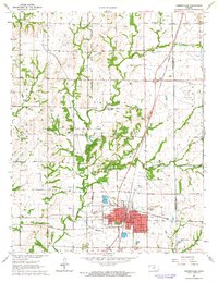
(11)- 1961 Map of Table Mound, 1963 Print
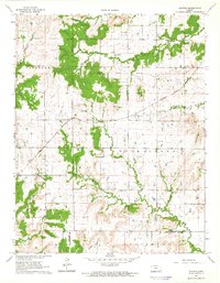
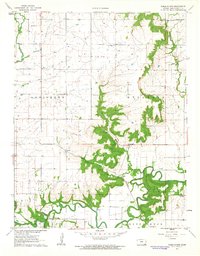 1961 Table Mound1963 Print · USGSMontgomery County in the early sixties remains a landscape of river-valley agriculture and scattered rural industry. Genealogists and historians can trace family locations near White Cem, the schoolhouse at Lone Elm Sch, or the settlement of Le Hunt.2 unique versions available
 - 1961 Map of Caney, 1963 Print
 1961 Caney1963 Print · USGSMontgomery County was a landscape of rail-driven commerce and emerging industry in the early sixties. Genealogists and local historians can trace the Old Indian Treaty Boundary, the Sunny Side Cem, and mid-century relics like the Drive-in Theater.3 unique versions available
 - 1962 Map of Caney NW, 1963 Print
 1962 Caney NW1963 Print · USGSThe rural border of Montgomery and Chautauqua counties is captured here in the early sixties, showing a landscape of timbered ridges and creek valleys. Researchers can trace family sites like Burton Cem, Lone Cherry Ch, and the Sunny Side Sch.
 - 1962 Map of Elk City, 1963 Print
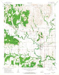 1962 Elk City1963 Print · USGSElk City and the surrounding rural townships are caught in detail during the early sixties, showing the town's original street grid and rail ties. Genealogists and local historians can locate Oak Hill Cemetery, follow the Atchison Topeka and Santa Fe tracks, and trace the winding Elk River.
 - 1962 Map of Liberty, 1964 Print
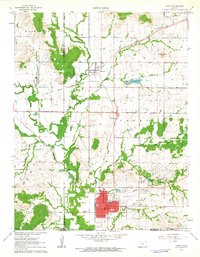
 1962 Liberty1964 Print · USGSIn the early sixties, the town of Liberty was a vital stop along the Atchison Topeka and Santa Fe railroad corridor. Family historians can trace local roots through the Old Indian Treaty Boundary and landmarks like Billings Sch and Harmony Cem.2 unique versions available
 - 1962 Map of Cherryvale, 1964 Print
 1962 Cherryvale1964 Print · USGSSoutheast Kansas in the early sixties is defined by the busy rail junction at Cherryvale and the surrounding oil and shale works. Researchers can trace the Old Indian Treaty Boundary or locate family roots at Hiltz Cem and Pleasant Dale Sch.2 unique versions available
 - 1962 Map of Coffeyville East, 1964 Print
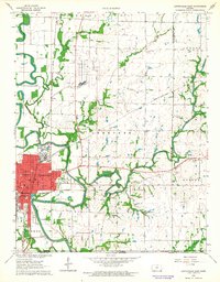 1962 Coffeyville East1964 Print · USGSCoffeyville and its surrounding townships show a thriving mid-century mix of oil production and local education just north of the Oklahoma border. Researchers can trace the OLD INDIAN TREATY BOUNDARY or locate family roots at Elmwood Cemetery and Walter Johnson Sch.2 unique versions available
 - 1963 Map of Tulsa
 1963 Tulsa1963 Print · USGSThe Oklahoma and Arkansas borderlands are shown here in the early sixties, a time of massive reservoir construction and heavy mining. Genealogists can trace family roots through settlements like Nowata, Pryor, and Jay, or locate historical zinc and lead mines and coal mines.
 - 1963 Map of Morehead, 1964 Print
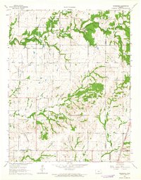 1963 Morehead1964 Print · USGSSoutheast Kansas at the start of the 1960s reveals a landscape defined by historical boundaries and the rail-and-oil economy. Researchers can trace the Old Indian Treaty Boundary or locate rural landmarks like Big Four Sch and Morehead Cem.2 unique versions available
 - 1963 Map of Lafontaine, 1964 Print
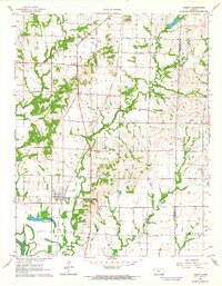
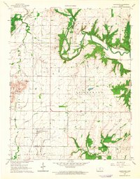 1963 Lafontaine1964 Print · USGSSoutheast Kansas in the 1960s reveals a structured landscape of railroads and river valleys along the Wilson and Montgomery County line. Trace family roots and local history through landmarks like the Bachelder Cem, Emmanuel Ch, and the path of the ATCHISON TOPEKA AND SANTA FE RAILROAD.
 - 1964 Map of Buxton, 1965 Print
 1964 Buxton1965 Print · USGSSoutheast Kansas in the mid-1960s reveals a landscape where rail transport and early frontier boundaries still define the land. Genealogists can trace rural roots at Upola, Buxton, and family-named landmarks like West Rainbow Sch or Mount Pleasant Cem.
End of results
Showing maps 1-11 of 11
Top cities of Montgomery County
- Coffeyville historical maps
- Independence historical maps
- Cherryvale historical maps
- Caney historical maps
- Sycamore historical maps
- Dearing historical maps
See more
Frequently asked questions
- What are the different types of historical maps available for Montgomery County?
- What is the oldest map of Montgomery County?
- Where can I purchase historical maps of Montgomery County for my home or office?
- Where can I download high-res historical maps of Montgomery County?
- Are there historical topographic maps available for Montgomery County?
- Is there historical aerial imagery available for Montgomery County?
- Where are historical maps of Montgomery County sourced from?