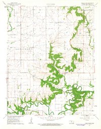
1961 Map of Table Mound
USGS Topo · Published 1963About this map
Elk River meanders through the southern half of this Kansas landscape, defined by the winding course of Gordon Creek and Pocket Creek as they converge toward the valley. The 1961 survey provides a clear view of the rural sections of Louisburg and Sycamore, where the Atchison Topeka and Santa Fe railroad tracks follow the river's path. Local life is anchored by small rural institutions such as Lone Elm Sch, Gamble Sch, and the Sycamore Valley Ch. Significant topographic elevation is found at Table Mound, which rises sharply above the riverbanks. The map also records numerous local burial sites, including White Cem and Simpson Cem, alongside industrial activity at various Oil Wells and a Quarry near the settlement of Le Hunt.
Find a feature on this map
29 named features on this map. Tap any name to fly to it.
Don’t see what you’re looking for? This feature index may not catch every label — zoom into the map to look around manually.
Map Details
Editions of this 1961 Table Mound Map
2 editions found
Other maps of this area

1886 · Independence
USGS Topo · 1:125,000

1894 · Independence
USGS Topo · 1:125,000

1905 · Independence
USGS Topo · 1:125,000

1947 · Joplin
USGS Topo · 1:250,000

1949 · Joplin
USGS Topo · 1:250,000

1954 · Joplin
USGS Topo · 1:250,000

1958 · Joplin
USGS Topo · 1:250,000

1959 · Joplin
USGS Topo · 1:250,000
1959 · Bolton
USGS Topo · 1:24,000
1959 · Neodesha
USGS Topo · 1:24,000