1980s Maps of Ness County, Kansas
Explore 10 historic maps of Ness County from the 1980s. These maps offer a rare glimpse into what life looked like during the 1980s — showing old roads, neighborhoods, homes, and landmarks that have changed or disappeared over time.
Whether you're researching your family's past, planning a metal detecting trip, or studying how Ness County's landscape evolved across the 1980s, these high-resolution maps are a powerful tool for exploring the history of this region.
- Focus on a specific era: All maps on this page are from the 1980s, giving you a focused view of this time period.
- See what’s changed: Compare century-old streets, trails, and buildings to today's modern landscape using overlays and satellite layers.
- Research with precision: Use these maps for genealogy, historical research, land use analysis, or educational projects.
- View, download, or print: Maps are fully viewable online in high resolution, and can be downloaded or printed for your own records.
Start exploring Ness County's history through authentic maps from the 1980s. This is your window into the past.
Ness County, KS maps
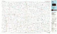
(10)- 1980 Map of Mc Cracken NE, 1981 Print
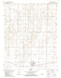
 1980 Mc Cracken NE1981 Print · USGSWestern Kansas rangeland meets industrial expansion in the late 1970s at the junction of four counties. Researchers can trace the development of the Smoky Hill Oil Field and locate localized operations like the Landing Strip and Claypit.
 - 1980 Map of Ransom, 1981 Print
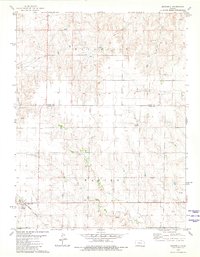
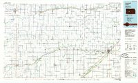
 1980 Ransom1981 Print · USGSRansom sat at a crossroads of rail and prairie in the late 1970s, anchoring a landscape of wind-swept townships and creek branches. Researchers can trace the Missouri Pacific line through town, locate the Ransom Cem, and find industrial markers like local Quarries and Oil Well sites.
 - 1980 Map of Brownell, 1981 Print
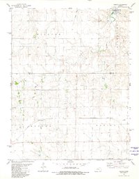
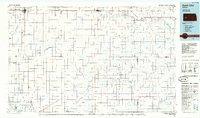
 1980 Brownell1981 Print · USGSThe community of Brownell and the surrounding prairie are captured here during the early eighties, as energy exploration and the railroad shaped the landscape. Genealogists and historians can trace the Missouri Pacific rail line and landmarks like Round House Rock and Big Timber Creek.
 - 1980 Map of Osgood, 1981 Print
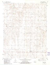
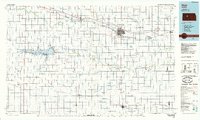
 1980 Osgood1981 Print · USGSThe Ness County plains and Smoly Hill River drainage are captured here during the 1980s, centered on the railroad stop of Osgood. Researchers can trace early family sites at Cyrus Cem, locate active Oil Wells, and explore the shoreline of the Cedar Bluff Reservoir.
 - 1981 Map of Arnold
 1981 Arnold1981 Print · USGSNear the Trego and Ness County border in the late 1970s, this area centered on the rural community of Arnold. Researchers can trace local genealogy at the Amish Cem and Arnold Cem or follow the historic Missouri Pacific rail line.
 - 1981 Map of Utica
 1981 Utica1981 Print · USGSThe Ness County town of Utica appears here in the early 1980s as a vital railroad stop and hub for regional energy production. Genealogists and historians can trace local family landmarks like the Utica Cem and the Missouri Pacific rail line.
 - 1985 Map of Healy
 1985 Healy1985 Print · USGSWestern Kansas in the mid-1980s shows a landscape where pioneer history and the railroad era overlap. Genealogists and historians can trace the Butterfield Overland Trail near Castle Rock or locate rural family outposts near Gove City and Arnold.2 unique versions available
 - 1985 Map of Larned
 1985 Larned1985 Print · USGSCentral Kansas in the mid-eighties was a landscape of resilient prairie towns and vital watercourses. Genealogists and historians can trace the paths of the Atchison Topeka and Santa Fe railroad through Larned, Garfield, and Ness City, while locating heritage sites like Fort Larned National Historic Site.2 unique versions available
 - 1985 Map of Scott City
 1985 Scott City1985 Print · USGSWestern Kansas in the mid-eighties shows a landscape of rail-linked grain towns and emerging energy fields. Genealogists and researchers can trace the Atchison Topeka and Santa Fe line through Alamota and Beeler, or locate family sites near White Woman Bottoms and Walnut Creek.2 unique versions available
 - 1985 Map of Hays
 1985 Hays1985 Print · USGSCentral Kansas in the mid-eighties shows a landscape of river-valley farming and emerging energy production. Trace the route of the Butterfield Overland Despatch Trail or locate family roots in Hays, Liebenthal, or Schoenchen.2 unique versions available
End of results
Showing maps 1-10 of 10
Top cities of Ness County
- Ness City historical maps
- Ransom historical maps
- Bazine historical maps
- Utica historical maps
- Brownell historical maps
Frequently asked questions
- What are the different types of historical maps available for Ness County?
- What is the oldest map of Ness County?
- Where can I purchase historical maps of Ness County for my home or office?
- Where can I download high-res historical maps of Ness County?
- Are there historical topographic maps available for Ness County?
- Is there historical aerial imagery available for Ness County?
- Where are historical maps of Ness County sourced from?