Old Maps of Ness County, Kansas for Genealogy
Trace your family roots with 156 historic maps of Ness County. These high-res maps reveal old neighborhoods, homesites, landmarks, and streets — helping you uncover where your ancestors lived and how the area evolved over time.
- Explore historic neighborhoods: Identify where your relatives may have lived in the 1800s or 1900s.
- Compare maps over time: Trace the changes in streets, buildings, and landmarks for multi-generational research.
- Perfect for genealogy & ancestry research: Used by family historians and researchers to map out lineage and migration.
These maps are an incredible resource for exploring your personal connection to Ness County's past.
Ness County, KS maps
(156)- 1892 Map of Ness
 1892 Ness1892 Print · USGSWestern Kansas at the turn of the century reveals a landscape shaped by the Atchison Topeka and Santa Fe Railroad and prairie watercourses. Researchers can locate early post offices and rail stops like Schoharie P.O., Bazine, and Jetmore.
 - 1893 Map of Ellis
 1893 Ellis1893 Print · USGSRailroad expansion and high plains river topography define this corner of Western Kansas in the early 1890s. Researchers can trace the early townships and find specific landmarks like Round Mound, the town of Ellis, and the corridor of the Union Pacific Railroad.4 unique versions available
 - 1894 Map of Ness
 1894 Ness1894 Print · USGSWestern Kansas at the close of the nineteenth century was a land of new rail towns and high plains homesteads. Genealogists and historians can trace the early development of Ness City and Jetmore, alongside smaller stops like Schoharie P.O. and Bazine.5 unique versions available
 - 1955 Map of Great Bend, 1966 Print
 1955 Great Bend1966 Print · USGSCentral Kansas during the mid-sixties transition reveals a landscape defined by new reservoirs and enduring rail corridors. Researchers can trace the development of towns like Hays and Great Bend or locate natural landmarks such as Round Mound and the wetlands of the Quivira National Wildlife Refuge.3 unique versions available
 - 1955 Map of Scott City, 1969 Print
 1955 Scott City1969 Print · USGSWestern Kansas in the mid-fifties is captured here as a landscape of rural schoolhouses and significant rail corridors. Family historians can trace the locations of Skyline and Beaver Creek Schools or follow the Union Pacific line through Oakley and Sharon Springs.4 unique versions available
 - 1957 Map of Great Bend
 1957 Great Bend1957 Print · USGSCentral Kansas at the peak of the postwar era shows a landscape of growing rail hubs and massive new water projects. Trace the routes of the Union Pacific through Hays or locate the newly formed shorelines of Cedar Bluff Reservoir and Kanopolis Reservoir.
 - 1958 Map of Great Bend
 1958 Great Bend1958 Print · USGSCentral Kansas in the late fifties reveals a landscape of high-plains agriculture and vital river crossings. Researchers can trace the development of regional hubs like Hays and Russell, or locate historic sites such as Fort Larned and the Cheyenne Bottoms wildlife area.2 unique versions available
 - 1958 Map of Scott City
 1958 Scott City1958 Print · USGSWestern Kansas at the peak of the post-war era reveals a landscape of high-plains agriculture and vital rail junctions. Genealogists and historians can trace old country school sites like Prairie Bell School, the landmark Chalk Pyramids, and small stops along the Union Pacific and Missouri Pacific.
 - 1965 Map of Beeler, 1967 Print
 1965 Beeler1967 Print · USGSNess County and the western Kansas plains are captured in the mid-1960s as the rail and road network supported local industry and small-town life. Trace the path of the Atchison Topeka and Santa Fe through Beeler, find the Beeler Cem, and locate early resource sites like the Silica Pit.
 - 1965 Map of Utica SW, 1967 Print
 1965 Utica SW1967 Print · USGSNess County was a landscape of expanding petroleum interests and prairie drainage during the mid-sixties. Researchers can trace the development of the Arnold Oil Field and Dumler Oil Field alongside the winding course of Walnut Creek.
 - 1965 Map of Mc Cracken, 1967 Print
 1965 Mc Cracken1967 Print · USGSRush and Ness counties come into focus during the mid-sixties, centered on the railroad town of McCracken. Researchers can trace the Missouri Pacific line past local landmarks like McCracken Cem, Big Timber Creek, and early oil wells.
 - 1966 Map of Alexander, 1967 Print
 1966 Alexander1967 Print · USGSThe rural landscapes of Rush and Ness counties are captured here in the mid-1960s, centered on the rail-side town of Alexander. Genealogists and historians can trace the Atchison Topeka and Santa Fe line, old quarries, and the Weber Oil Field.
 - 1966 Map of Ransom SE, 1967 Print
 1966 Ransom SE1967 Print · USGSNess County, Kansas, in the mid-1960s reveals a quiet agricultural landscape defined by township boundaries and prairie drainages. Researchers can locate the Brownell Cem and trace the paths of Bazine Dry Creek and Long Creek.
 - 1966 Map of Mc Cracken SW, 1967 Print
 1966 Mc Cracken SW1967 Print · USGSThe Ness County high plains are captured here in the mid-sixties, showing the intersection of the Missouri Pacific line and rural township life. Genealogists can locate family landmarks such as Ramsey Cem and St Marys Cem along these section lines.
 - 1966 Map of Ness City, 1967 Print
 1966 Ness City1967 Print · USGSNess City at the mid-century serves as a hub for the central Kansas plains, where the railroad and river systems meet. Researchers can trace the Atchison Topeka and Santa Fe line, explore multiple Oil Wells, and locate rural burial grounds like Sacred Heart Cem and Chenoworth Cem.
 - 1966 Map of Ness City NE, 1967 Print
 1966 Ness City NE1967 Print · USGSNess County was defined by its rail-and-creek geography during the mid-sixties, reflecting a classic Kansas prairie landscape. Genealogists and local historians can trace family roots near Fairview Cem or follow the path of the Atchison Topeka and Santa Fe railroad.
 - 1966 Map of Bazine, 1967 Print
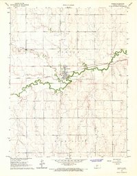 1966 Bazine1967 Print · USGSBazine and the surrounding Ness County plains are captured in the mid-sixties during a period of steady industrial expansion. Researchers can locate family sites near Bazine Cem or trace the path of the Atchison Topeka and Santa Fe railroad.
 - 1966 Map of Laird, 1967 Print
 1966 Laird1967 Print · USGSMid-century Ness County comes to life in this survey showing the intersection of rail and river commerce. Genealogists and historians can trace the Atchison Topeka and Santa Fe line through Laird and locate the Sunshine Oil Field.
 - 1966 Map of Ransom SW, 1967 Print
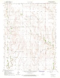 1966 Ransom SW1967 Print · USGSNess County was primarily a landscape of winding creek beds and remote townships in the mid-sixties. Researchers can locate the North Star Cem and trace the paths of Wild Horse Creek and Forrester Creek through this rural terrain.
 - 1966 Map of Utica SE, 1967 Print
 1966 Utica SE1967 Print · USGSNess County during the mid-sixties shows a landscape defined by traditional townships and emerging energy production. Researchers can trace land ties and local landmarks like Prairie Chapel Cem, the Dickman Oil Field, and North Fork Walnut Creek.
 - 1970 Map of Bazine SE, 1972 Print
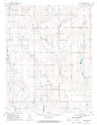 1970 Bazine SE1972 Print · USGSPawnee and Ness Counties are captured here during a peak era of petroleum production in the early seventies. Genealogists and local historians can trace the specific locations of the Schadel Oil Field, Steffen Oil Field, and landmarks like High Point.
 - 1970 Map of Ness City SW, 1972 Print
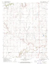 1970 Ness City SW1972 Print · USGSNess and Hodgeman counties are captured here in the early seventies, showing a rural landscape where the energy economy meets traditional prairie life. Researchers can trace the Petersilie Oil Field and find family-history landmarks like Kunze Cem and the settlement of Harold.
 - 1970 Map of Bazine SW, 1972 Print
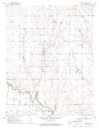 1970 Bazine SW1972 Print · USGSNess and Hodgeman Counties are captured here at the height of the regional petroleum boom in the early seventies. Local researchers can trace the winding Pawnee River near Marena and locate family history at St John the Baptist Cem or Crandall Cem.
 - 1970 Map of Ness City SE, 1972 Print
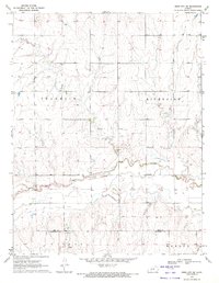 1970 Ness City SE1972 Print · USGSThe Kansas plains north of the Hodgeman county line are captured here in 1970, showing a landscape defined by the Pawnee River and the Riverside Oil Field. Researchers can locate Riverside Cem and the settlement of Riverside, while tracing local industry via several Sandpits.
 - 1974 Map of Beeler SE, 1976 Print
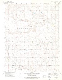 1974 Beeler SE1976 Print · USGSNess County and Hodgeman County land is captured here in the mid-seventies as petroleum development began to dot the plains. Researchers can locate the Manteno Community Hall, a local Cem, and the settlement of Monroe along the South Fork.
Showing maps 1-25 of 156
Top cities of Ness County
- Ness City historical maps
- Ransom historical maps
- Bazine historical maps
- Utica historical maps
- Brownell historical maps
Frequently asked questions
- What are the different types of historical maps available for Ness County?
- What is the oldest map of Ness County?
- Where can I purchase historical maps of Ness County for my home or office?
- Where can I download high-res historical maps of Ness County?
- Are there historical topographic maps available for Ness County?
- Is there historical aerial imagery available for Ness County?
- Where are historical maps of Ness County sourced from?