1900s (20th Century) Maps of Olivet, Kansas
Explore 8 historic maps of Olivet from the 1900s (20th Century). These maps offer a rare glimpse into what life looked like during the 1900s — showing old roads, neighborhoods, homes, and landmarks that have changed or disappeared over time.
Whether you're researching your family's past, planning a metal detecting trip, or studying how Olivet's landscape evolved across the 1900s, these high-resolution maps are a powerful tool for exploring the history of this region.
- Focus on a specific era: All maps on this page are from the 1900s, giving you a focused view of this time period.
- See what’s changed: Compare century-old streets, trails, and buildings to today's modern landscape using overlays and satellite layers.
- Research with precision: Use these maps for genealogy, historical research, land use analysis, or educational projects.
- View, download, or print: Maps are fully viewable online in high resolution, and can be downloaded or printed for your own records.
Start exploring Olivet's history through authentic maps from the 1900s. This is your window into the past.
Olivet, KS maps
(8)- 1947 Map of Lawrence, 1954 Print
 1947 Lawrence1954 Print · USGSEastern Kansas and western Missouri thrive in the late 1940s, showing a landscape defined by major river valleys and a dense railway network. Genealogists can trace family settlements from Lawrence to Greenwood and locate landmarks like Olathe Navy and Lake Lotawana.
 - 1950 Map of Lawrence
 1950 Lawrence1950 Print · USGSMid-century Kansas and Missouri come alive in this map of the river-valley corridors just as the interstate era was beginning. Researchers can trace the legacy of major rail lines like the Union Pacific RR and locate ancestral roots in towns from Lawrence to Harrisonville.
 - 1956 Map of Lawrence, 1967 Print
 1956 Lawrence1967 Print · USGSEastern Kansas and the Missouri border country are captured here during the mid-century transition to the interstate era. Genealogists and local historians can trace family-named terrain like Summers Mound and the footprint of Sunflower Ordnance Works near Baldwin City.4 unique versions available
 - 1957 Map of Lebo, 1958 Print
 1957 Lebo1958 Print · USGSThe Kansas prairie at the mid-century reveals a landscape defined by the Atchison Topeka and Santa Fe railroad and old boundary lines. Genealogists can trace family names near Arvonia or locate burials at Lincoln Cem and Key West Cem.2 unique versions available
 - 1957 Map of Waverly NW, 1958 Print
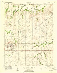
 1957 Waverly NW1958 Print · USGSOsage and Coffey Counties come alive in the late fifties, showing a rural landscape defined by the railroad and historic borders. Trace the legacy of Olivet, locate the Olivet Cem, and follow the Old Indian Boundary as it crosses the plains.3 unique versions available
 - 1961 Map of Lawrence
 1961 Lawrence1961 Print · USGSThe Kansas-Missouri borderland shows its mid-century transition from a rail-dependent agricultural region to a suburbanizing landscape. Genealogists can trace family footprints through numerous Cem sites and distinctive terrain landmarks like Graves Mound and Summers Mound.
 - 1985 Map of Garnett
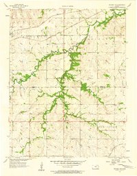
 1985 Garnett1985 Print · USGSAnderson County and its neighbors in the mid-eighties show a landscape of rising reservoirs and enduring rail towns. Genealogists and historians can trace the transition from rail to highway at Beto Junction or locate heritage sites like Silkville and Neosho Rapids.
 - 1990 Map of Garnett
 1990 Garnett1990 Print · USGSEast-central Kansas was a landscape of major reservoirs and established rail towns during the 1990s. Genealogists and historians can trace the paths of the Missouri Pacific Railroad and the Atchison Topeka and Santa Fe Railway through towns like Garnett and Silkville.
End of results
Showing maps 1-8 of 8
Top cities near Olivet
- Osage City historical maps
- Lyndon historical maps
- Lebo historical maps
- Ottumwa historical maps
- Waverly historical maps
- Hartford historical maps
See more
Frequently asked questions
- What are the different types of historical maps available for Olivet?
- What is the oldest map of Olivet?
- Where can I purchase historical maps of Olivet for my home or office?
- Where can I download high-res historical maps of Olivet?
- Are there historical topographic maps available for Olivet?
- Is there historical aerial imagery available for Olivet?
- Where are historical maps of Olivet sourced from?