1940s Maps of Scott County, Kansas
Explore 5 historic maps of Scott County from the 1940s. These maps offer a rare glimpse into what life looked like during the 1940s — showing old roads, neighborhoods, homes, and landmarks that have changed or disappeared over time.
Whether you're researching your family's past, planning a metal detecting trip, or studying how Scott County's landscape evolved across the 1940s, these high-resolution maps are a powerful tool for exploring the history of this region.
- Focus on a specific era: All maps on this page are from the 1940s, giving you a focused view of this time period.
- See what’s changed: Compare century-old streets, trails, and buildings to today's modern landscape using overlays and satellite layers.
- Research with precision: Use these maps for genealogy, historical research, land use analysis, or educational projects.
- View, download, or print: Maps are fully viewable online in high resolution, and can be downloaded or printed for your own records.
Start exploring Scott County's history through authentic maps from the 1940s. This is your window into the past.
Scott County, KS maps
(5)- 1940 Map of Scott City
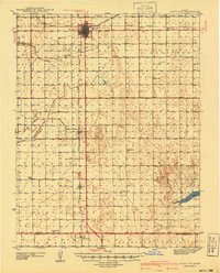 1940 Scott City1940 Print · USGSWestern Kansas agriculture and early energy development intersect in the late 1930s. Genealogists can trace rural school districts like Buffalo Sch and Lone Valley Sch or locate ancestors in the Scott City Cem.
 - 1941 Map of Modoc
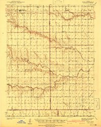 1941 Modoc1941 Print · USGSWichita and Scott counties are shown just before the war, when the rural school system and the Missouri Pacific railroad anchored the High Plains economy. Researchers can locate numerous local landmarks including St Marys Cem, Lydia Ch, and schools like Prairie Bell Sch.
 - 1941 Map of Pence
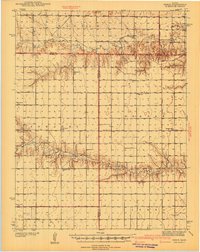 1941 Pence1941 Print · USGSWestern Kansas high plains life is preserved here during the late Depression era, showing the intersection of Logan, Wichita, and Scott counties. Genealogists can trace early 20th-century rural life through landmarks like Pence Cem and a network of schools including Lone Corner Sch and High Prairie Sch.2 unique versions available
 - 1942 Map of Sandon
 1942 Sandon1942 Print · USGSWestern Kansas at the end of the Depression era reveals a landscape shaped by both deep canyon drainages and the arrival of organized recreation and preservation. Genealogists can locate family-named landmarks and rural school sites like Goodluck Sch and Zanobia Sch, or trace the historical Pueblo Ruins Monument near McBride.
 - 1942 Map of Lake Mc Bride
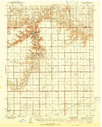
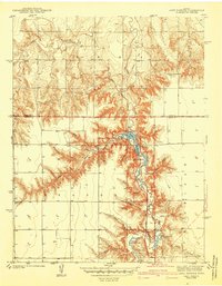 1942 Lake Mc Bride1942 Print · USGSWestern Kansas at the dawn of the 1940s reveals a unique intersection of ancient history and New Deal-era public works. Researchers can trace rural school locations like State Park Sch and explore landmarks like El Quartelejo Pueblo Ruins Monument.5 unique versions available
End of results
Showing maps 1-5 of 5
Top cities of Scott County
Frequently asked questions
- What are the different types of historical maps available for Scott County?
- What is the oldest map of Scott County?
- Where can I purchase historical maps of Scott County for my home or office?
- Where can I download high-res historical maps of Scott County?
- Are there historical topographic maps available for Scott County?
- Is there historical aerial imagery available for Scott County?
- Where are historical maps of Scott County sourced from?