Old Maps of Scott County, Kansas for Metal Detecting
Plan your next treasure hunt with 137 historic maps of Scott County. Find old homesites, ghost towns, trails, and gathering spots that may be lost to time — perfect for identifying promising metal detecting locations.
- Locate forgotten sites: Uncover places like long-lost settlements, abandoned rail lines, or gathering spots.
- Plan better hunts: Use map overlays combined with LiDAR or satellite views to narrow in on historically rich areas.
- Made for detectorists: Thousands of hobbyists use these maps to discover relics, coins, and hidden history.
Use these historic maps to boost your research and find new opportunities beneath the surface of Scott County.
Scott County, KS maps
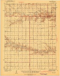
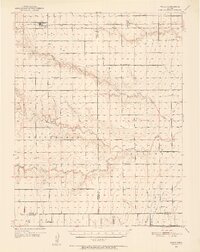
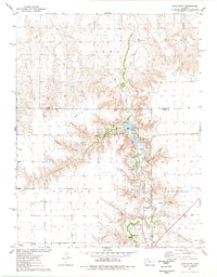
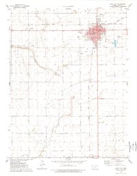
(137)- 1939 Map of Lake Mc Bride, 1958 Print
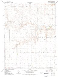
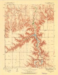 1939 Lake Mc Bride1958 Print · USGSWestern Kansas at the end of the Depression reveals a landscape of remote schoolhouses and significant archaeological sites along the Ladder Creek breaks. Genealogists and historians can locate early landmarks like El Quartelejo Pueblo Ruins Monument, Glendale Sch, and the rugged Suicide Bluffs.5 unique versions available
 - 1939 Map of Sandon, 1959 Print
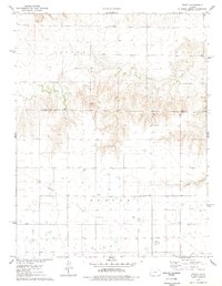
 1939 Sandon1959 Print · USGSWestern Kansas at the end of the 1930s reveals a landscape of remote schoolhouses and deep canyons along the Ladder Creek drainage. Genealogists and local historians can trace rural landmarks like Zanobia Sch, the Pueblo Ruins Monument, and the settlement of Sandon along the Missouri Pacific tracks.
 - 1939 Map of Pence, 1971 Print
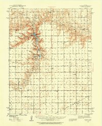
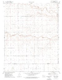
 1939 Pence1971 Print · USGSWestern Kansas farm life is meticulously documented in this late 1930s survey of the Logan, Wichita, and Scott county lines. Researchers can trace the locations of numerous rural schoolhouses like Liberty Sch and Prairie View Sch, along with the Pence Cem.2 unique versions available
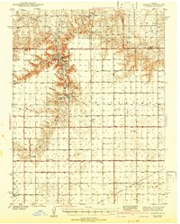
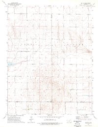
 - 1940 Map of Scott City
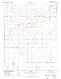
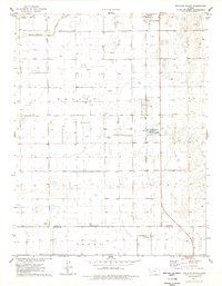
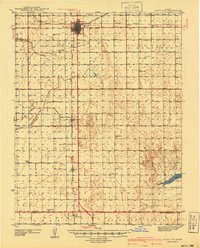 1940 Scott City1940 Print · USGSWestern Kansas agriculture and early energy development intersect in the late 1930s. Genealogists can trace rural school districts like Buffalo Sch and Lone Valley Sch or locate ancestors in the Scott City Cem.
 - 1941 Map of Modoc
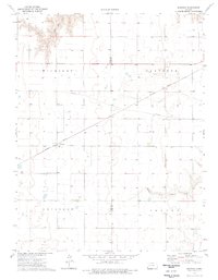
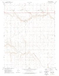
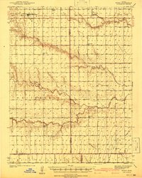 1941 Modoc1941 Print · USGSWichita and Scott counties are shown just before the war, when the rural school system and the Missouri Pacific railroad anchored the High Plains economy. Researchers can locate numerous local landmarks including St Marys Cem, Lydia Ch, and schools like Prairie Bell Sch.
 - 1941 Map of Pence
 1941 Pence1941 Print · USGSWestern Kansas high plains life is preserved here during the late Depression era, showing the intersection of Logan, Wichita, and Scott counties. Genealogists can trace early 20th-century rural life through landmarks like Pence Cem and a network of schools including Lone Corner Sch and High Prairie Sch.2 unique versions available
 - 1942 Map of Sandon
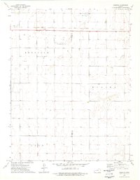
 1942 Sandon1942 Print · USGSWestern Kansas at the end of the Depression era reveals a landscape shaped by both deep canyon drainages and the arrival of organized recreation and preservation. Genealogists can locate family-named landmarks and rural school sites like Goodluck Sch and Zanobia Sch, or trace the historical Pueblo Ruins Monument near McBride.
 - 1942 Map of Lake Mc Bride
 1942 Lake Mc Bride1942 Print · USGSWestern Kansas at the dawn of the 1940s reveals a unique intersection of ancient history and New Deal-era public works. Researchers can trace rural school locations like State Park Sch and explore landmarks like El Quartelejo Pueblo Ruins Monument.5 unique versions available
 - 1951 Map of Scott City, 1952 Print
 1951 Scott City1952 Print · USGSScott County at mid-century was a landscape of rail-driven commerce and emerging energy production. Genealogists can trace rural family roots through landmarks like Kingdom Hall Ch, the Scott City Cem, and several country schools including Hines Sch and Mt Hope Sch.
 - 1951 Map of Modoc, 1952 Print
 1951 Modoc1952 Print · USGSWestern Kansas farming communities are captured in the early fifties as the rural school system and steam-era rail lines still defined the landscape. Genealogists can locate family landmarks like St Marys Cem, Lydia Ch, and several country schools including Grandview Sch.
 - 1955 Map of Scott City, 1969 Print
 1955 Scott City1969 Print · USGSWestern Kansas in the mid-fifties is captured here as a landscape of rural schoolhouses and significant rail corridors. Family historians can trace the locations of Skyline and Beaver Creek Schools or follow the Union Pacific line through Oakley and Sharon Springs.4 unique versions available
 - 1958 Map of Scott City
 1958 Scott City1958 Print · USGSWestern Kansas at the peak of the post-war era reveals a landscape of high-plains agriculture and vital rail junctions. Genealogists and historians can trace old country school sites like Prairie Bell School, the landmark Chalk Pyramids, and small stops along the Union Pacific and Missouri Pacific.
 - 1974 Map of Amy SW, 1976 Print
 1974 Amy SW1976 Print · USGSWestern Kansas at the start of the seventies reveals a landscape of high-plains agriculture and mineral extraction across the borders of three counties. Genealogists and historians can trace the rural layout of Pleasant Valley or locate local landmarks like Dry Lake and the Caliche Pits.
 - 1974 Map of Healy NW, 1976 Print
 1974 Healy NW1976 Print · USGSThe Smoky Hill River valley and the western Kansas high plains are documented here in the mid-1970s. Researchers can trace the drainage networks of Hell Creek and West Salt Creek or locate local mineral resources like the Caliche Pits.
 - 1974 Map of Grigston, 1976 Print
 1974 Grigston1976 Print · USGSWestern Kansas agricultural and industrial life is captured here in the mid-1970s, as the High Plains landscape supported both cattle and energy. Researchers can trace the Atchison Topeka and Santa Fe rail line through Grigston or locate specific Oil Wells and a large Feedlot.
 - 1974 Map of Manning, 1977 Print
 1974 Manning1977 Print · USGSMid-century western Kansas unfolds here during the 1970s, showcasing the high plains agriculture of the Scott and Lane County line. Researchers can trace the railroad legacy of Manning along the Missouri Pacific or locate early industrial sites like the Caliche Pits.
 - 1976 Map of Lake Scott, 1978 Print
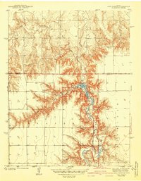
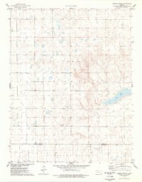
 1976 Lake Scott1978 Print · USGSWestern Kansas canyon country comes to life in the mid-seventies, showing the deep draws and springs that provided rare refuge on the plains. Genealogists and historians can locate the El Cuartelejo Ruins, White Womans Grave, and the site of an Old Railroad Grade.
 - 1976 Map of Pence, 1978 Print
 1976 Pence1978 Print · USGSScott County and Logan County were largely defined by rural townships and agricultural industry in the mid-1970s. Genealogists can locate family landmarks like Pence Cem and Scott Ch near the historic settlement of Pence.
 - 1976 Map of Modoc SW, 1978 Print
 1976 Modoc SW1978 Print · USGSWichita County in the late 1970s shows a landscape of wide-open plains and seasonal drainages. Genealogists and local historians can locate the Lydia Ch and Cem near the county line, while tracing the paths of White Woman Creek and Sand Creek.
 - 1976 Map of Modoc SE, 1978 Print
 1976 Modoc SE1978 Print · USGSWestern Kansas land use comes into focus in the mid-1970s, showing a landscape defined by watercourses and energy infrastructure. Researchers can trace the path of White Woman Creek or locate local landmarks like East Hibbard and the regional Oil Field.
 - 1976 Map of Shallow Water, 1978 Print
 1976 Shallow Water1978 Print · USGSWestern Kansas during the mid-seventies shows a landscape of high-plains agriculture and rising energy production. Genealogists and local historians can trace the rural infrastructure of Shallow Water and Friend, from the Prairie View Ch to the industrial Refinery and sprawling Oil Field.
 - 1976 Map of Pence NW, 1978 Print
 1976 Pence NW1978 Print · USGSWestern Kansas at the height of the 1970s shows a landscape of agricultural utility and aviation transit at the county lines. Trace local infrastructure through private aviation sites like Kough Landing Strip and the winding course of Chalk Creek.
 - 1976 Map of Modoc, 1978 Print
 1976 Modoc1978 Print · USGSScott County, Kansas, is captured in the mid-seventies, showing the high plains landscape and the vital rail corridor through Modoc. Genealogists and historians can trace the townsite at Modoc Cem and the path of the Missouri Pacific railroad.
 - 1976 Map of Pawnee Mound, 1978 Print
 1976 Pawnee Mound1978 Print · USGSWestern Kansas at the end of the seventies reveals a landscape of high-plains relief and seasonal basins. Researchers can trace the boundary between Scott Co and Finney Co while locating landmarks like Pawnee Mound and the basin of Dry Lake.
 - 1976 Map of Scott City, 1978 Print
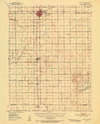
 1976 Scott City1978 Print · USGSScott City was a thriving rail and agricultural center in the mid-1970s, where two major lines met on the High Plains. Genealogists and local historians can trace civic life through the Courthouse and St Joseph Sch, or locate rural landmarks like Shallow Water and the Scott City Cem.
Showing maps 1-25 of 137
Top cities of Scott County
Frequently asked questions
- What are the different types of historical maps available for Scott County?
- What is the oldest map of Scott County?
- Where can I purchase historical maps of Scott County for my home or office?
- Where can I download high-res historical maps of Scott County?
- Are there historical topographic maps available for Scott County?
- Is there historical aerial imagery available for Scott County?
- Where are historical maps of Scott County sourced from?