1980s Maps of Scott County, Kansas
Explore 5 historic maps of Scott County from the 1980s. These maps offer a rare glimpse into what life looked like during the 1980s — showing old roads, neighborhoods, homes, and landmarks that have changed or disappeared over time.
Whether you're researching your family's past, planning a metal detecting trip, or studying how Scott County's landscape evolved across the 1980s, these high-resolution maps are a powerful tool for exploring the history of this region.
- Focus on a specific era: All maps on this page are from the 1980s, giving you a focused view of this time period.
- See what’s changed: Compare century-old streets, trails, and buildings to today's modern landscape using overlays and satellite layers.
- Research with precision: Use these maps for genealogy, historical research, land use analysis, or educational projects.
- View, download, or print: Maps are fully viewable online in high resolution, and can be downloaded or printed for your own records.
Start exploring Scott County's history through authentic maps from the 1980s. This is your window into the past.
Scott County, KS maps
(5)- 1985 Map of Healy
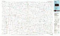 1985 Healy1985 Print · USGSWestern Kansas in the mid-1980s shows a landscape where pioneer history and the railroad era overlap. Genealogists and historians can trace the Butterfield Overland Trail near Castle Rock or locate rural family outposts near Gove City and Arnold.2 unique versions available
 - 1985 Map of Leoti
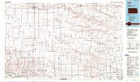
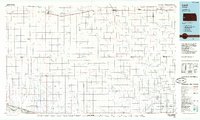 1985 Leoti1985 Print · USGSWestern Kansas at the mid-eighties was a landscape defined by its rail-side grain stops and a grid of rural section roads. Researchers can trace the path of the Missouri Pacific through Leoti or locate small landmarks like Mark Hoard Memorial Airfield and the County Cem.
 - 1985 Map of Scott City
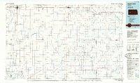 1985 Scott City1985 Print · USGSWestern Kansas in the mid-eighties shows a landscape of rail-linked grain towns and emerging energy fields. Genealogists and researchers can trace the Atchison Topeka and Santa Fe line through Alamota and Beeler, or locate family sites near White Woman Bottoms and Walnut Creek.2 unique versions available
 - 1985 Map of Sharon Springs
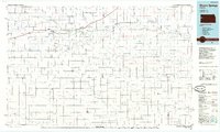 1985 Sharon Springs1985 Print · USGSWestern Kansas at the mid-eighties reveals a landscape shaped by the Union Pacific and the historic Butterfield Overland Trail. Researchers can trace the frontier legacy of the Fort Wallace (site) and explore rural landmarks from Weskan to Russell Springs.2 unique versions available
 - 1987 Map of Leoti, 1988 Print
 1987 Leoti1988 Print · USGSWestern Kansas at the close of the eighties shows a landscape defined by industrial gas fields and a sprawling railroad network. Researchers can trace small-town development and rural infrastructure near Leoti, Tribune, and the Mark Heard Memorial Airfield.
End of results
Showing maps 1-5 of 5
Top cities of Scott County
Frequently asked questions
- What are the different types of historical maps available for Scott County?
- What is the oldest map of Scott County?
- Where can I purchase historical maps of Scott County for my home or office?
- Where can I download high-res historical maps of Scott County?
- Are there historical topographic maps available for Scott County?
- Is there historical aerial imagery available for Scott County?
- Where are historical maps of Scott County sourced from?