Old Maps of Wickliffe, Kentucky for Academic Research
Study the evolution of Wickliffe with 13 high-resolution historic maps. Whether you're teaching, researching, or modeling changes in land use, these maps provide essential visual documentation of urban, environmental, and geographic change.
- Analyze long-term change: Track patterns in development, transportation, and natural features.
- Ideal for environmental or urban studies: Support academic projects with primary historical map data.
- Use in the classroom or lab: Educators and researchers rely on these maps to bring historical context to life.
These maps are a powerful tool for teaching, research, and visualizing how Wickliffe has changed over the decades.
Wickliffe, KY maps
(13)- 1939 Map of Wickliffe
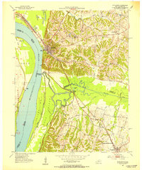
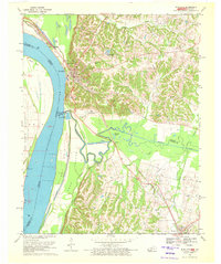
 1939 Wickliffe1939 Print · USGSThe confluence of the Ohio and Mississippi Rivers in the late 1930s reveals a landscape of river-bend settlements and early flood control. Genealogists can locate numerous rural landmarks such as St Pauls Ch & Sch, Cherry Geveden Sch, and the historic site of Fort Jefferson.2 unique versions available
 - 1951 Map of Wickliffe, 1953 Print
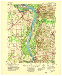
 1951 Wickliffe1953 Print · USGSThe river confluence at the Kentucky-Missouri border comes to life in the early fifties, showing the strategic rail and water hub around Wickliffe. Researchers can locate old family landmarks like Harrison Hughes Cem or trace the early paths of the Illinois Central railroad.2 unique versions available
 - 1952 Map of Wickliffe, 1964 Print
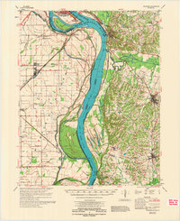
 1952 Wickliffe1964 Print · USGSThe confluence of the Ohio and Mississippi rivers in the early fifties shows a bustling network of river commerce and rail lines. You can trace family roots through numerous rural landmarks like North Ballard Ch & Cem, Birds Point Sch, and the rail junction at Winford Junction.
 - 1955 Map of Wickliffe
 1955 Wickliffe1955 Print · USGSThe confluence of the great river systems at the Kentucky-Missouri-Illinois border is documented here in the mid-fifties. Researchers can locate vanished rural landmarks and river landings like Norfolk Ldg, Thirty Four Corner Sch, and the Mississippi Ch & Cem.
 - 1956 Map of Dyersburg, 1960 Print
 1956 Dyersburg1960 Print · USGSThe Four Rivers region comes alive in the mid-fifties, capturing the intricate borderlands of Tennessee, Kentucky, and Missouri. Genealogists and historians can trace the rail-and-river networks connecting Dyersburg, Caruthersville, and the shoreline of Reelfoot Lake.4 unique versions available
 - 1970 Map of Wickliffe, 1972 Print
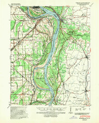
 1970 Wickliffe1972 Print · USGSThe river bluffs of western Kentucky met the great confluence in the 1970s, where the Missouri and Illinois borders converge. Genealogists and historians can trace significant landmarks like the Ancient Buried City, the Site of Fort Jefferson, and the Wickliffe Cem.2 unique versions available
 - 1972 Map of Wickliffe
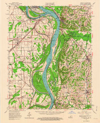
 1972 Wickliffe1972 Print · USGSThe confluence of the Ohio and Mississippi Rivers is captured here in the early seventies, showing a landscape defined by major levees and river commerce. Genealogists can trace family landmarks like Bird Cem and Birds Point Sch or the riverside town of Wickliffe.
 - 1985 Map of Sikeston, 1986 Print
 1985 Sikeston1986 Print · USGSThe Missouri Bootheel and the four-state river convergence are captured in the mid-eighties as the modern agricultural and rail networks matured. Researchers can locate regional landmarks like the Towosahgy State Historic Site, Oak Grove Cem, and towns along the St Louis Southwestern Railroad.2 unique versions available
 - 2010 Map of Wickliffe, 2010 Print
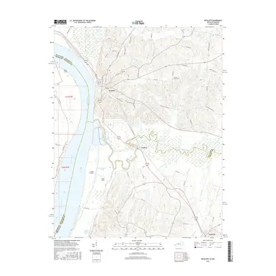
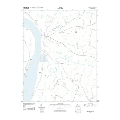 2010 Wickliffe2010 Print · USGSCovers Wickliffe, including Bardwell, Winford, and other nearby areas
 - 2013 Map of Wickliffe, 2013 Print
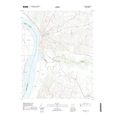
 2013 Wickliffe2013 Print · USGSCovers Wickliffe, including Bardwell, Winford, and other nearby areas
 - 2016 Map of Wickliffe, 2016 Print
 2016 Wickliffe2016 Print · USGSCovers Wickliffe, including Bardwell, Winford, and other nearby areas
 - 2019 Map of Wickliffe, 2019 Print
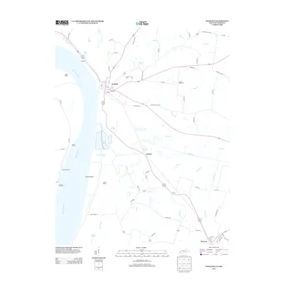
 2019 Wickliffe2019 Print · USGSCovers Wickliffe, including Bardwell, Winford, and other nearby areas
 - 2022 Map of Wickliffe, 2022 Print
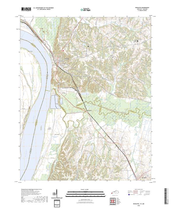 2022 Wickliffe2022 Print · USGSThe river bluffs of Ballard County come into focus in the early 2020s, showing the strategic position of Wickliffe above the Mississippi River floodplains. Genealogists can locate several key burial grounds including Cone Creek Cem and Bethlehem Cem.
End of results
Showing maps 1-13 of 13
Top cities near Wickliffe
- Charleston historical maps
- Cairo historical maps
- La Center historical maps
- Mounds historical maps
- Bardwell historical maps
- Barlow historical maps
See more
Frequently asked questions
- What are the different types of historical maps available for Wickliffe?
- What is the oldest map of Wickliffe?
- Where can I purchase historical maps of Wickliffe for my home or office?
- Where can I download high-res historical maps of Wickliffe?
- Are there historical topographic maps available for Wickliffe?
- Is there historical aerial imagery available for Wickliffe?
- Where are historical maps of Wickliffe sourced from?