2020s Maps of Boone County, Kentucky
Explore 13 historic maps of Boone County from the 2020s. These maps offer a rare glimpse into what life looked like during the 2020s — showing old roads, neighborhoods, homes, and landmarks that have changed or disappeared over time.
Whether you're researching your family's past, planning a metal detecting trip, or studying how Boone County's landscape evolved across the 2020s, these high-resolution maps are a powerful tool for exploring the history of this region.
- Focus on a specific era: All maps on this page are from the 2020s, giving you a focused view of this time period.
- See what’s changed: Compare century-old streets, trails, and buildings to today's modern landscape using overlays and satellite layers.
- Research with precision: Use these maps for genealogy, historical research, land use analysis, or educational projects.
- View, download, or print: Maps are fully viewable online in high resolution, and can be downloaded or printed for your own records.
Start exploring Boone County's history through authentic maps from the 2020s. This is your window into the past.
Boone County, KY maps
(13)- 2022 Map of Burlington, 2022 Print
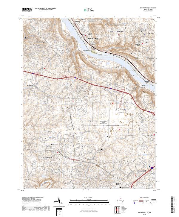 2022 Burlington2022 Print · USGSNorthern Kentucky and the Cincinnati riverfront are captured here in the early twenty-first century. Researchers can trace family sites at the Old Burlington Cem, Hebron Lutheran Church Cem, and the Boone County Justice Center.
 - 2022 Map of Rising Sun, 2022 Print
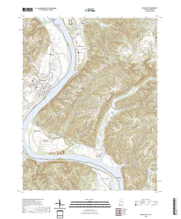 2022 Rising Sun2022 Print · USGSSpanning the Ohio River at the Indiana-Kentucky border, this recent survey captures the modern landscape of Rising Sun and its surrounding river bottoms. Genealogists can locate numerous historic burial sites including Fulton Burying Ground, Old Belleview Cem, and the community of Rabbit Hash.
 - 2022 Map of Aberdeen, 2022 Print
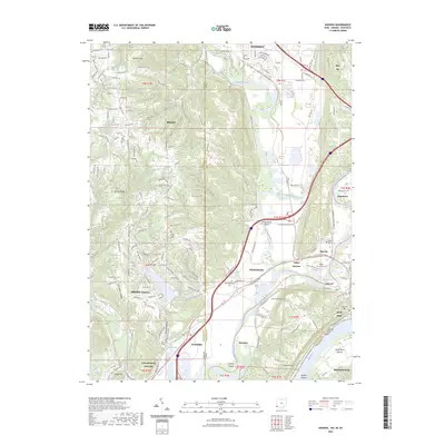
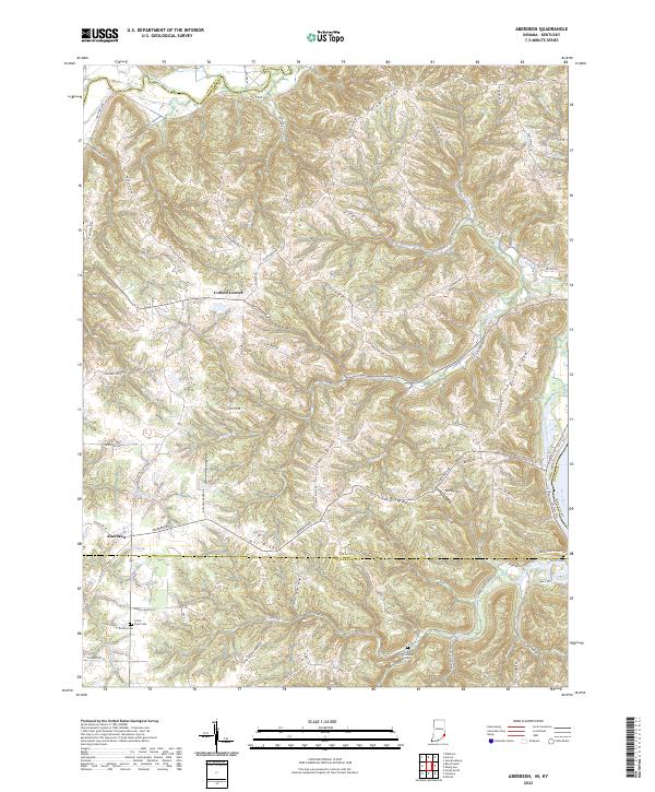 2022 Aberdeen2022 Print · USGSThe tri-county border of Indiana meets the Kentucky shoreline in the early 2020s, showing a landscape of high ridges and deep creek valleys. Researchers can locate family sites at Bovard Cem or Grant Brothers Cem near the settlements of Aberdeen and Cofield Corner.
 - 2022 Map of Patriot, 2022 Print
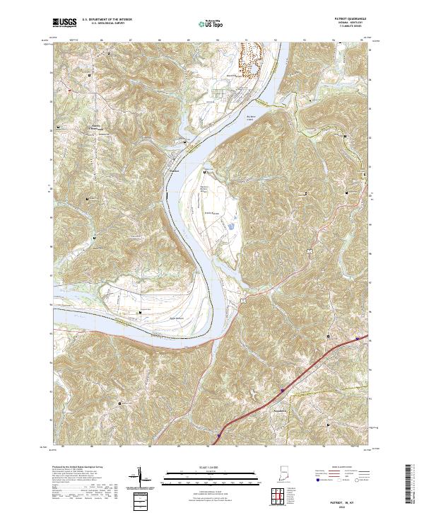 2022 Patriot2022 Print · USGSThe Indiana-Kentucky borderlands along the Ohio River come to life in this contemporary survey of the hills surrounding Patriot. Genealogists and researchers can trace family landmarks like Richardson Cem and the small settlements of Searey Crossroads and Napoleon.
 - 2022 Map of Lawrenceburg, 2022 Print
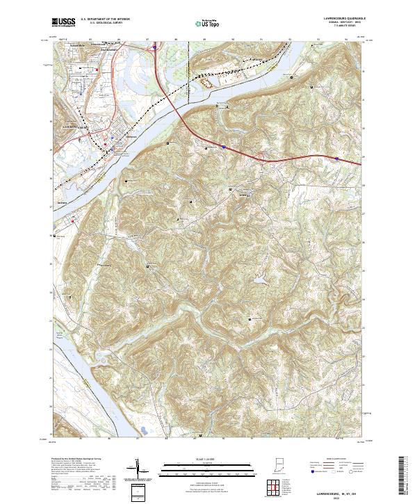 2022 Lawrenceburg2022 Print · USGSThe tri-state border region comes alive on this survey of the river valleys where the Great Miami River meets the Ohio River. Researchers can trace early family settlements through numerous ridge-top burial grounds like Tousey Cem and Barnard Cem.
 - 2022 Map of Aurora, 2022 Print
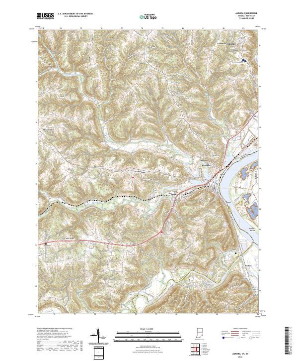 2022 Aurora2022 Print · USGSThe Indiana riverfront and its upland ridges come into sharp focus in this contemporary survey of the Dearborn County area. Trace family roots and local industry through the streets of Aurora and Lawrenceburg, or locate Mount Tabor Church Cem and the settlement of Wilmington.
 - 2022 Map of Verona, 2022 Print
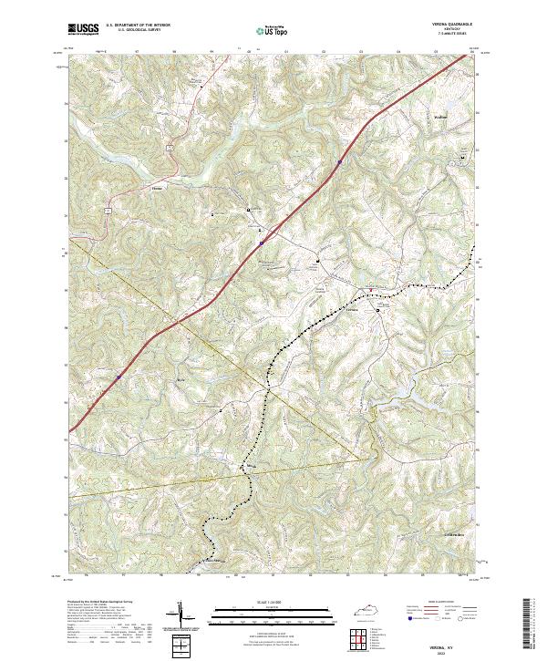 2022 Verona2022 Print · USGSThe hill country of Boone and Grant counties comes into sharp focus in this recent survey. Local historians can trace family roots at Beaverlick Cem and Saint Patricks Cem or explore the rural hubs of Verona and Zion Station.
 - 2022 Map of Union, 2022 Print
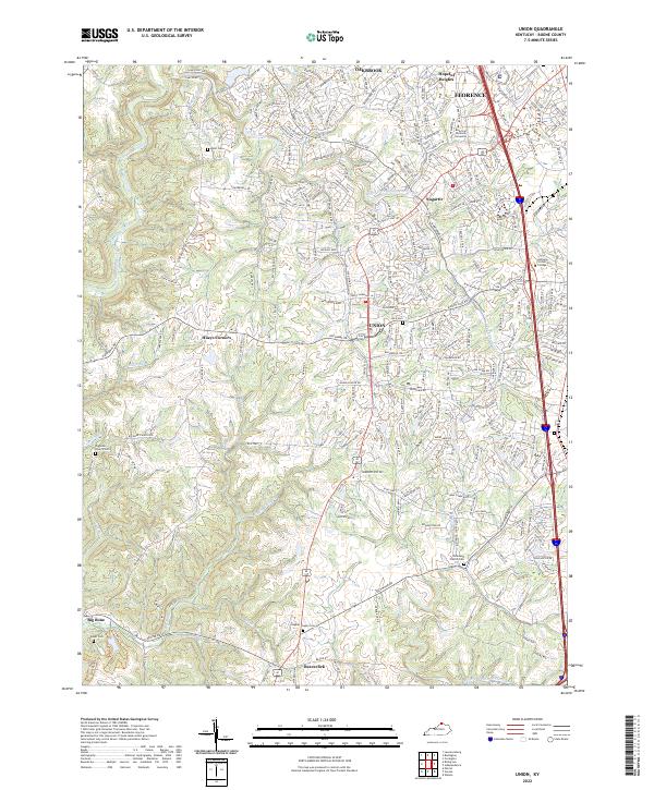 2022 Union2022 Print · USGSNorthern Kentucky at the start of the 2020s shows the suburban growth of Florence and Union meeting older rural crossroads. Genealogists can trace family lines through several local burial sites, including Rice Cem and Hughes Chapel Cem, or find the interestingly named Sugartit near the creek forks.
 - 2022 Map of Walton, 2022 Print
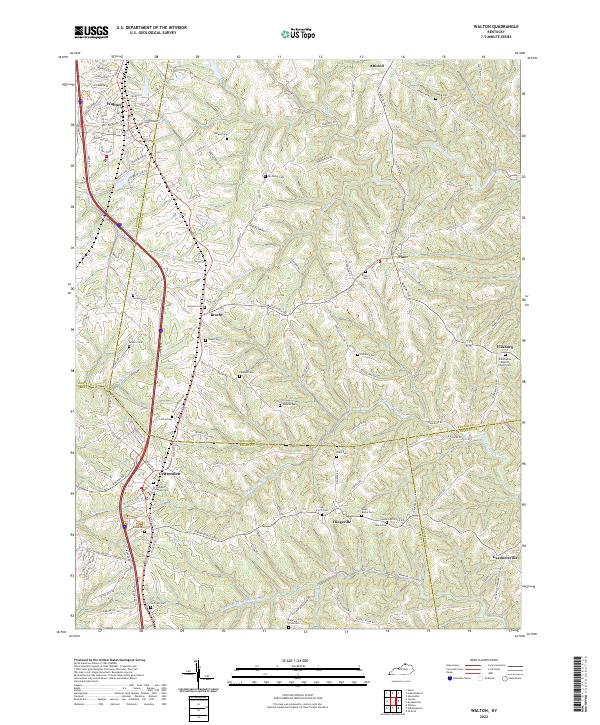 2022 Walton2022 Print · USGSNorthern Kentucky's ridge-and-valley landscape comes to life in this survey of the borders where Boone, Kenton, and Grant Counties meet. Genealogists and local researchers can trace numerous family-named burial sites and rural communities like Bracht, Fiskburg, and the Crittenden Christian Cem.
 - 2022 Map of Independence, 2022 Print
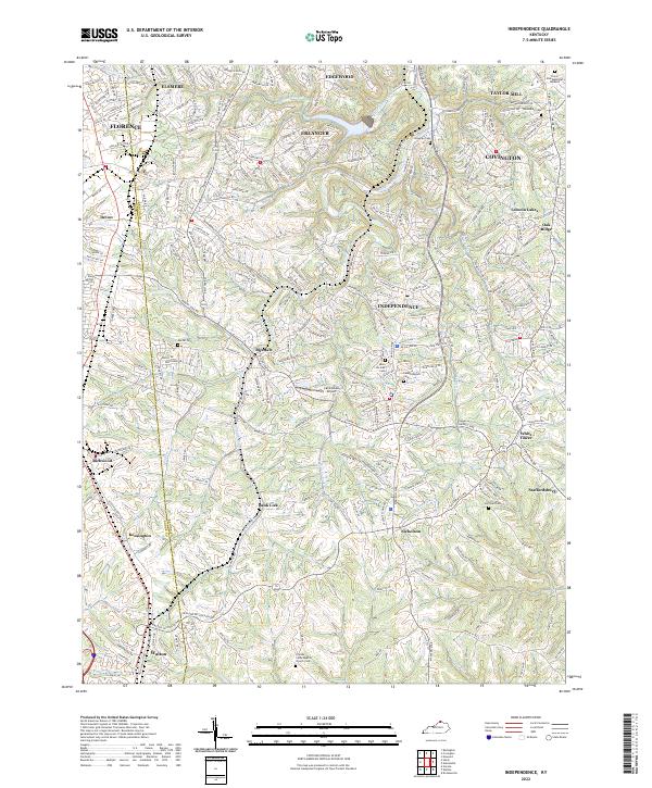 2022 Independence2022 Print · USGSNorthern Kentucky's suburban landscape is documented here in the early twenty-first century, spanning the border of Boone and Kenton counties. Family historians can trace local burial sites like Saint Cecilias Cem and old settlements such as Ricedale and Staffordsburg.
 - 2022 Map of Covington, 2022 Print
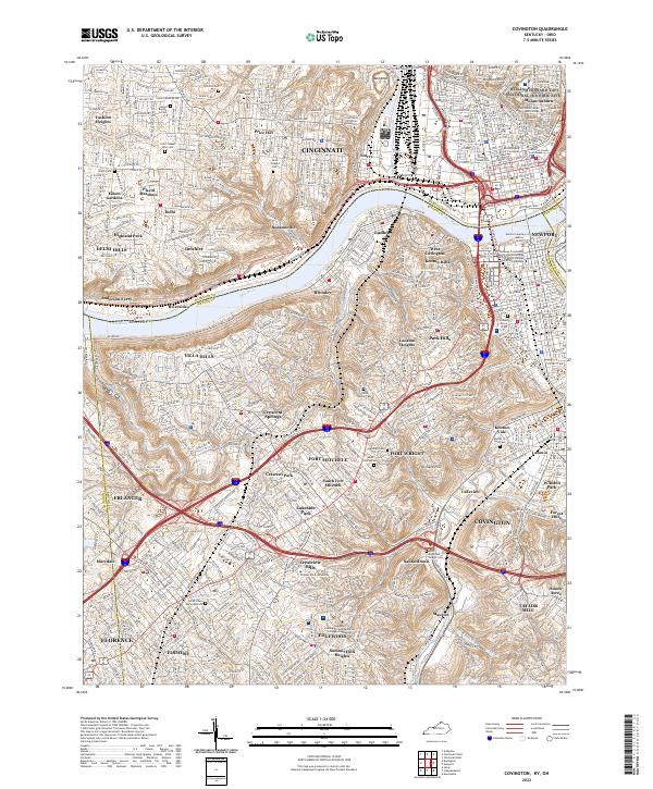 2022 Covington2022 Print · USGSNorthern Kentucky and Cincinnati meet along the Ohio River in this detailed survey of the 2020s. Trace your family roots through the Linden Grove Cem, visit the William Howard Taft National Historic Site, or locate the historic Anderson Ferry.
 - 2023 Map of Addyston, 2023 Print
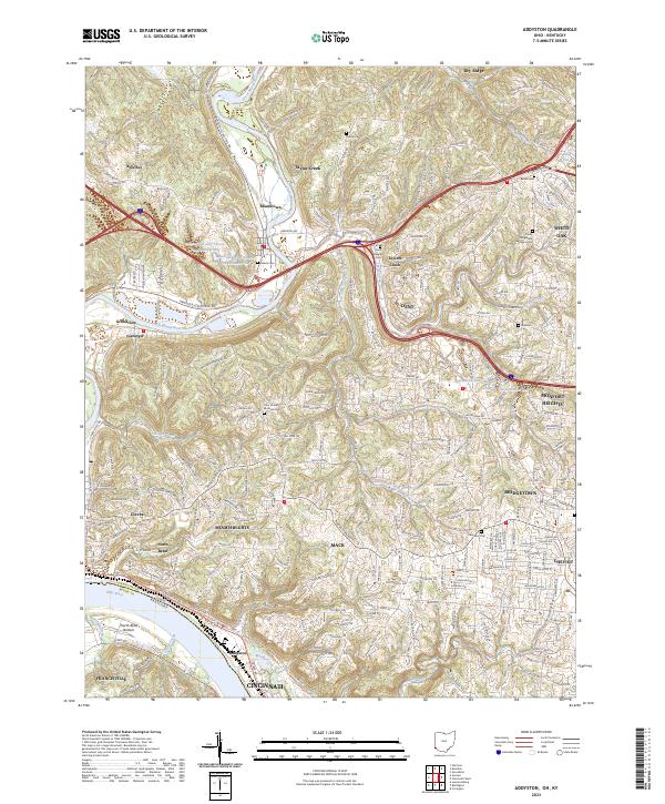 2023 Addyston2023 Print · USGSHamilton County's riverfront communities are captured here as they stand today, from the industrial banks of the Ohio River to the residential ridges. Researchers can locate numerous local burial sites including Miami Cem and Ebenezer Cem or trace the winding course of the Great Miami River.
 - 2023 Map of Hooven, 2023 Print
 2023 Hooven2023 Print · USGSThe river valleys of the Whitewater, Great Miami, and Ohio converge at the tri-state border in this modern era survey. Local historians and genealogists can trace family landmarks and burial sites like Elizabethtown Cem or the specialized Lost Bridge Airport.
End of results
Showing maps 1-13 of 13
Top cities of Boone County
Frequently asked questions
- What are the different types of historical maps available for Boone County?
- What is the oldest map of Boone County?
- Where can I purchase historical maps of Boone County for my home or office?
- Where can I download high-res historical maps of Boone County?
- Are there historical topographic maps available for Boone County?
- Is there historical aerial imagery available for Boone County?
- Where are historical maps of Boone County sourced from?