Old Maps of Breathitt County, Kentucky for Hiking & Exploration
Hike through history with 164 historic maps of Breathitt County. Explore old trails, ghost towns, and forgotten backroads — perfect for outdoor adventurers and local explorers.
- Rediscover forgotten places: Map out old mining camps, roads, and footpaths that no longer exist on modern maps.
- Layer with modern tools: Combine with LiDAR or satellite views to plan hikes through historical terrain.
- Made for exploration: Popular among hikers, overlanders, and local history lovers.
Use these maps to find adventure and explore the hidden past of Breathitt County.
Breathitt County, KY maps
(164)- 1886 Map of Prestonsburg
 1886 Prestonsburg1886 Print · USGSEastern Kentucky's river-and-rail economy is captured here in the late nineteenth century as steam power reached deep into the mountains. Genealogists can trace family homesteads near Prestonburgh, Paintsville, and early settlements like Peach Orchard or Boon's Camp.
 - 1889 Map of Salyersville, 1949 Print
 1889 Salyersville1949 Print · USGSEastern Kentucky at the close of the nineteenth century reveals a complex landscape of river-valley settlements and highland hollows. Genealogists can trace early homesteads and communities like Salyersville, Hazel Green, and Jackson along the winding Licking River and Quicksand Creek.
 - 1890 Map of Whitesburg
 1890 Whitesburg1890 Print · USGSThe Cumberland Plateau in the 1880s is a world of deep hollows and isolated mountain settlements. Genealogists can trace family roots in early communities like Whitesburgh and Pikeville or locate crossings at Pound Gap and Shelby Gap.
 - 1891 Map of Manchester
 1891 Manchester1891 Print · USGSEastern Kentucky's mountain settlements and early salt industry come to life in the years following the Reconstruction era. Genealogists and historians can locate early family landmarks such as Moore Store, the Salt Works, and Boush Store.7 unique versions available
 - 1891 Map of Hazard
 1891 Hazard1891 Print · USGSEastern Kentucky's coal country is shown here in the late nineteenth century, focusing on the river-fed valleys of the Cumberland Plateau. Researchers can trace the early layouts of Hazard and Hyden or locate family homesteads near Crockettsville and Dwarf.5 unique versions available
 - 1891 Map of Salyersville
 1891 Salyersville1891 Print · USGSEastern Kentucky's rugged plateau is captured in the late nineteenth century as small river towns and remote hollows defined the region. Genealogists can trace family roots through mountain settlements like Salyersville, Hazel Green, and Maytown along the Licking River.2 unique versions available
 - 1892 Map of Whitesburg
 1892 Whitesburg1892 Print · USGSEastern Kentucky and the Virginia borderlands appear here in the late nineteenth century as a landscape of isolated mountain hollows. Genealogists and historians can trace early family settlements along Kingdom Come Creek, Beef Hide, and the strategic passage at Pound Gap.4 unique versions available
 - 1892 Map of Prestonsburg
 1892 Prestonsburg1892 Print · USGSEastern Kentucky is shown in the late nineteenth century as a landscape of river-centered trade and early mountain settlement. Genealogists and historians can trace family-named locations like Laynesville, Oil Spring, and the post office at Eden (Inez P.O.).4 unique versions available
 - 1892 Map of Beattyville
 1892 Beattyville1892 Print · USGSThe Kentucky River and its headwaters define this late nineteenth-century survey of the rugged Cumberland Plateau. Researchers can trace the early industrial sites of Estill Furnace and Fitchburg Furnace alongside the path of the Kentucky Union Railroad.6 unique versions available
 - 1899 Map of Salyersville
 1899 Salyersville1899 Print · USGSEastern Kentucky's mountain communities were well-established along the winding river forks at the turn of the century. Genealogists and local historians can trace family-named landmarks and old settlements like Hazel Green, Ezel, and West Liberty along the Licking River.4 unique versions available
 - 1912 Map of Hindman
 1912 Hindman1912 Print · USGSThe Kentucky hills around Hindman appear in remarkable detail during the early twentieth century, showing a landscape defined by isolated hollows. Genealogists can trace early homesteads and communities like Elmrock, Kite, and Democrat, as well as numerous numbered schoolhouses along Troublesome Creek.
 - 1913 Map of Buckhorn
 1913 Buckhorn1913 Print · USGSThe North and Middle Forks of the Kentucky River dominate this pre-WWI landscape of steep ridges and deep valleys. Genealogists can locate family homesteads near Witherspoon College or trace ancestors along the Lexington and Eastern Ry through Chavies and Haddix.2 unique versions available
 - 1914 Map of Troublesome
 1914 Troublesome1914 Print · USGSEastern Kentucky's mountain hollows and ridge-top boundaries are captured here during the early 20th century. Genealogists and historians can trace numerous rural educational sites like Balls Fork School and Caney School, or locate small settlements such as Buckhorn and Dwarf.3 unique versions available
 - 1915 Map of Prestonsburg
 1915 Prestonsburg1915 Print · USGSEastern Kentucky's coal and rail landscape is meticulously detailed in the years before the Great War. Genealogists and historians can trace families across Big Lick School, the Cliff Mine, and early post offices like Maytown Langley PO.2 unique versions available
 - 1915 Map of Hindman
 1915 Hindman1915 Print · USGSEastern Kentucky's high ridges and deep hollows are captured here during the mid-1910s, showing a landscape defined by isolated farmsteads and rural school districts. Genealogists can trace family footprints near Hindman or locate small settlements like Handshoe, Iris, and the WC TU School.4 unique versions available
 - 1918 Map of Prestonsburg
 1918 Prestonsburg1918 Print · USGSEastern Kentucky's river-and-rail corridors are captured here just before the close of the Great War. Genealogists can trace family roots through hillside settlements and early postal stops like Maytown Langley PO, Ivyton, and Big Lick School.3 unique versions available
 - 1951 Map of Tiptop, 1952 Print
 1951 Tiptop1952 Print · USGSBreathitt and Magoffin counties are captured here in the early fifties, showcasing the intricate system of hollows and ridges that defined the coalfield economy. Genealogists can locate family landmarks like the John Bailey Cem and Decoy PO alongside the Chesapeake and Ohio rail line.4 unique versions available
 - 1951 Map of Guage, 1952 Print
 1951 Guage1952 Print · USGSBreathitt County in the early fifties is mapped here as a network of narrow valleys and family-named landmarks centered on the winding Quicksand Creek. Local historians can trace numerous small schoolhouses and family burial grounds, including the Keith Sch, Big Caney Ch, and Mc Quinn Cem.4 unique versions available
 - 1951 Map of Landsaw, 1953 Print
 1951 Landsaw1953 Print · USGSWolfe and Breathitt Counties are shown here in the early fifties, where hollow-dwelling communities were connected by a intricate web of mountain schools and churches. Genealogists can trace family landmarks like Bethany Orphanage, the Hollon Cem, and the village of Hollonville.
 - 1951 Map of Seitz, 1953 Print
 1951 Seitz1953 Print · USGSMagoffin County at mid-century reveals a landscape of isolated hollows and creek-side communities before major modernization. Genealogists can trace family landmarks and schools like Puncheon Cem, Wagers Sch, and the settlements at Seitz and Netty.
 - 1951 Map of Quicksand, 1953 Print
 1951 Quicksand1953 Print · USGSBreathitt County in the early fifties shows a landscape of deep hollows and river bends defined by the Louisville and Nashville Railroad. Genealogists can trace family lines through the Experimental Farm and dozens of local burial grounds like Sewell Cem and Hargis Cem.
 - 1951 Map of Salyersville South, 1953 Print
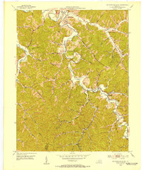 1951 Salyersville South1953 Print · USGSMagoffin County life in the early fifties was centered on the river valleys and the busy Chesapeake and Ohio rail line. Researchers can trace family sites at Swampton, locate dozens of remote hollow schools like Bear Branch Sch, and find ancestors in the Gardner Cem.
 - 1951 Map of Jackson, 1953 Print
 1951 Jackson1953 Print · USGSBreathitt County in the early fifties shows a rugged landscape of river bends and mountain hollows centered on the town of Jackson. Genealogists can trace family names at the Higgins Cem and Spicer Cem, or locate rural landmarks like the Chenowee Tunnel and Wolverine.
 - 1951 Map of Lee City, 1965 Print
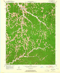 1951 Lee City1965 Print · USGSWolfe County in the early fifties is captured here as a landscape of tight-knit hollows and ridge-line communities. Genealogists and local historians can trace family locations through numerous landmarks like Wheel Rim (Elam Cem), Magoffin Institute, and Lee City.
 - 1952 Map of Tallega, 1954 Print
 1952 Tallega1954 Print · USGSBreathitt County in the early fifties shows a landscape shaped by its river forks and the Louisville and Nashville railroad. Genealogists can locate numerous rural landmarks like Tallega Mission Sch, Primrose, and the Rock Lick Mission Hall.
Showing maps 1-25 of 164
Top cities of Breathitt County
Frequently asked questions
- What are the different types of historical maps available for Breathitt County?
- What is the oldest map of Breathitt County?
- Where can I purchase historical maps of Breathitt County for my home or office?
- Where can I download high-res historical maps of Breathitt County?
- Are there historical topographic maps available for Breathitt County?
- Is there historical aerial imagery available for Breathitt County?
- Where are historical maps of Breathitt County sourced from?