
1951 Map of Guage
USGS Topo · Published 1952About this map
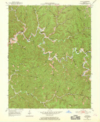
Quicksand Creek winds through this 1950s landscape, serving as the central artery for a series of remote valley settlements in Breathitt and Magoffin counties. Small community hubs like Guage, Rousseau, and Lunah are situated at key junctions where numerous branches and forks, such as Caney Creek and Holley Branch, meet the main waterway. The map reveals a dense network of local genealogy markers, including the Big Caney Ch and several family-named burial grounds like the Roark Cem and Shack Allen Cem. Education in this era was localized, as evidenced by the distribution of the Wolf Creek Sch, Richie Sch, and Keith Sch. The terrain is characterized by intricate drainage patterns with countless named hollows and branches, illustrating how early Appalachian settlement and transport were dictated by the complex creek systems of the Cumberland Plateau.
Find a feature on this map
76 named features on this map. Tap any name to fly to it.
Don’t see what you’re looking for? This feature index may not catch every label — zoom into the map to look around manually.
Map Details
Editions of this 1951 Guage Map
4 editions found
Other maps of this area

1889 · Salyersville
USGS Topo · 1:125,000

1891 · Hazard
USGS Topo · 1:125,000

1891 · Salyersville
USGS Topo · 1:125,000

1899 · Salyersville
USGS Topo · 1:125,000

1913 · Buckhorn
USGS Topo · 1:62,500

1914 · Troublesome
USGS Topo · 1:62,500

1951 · Tiptop
USGS Topo · 1:24,000

1951 · Seitz
USGS Topo · 1:24,000

1951 · Quicksand
USGS Topo · 1:24,000
1951 · Salyersville South
USGS Topo · 1:24,000