
1951 Map of Tiptop
USGS Topo · Published 1952About this map
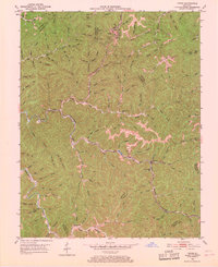
The rugged coal and timber lands of eastern Kentucky are meticulously detailed here, centered on the settlement of Tiptop. This era reflects a landscape defined by the Chesapeake and Ohio railroad corridor, which snakes through the steep valleys to support local resource extraction. Several Strip Mines are visible near Evanston, illustrating the industrial activity of the early 1950s. Family history is deeply rooted in this topography, evidenced by several scattered burial grounds including the John Bailey Cem, Benton Mann Cem, and Betts Mann Cem. Education and faith served as the social pillars for these hollows, with community landmarks like the Big Caney Sch, Duco Sch, and Faith Mt Ch positioned along the winding branches of Big Caney Creek and Hard Fork. The presence of the Decoy PO in the southern portion of the quadrangle marks a center of rural communication during this period.
Find a feature on this map
105 named features on this map. Tap any name to fly to it.
Don’t see what you’re looking for? This feature index may not catch every label — zoom into the map to look around manually.
Map Details
Editions of this 1951 Tiptop Map
4 editions found
Other maps of this area

1886 · Prestonsburg
USGS Topo · 1:125,000

1889 · Salyersville
USGS Topo · 1:125,000

1890 · Whitesburg
USGS Topo · 1:125,000

1891 · Hazard
USGS Topo · 1:125,000

1891 · Salyersville
USGS Topo · 1:125,000

1892 · Whitesburg
USGS Topo · 1:125,000

1892 · Prestonsburg
USGS Topo · 1:125,000

1899 · Salyersville
USGS Topo · 1:125,000

1912 · Hindman
USGS Topo · 1:48,000

1914 · Troublesome
USGS Topo · 1:62,500