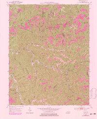
1951 Map of Tiptop
USGS Topo · Published 1983About this map
Tiptop and the surrounding hollows of the Cumberland Plateau are defined by the intensive coal industry and family settlement patterns of the early 1950s. The landscape is heavily marked by Strip Mines and infrastructure like the Conveyor and the Chesapeake and Ohio railroad, which serviced the region's extraction economy. These industrial features sit in close proximity to rural community hubs such as Faith Mt Ch, Big Caney Sch, and Hawes Fork Sch.
Find a feature on this map
127 named features on this map. Tap any name to fly to it.
Don’t see what you’re looking for? This feature index may not catch every label — zoom into the map to look around manually.
Map Details
Editions of this 1951 Tiptop Map
4 editions found

Other maps of this area

1886 · Prestonsburg
USGS Topo · 1:125,000

1889 · Salyersville
USGS Topo · 1:125,000

1890 · Whitesburg
USGS Topo · 1:125,000

1891 · Hazard
USGS Topo · 1:125,000

1891 · Salyersville
USGS Topo · 1:125,000

1892 · Whitesburg
USGS Topo · 1:125,000

1892 · Prestonsburg
USGS Topo · 1:125,000

1899 · Salyersville
USGS Topo · 1:125,000

1912 · Hindman
USGS Topo · 1:48,000

1914 · Troublesome
USGS Topo · 1:62,500