2020s Maps of Mount Washington, Kentucky
Explore 2 historic maps of Mount Washington from the 2020s. These maps offer a rare glimpse into what life looked like during the 2020s — showing old roads, neighborhoods, homes, and landmarks that have changed or disappeared over time.
Whether you're researching your family's past, planning a metal detecting trip, or studying how Mount Washington's landscape evolved across the 2020s, these high-resolution maps are a powerful tool for exploring the history of this region.
- Focus on a specific era: All maps on this page are from the 2020s, giving you a focused view of this time period.
- See what’s changed: Compare century-old streets, trails, and buildings to today's modern landscape using overlays and satellite layers.
- Research with precision: Use these maps for genealogy, historical research, land use analysis, or educational projects.
- View, download, or print: Maps are fully viewable online in high resolution, and can be downloaded or printed for your own records.
Start exploring Mount Washington's history through authentic maps from the 2020s. This is your window into the past.
Mount Washington, KY maps
(2)- 2022 Map of Mount Washington, 2022 Print
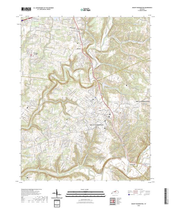 2022 Mount Washington2022 Print · USGSMount Washington and its surrounding Bullitt County communities are captured here in the early 2020s as residential growth meets the river valleys. Researchers can trace local heritage through numerous burial sites like Mount Washington Cem or explore the geography of Floyds Fork and Smithville.
 - 2022 Map of Waterford, 2022 Print
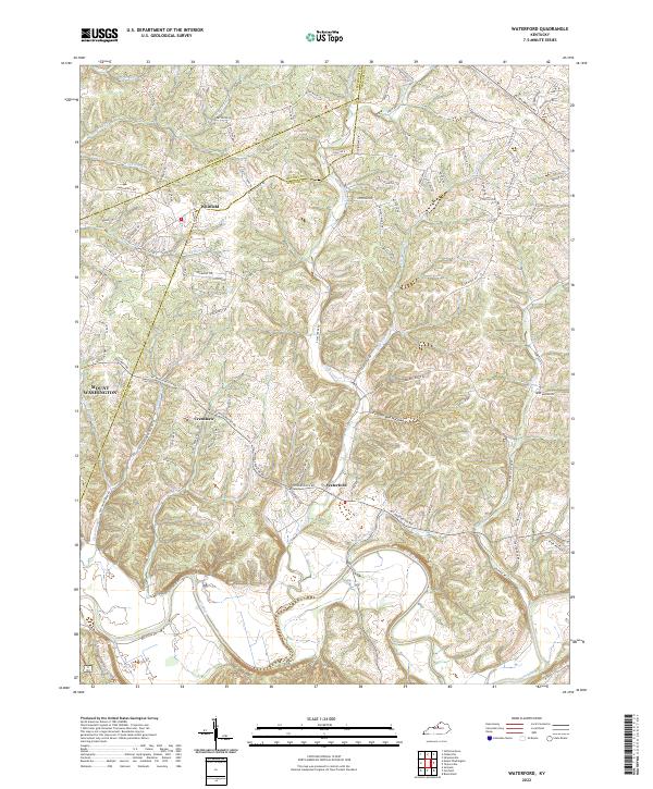 2022 Waterford2022 Print · USGSThe Salt River valley and the historic settlement of Waterford are captured in this modern survey of the Spencer County countryside. Researchers can trace family landmarks along Plum Creek, the drainage of Feather Bed Hollow, and the rural crossroads of Whitfield.
End of results
Showing maps 1-2 of 2
Top cities near Mount Washington
- Louisville historical maps
- Jeffersonville historical maps
- New Albany historical maps
- Jeffersontown historical maps
- Clarksville historical maps
- Shively historical maps
See more
Frequently asked questions
- What are the different types of historical maps available for Mount Washington?
- What is the oldest map of Mount Washington?
- Where can I purchase historical maps of Mount Washington for my home or office?
- Where can I download high-res historical maps of Mount Washington?
- Are there historical topographic maps available for Mount Washington?
- Is there historical aerial imagery available for Mount Washington?
- Where are historical maps of Mount Washington sourced from?