Old Maps of Owensboro, Kentucky
Explore 19 old maps of Owensboro, spanning from 1901 to today. These high-resolution historic maps reveal how streets, neighborhoods, landmarks, and natural features evolved over time — perfect for genealogy, metal detecting, research, and local history exploration.
What you can do with these maps:
- See how Owensboro changed over time: Compare historical maps to modern-day views to trace roads, homesites, rail lines & more.
- View detailed metadata: Each map includes creators, publishers, year, scale, and archive source.
- Overlay maps with satellite & LiDAR: Visualize the past alongside modern tools to explore terrain & human change.
- Trusted historical sources: Maps sourced from the USGS, Library of Congress, and other archives.
- Access maps your way: View online, download high-res files, or order prints for personal or research use.
Start exploring old maps of Owensboro to uncover forgotten places, hidden landmarks, and the deep history beneath your feet.
Owensboro, KY maps
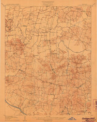
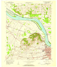
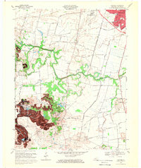
(19)- 1901 Map of Owensboro
 1901 Owensboro1901 Print · USGSCovers Owensboro, including Rockport, Chrisney, and other nearby areas5 unique versions available
 - 1906 Map of Sutherland
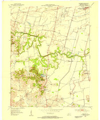
 1906 Sutherland1906 Print · USGSCovers Owensboro, including Livermore, Masonville, and other nearby areas3 unique versions available
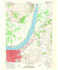
 - 1952 Map of Owensboro East, 1953 Print
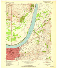 1952 Owensboro East1953 Print · USGSCovers Owensboro, including Spencer County Farm, Patronville, and other nearby areas
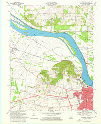
 - 1952 Map of Owensboro West, 1953 Print
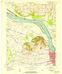 1952 Owensboro West1953 Print · USGSCovers Owensboro, including Enterprise, Stanley, and other nearby areas
 - 1953 Map of Sutherland, 1954 Print
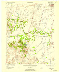
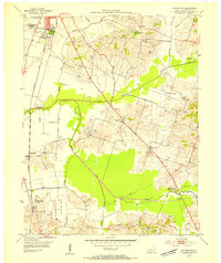 1953 Sutherland1954 Print · USGSCovers Owensboro, including Masonville, Sutherland, and other nearby areas
 - 1953 Map of Panther, 1954 Print
 1953 Panther1954 Print · USGSCovers Owensboro, including Rome, Handyville, and other nearby areas
 - 1954 Map of Evansville
 1954 Evansville1954 Print · USGSCovers Owensboro, including Evansville, Bowling Green, and other nearby areas
 - 1956 Map of Panther, 1957 Print
 1956 Panther1957 Print · USGSCovers Owensboro, including Rome, Handyville, and other nearby areas
 - 1956 Map of Sutherland, 1957 Print
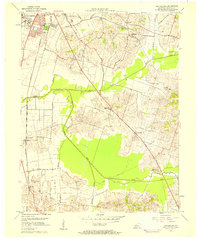 1956 Sutherland1957 Print · USGSCovers Owensboro, including Masonville, Sutherland, and other nearby areas2 unique versions available
 - 1956 Map of Owensboro East, 1957 Print
 1956 Owensboro East1957 Print · USGSCovers Owensboro, including Spencer County Farm, Patronville, and other nearby areas
 - 1956 Map of Owensboro West, 1957 Print
 1956 Owensboro West1957 Print · USGSCovers Owensboro, including Enterprise, Stanley, and other nearby areas2 unique versions available
 - 1957 Map of Evansville, 1969 Print
 1957 Evansville1969 Print · USGSCovers Owensboro, including Evansville, Bowling Green, and other nearby areas3 unique versions available
 - 1961 Map of Evansville
 1961 Evansville1961 Print · USGSCovers Owensboro, including Evansville, Bowling Green, and other nearby areas2 unique versions available
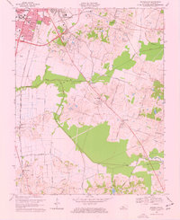
 - 1967 Map of Owensboro East, 1970 Print
 1967 Owensboro East1970 Print · USGSCovers Owensboro, including Spencer County Farm, Patronville, and other nearby areas3 unique versions available
 - 1968 Map of Owensboro West, 1969 Print
 1968 Owensboro West1969 Print · USGSCovers Owensboro, including Enterprise, Stanley, and other nearby areas3 unique versions available
 - 1968 Map of Sutherland, 1969 Print
 1968 Sutherland1969 Print · USGSCovers Owensboro, including Masonville, Sutherland, and other nearby areas3 unique versions available
 - 1968 Map of Panther, 1970 Print
 1968 Panther1970 Print · USGSCovers Owensboro, including Rome, Handyville, and other nearby areas2 unique versions available
 - 1986 Map of Evansville
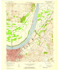
 1986 Evansville1986 Print · USGSCovers Owensboro, including Evansville, Henderson, and other nearby areas
 - 1991 Map of Evansville
 1991 Evansville1991 Print · USGSCovers Owensboro, including Evansville, Henderson, and other nearby areas
End of results
Showing maps 1-19 of 19
Top cities near Owensboro
- Newburgh historical maps
- Rockport historical maps
- Lewisport historical maps
- Calhoun historical maps
- Grandview historical maps
Top neighborhoods of Owensboro
Frequently asked questions
- What are the different types of historical maps available for Owensboro?
- What is the oldest map of Owensboro?
- Where can I purchase historical maps of Owensboro for my home or office?
- Where can I download high-res historical maps of Owensboro?
- Are there historical topographic maps available for Owensboro?
- Is there historical aerial imagery available for Owensboro?
- Where are historical maps of Owensboro sourced from?