Old Maps of Tuck, Kentucky for Hiking & Exploration
Hike through history with 14 historic maps of Tuck. Explore old trails, ghost towns, and forgotten backroads — perfect for outdoor adventurers and local explorers.
- Rediscover forgotten places: Map out old mining camps, roads, and footpaths that no longer exist on modern maps.
- Layer with modern tools: Combine with LiDAR or satellite views to plan hikes through historical terrain.
- Made for exploration: Popular among hikers, overlanders, and local history lovers.
Use these maps to find adventure and explore the hidden past of Tuck.
Tuck, KY maps
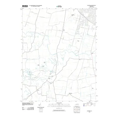
(14)- 1906 Map of Sutherland
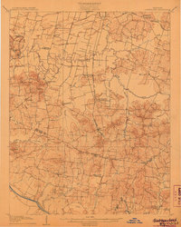 1906 Sutherland1906 Print · USGSDaviess and McLean counties come into focus at the start of the twentieth century, when the rail lines and river forks dictated the pace of rural life. Genealogists and local historians can trace early homes and landmarks near Utica, St Martins Church, and the distinctive Backbone Ridge.3 unique versions available
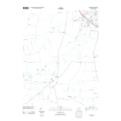
 - 1953 Map of Panther, 1954 Print
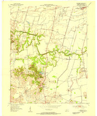 1953 Panther1954 Print · USGSSouth of Owensboro in the early fifties, this area shows a landscape defined by meandering creeks and emerging industry. Genealogists and historians can trace family-named landmarks and rural centers like St Raphael Ch, Mosleyville, and the extensive strip mines near Zion Hill.
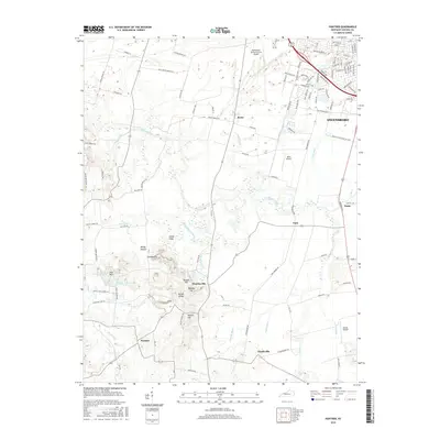
 - 1954 Map of Evansville
 1954 Evansville1954 Print · USGSThe Ohio River borderlands between Indiana and Kentucky appear here during a period of robust industrial and military growth. Genealogists and researchers can trace the rail corridors of the Illinois Central and find landmarks like US Lock and Dam No 48 or Camp Breckinridge.
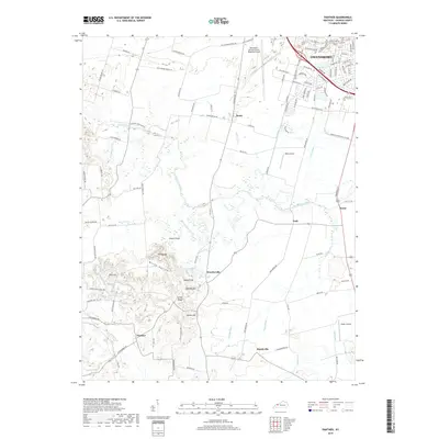
 - 1956 Map of Panther, 1957 Print
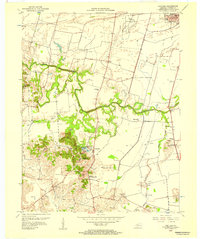 1956 Panther1957 Print · USGSDaviess County in the mid-1950s reveals a landscape of growing industry and deep-rooted rural communities south of the Ohio River. Researchers can trace early energy production and family centers through the numerous Oil Wells, Strip Mines, and local landmarks like St Raphael Ch or Sutherland Consolidated Sch.
 - 1957 Map of Evansville, 1969 Print
 1957 Evansville1969 Print · USGSIndiana and Kentucky meet along the Ohio River in this mid-century survey of a vital industrial and transport corridor. Genealogists and historians can trace the development of river towns like Owensboro and Newburgh or locate old rail lines like the Southern Ry.3 unique versions available
 - 1961 Map of Evansville
 1961 Evansville1961 Print · USGSThe Ohio River valley and its surrounding coalfields are captured here during the late fifties and early sixties. Trace the industrial rail networks of the Illinois Central RR and explore regional landmarks like Mammoth Cave National Park and Angel Mounds State Memorial.2 unique versions available
 - 1968 Map of Panther, 1970 Print
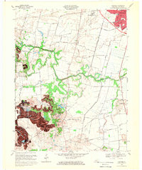 1968 Panther1970 Print · USGSDaviess County in the late 1960s shows a landscape of traditional farmsteads and rural parishes meeting modern aviation and industry. Researchers can find many family landmarks, from Windy Hollow to consolidated country schools like Snyder Consolidated Sch and Sutherland Consolidated Sch.2 unique versions available
 - 1986 Map of Evansville
 1986 Evansville1986 Print · USGSThe Ohio River valley thrives in the mid-1980s as a hub of river commerce, industry, and natural preservation spanning the Indiana-Kentucky border. Genealogists and historians can locate remote landmarks like Dead Mans Cem, Lippe Church, and the riverside community of Scuffletown.
 - 1991 Map of Evansville
 1991 Evansville1991 Print · USGSThe tri-state region of Indiana and Kentucky was a hub of river commerce and rail transport in the early nineties. Researchers can trace the industrial corridor between Evansville and Owensboro, locating landmarks like Angel Mounds State Memorial and the Seaboard System railroad.
 - 2010 Map of Panther, 2010 Print
 2010 Panther2010 Print · USGSCovers Tuck, including Owensboro, Moseleyville, and other nearby areas
 - 2013 Map of Panther, 2013 Print
 2013 Panther2013 Print · USGSCovers Tuck, including Owensboro, Moseleyville, and other nearby areas
 - 2016 Map of Panther, 2016 Print
 2016 Panther2016 Print · USGSCovers Tuck, including Owensboro, Moseleyville, and other nearby areas
 - 2019 Map of Panther, 2019 Print
 2019 Panther2019 Print · USGSCovers Tuck, including Owensboro, Moseleyville, and other nearby areas
 - 2022 Map of Panther, 2022 Print
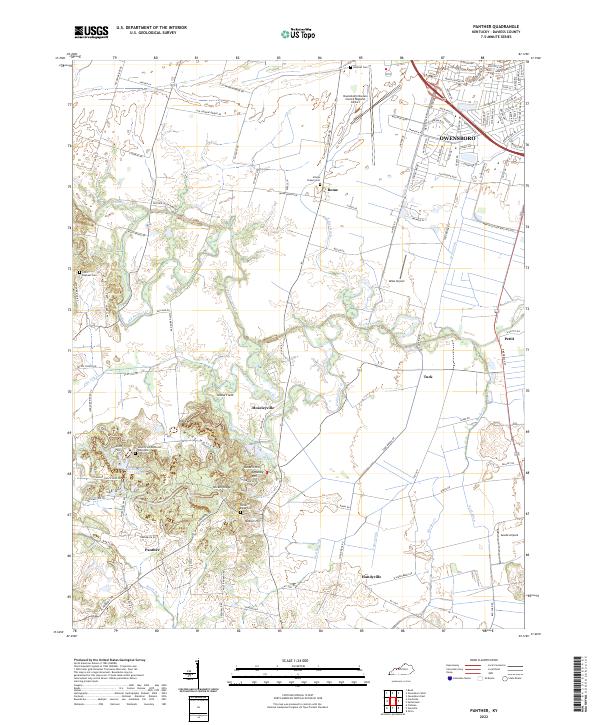 2022 Panther2022 Print · USGSThe southern outskirts of Owensboro meet rural Daviess County in the early twenty-first century, showing a landscape shaped by drainage engineering and aviation. Researchers can locate several burial grounds including Atheys Chapel Cemetery and trace local hamlets like Moseleyville and Handyville.
End of results
Showing maps 1-14 of 14
Top cities near Tuck
Frequently asked questions
- What are the different types of historical maps available for Tuck?
- What is the oldest map of Tuck?
- Where can I purchase historical maps of Tuck for my home or office?
- Where can I download high-res historical maps of Tuck?
- Are there historical topographic maps available for Tuck?
- Is there historical aerial imagery available for Tuck?
- Where are historical maps of Tuck sourced from?