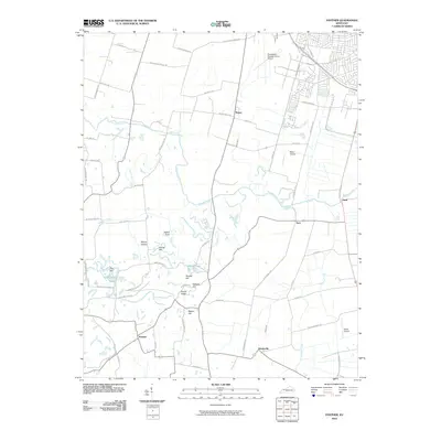
2010 Map of Panther
USGS Topo · Published 2010About this map
Panther Creek and its tributary Old Panther Creek dominate this central Kentucky landscape south of Owensboro. The area is defined by a dense network of rural roads and family-named terrain features, such as Zion Hill, Nation Hill, and Nickel Ridge. Aviation is a notable component of the local geography, with the Owensboro-Daviess County Airport occupying the northern edge, complemented by smaller landing strips like Miles Airport and Goode Airpark. The small communities of Panther, Handyville, and Rome serve as local hubs for the surrounding agricultural land. The presence of Windy Hollow Lakes and Miller Lake indicates pockets of recreation and managed water resources amidst the meandering creeks and drainage ditches like Keller Ditch.
Find a feature on this map
55 named features on this map. Tap any name to fly to it.
Don’t see what you’re looking for? This feature index may not catch every label — zoom into the map to look around manually.
Map Details
Editions of this 2010 Panther Map
This is the sole edition of this map. No revisions or reprints were ever made.
Other maps of this area

1901 · Owensboro
USGS Topo · 1:62,500

1905 · Newburg
USGS Topo · 1:62,500

1906 · Sutherland
USGS Topo · 1:62,500

1908 · Calhoun
USGS Topo · 1:62,500

1952 · Owensboro East
USGS Topo · 1:24,000

1952 · Owensboro West
USGS Topo · 1:24,000

1952 · Reed
USGS Topo · 1:24,000

1952 · Calhoun
USGS Topo · 1:24,000

1953 · Sutherland
USGS Topo · 1:24,000

1953 · Utica
USGS Topo · 1:24,000