1950s Maps of Harlan County, Kentucky
Explore 19 historic maps of Harlan County from the 1950s. These maps offer a rare glimpse into what life looked like during the 1950s — showing old roads, neighborhoods, homes, and landmarks that have changed or disappeared over time.
Whether you're researching your family's past, planning a metal detecting trip, or studying how Harlan County's landscape evolved across the 1950s, these high-resolution maps are a powerful tool for exploring the history of this region.
- Focus on a specific era: All maps on this page are from the 1950s, giving you a focused view of this time period.
- See what’s changed: Compare century-old streets, trails, and buildings to today's modern landscape using overlays and satellite layers.
- Research with precision: Use these maps for genealogy, historical research, land use analysis, or educational projects.
- View, download, or print: Maps are fully viewable online in high resolution, and can be downloaded or printed for your own records.
Start exploring Harlan County's history through authentic maps from the 1950s. This is your window into the past.
Harlan County, KY maps
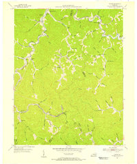
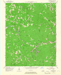
(19)- 1954 Map of Helton, 1955 Print
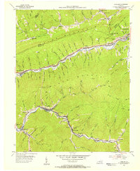
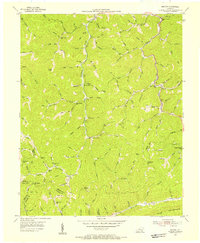 1954 Helton1955 Print · USGSLeslie County mountain life in the mid-1950s was centered on the hollows and mountain gaps of the Cumberland Plateau. Genealogists can trace a remarkable network of neighborhood schools like Beech Fork Sch and Salt Trace Sch, alongside landmarks like Honey Branch Cem.2 unique versions available
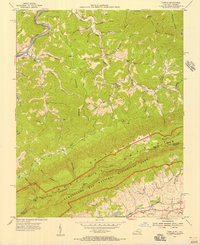
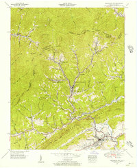
 - 1954 Map of Evarts, 1955 Print
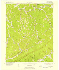
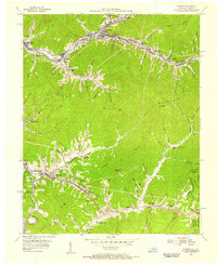 1954 Evarts1955 Print · USGSHarlan County's mining and rail corridors are captured here in the mid-1950s as the Louisville and Nashville winds through the hills. Genealogists can trace family landmarks like Middleton Cem and settlements such as Crummies and Kenvir.3 unique versions available
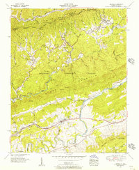
 - 1954 Map of Bledsoe, 1955 Print
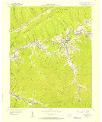
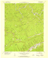 1954 Bledsoe1955 Print · USGSHarlan County in the mid-fifties shows a world of mountain hollows and coal-country settlements before modern expansion. Genealogists can trace family landmarks like Napier Sch Cem, Abner Chapel, and the isolated Cedar Chapel along the creek branches.3 unique versions available
 - 1954 Map of Benham, 1956 Print
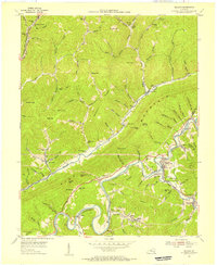
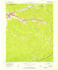 1954 Benham1956 Print · USGSCentral Harlan County coal towns thrive in the mid-fifties along the steep ridges of Black Mountain. Researchers can trace the Louisville and Nashville rail lines serving Benham and Lynch, or locate family sites like Creech Cem.4 unique versions available
 - 1954 Map of Tilford, 1956 Print
 1954 Tilford1956 Print · USGSEastern Kentucky's coal-country hollows are shown in detail during the mid-1950s, as small rail-side communities thrived along the ridges. Genealogists can trace family landmarks and rural institutions like Mt Olivet Ch, Slemp, and Turkey Creek Sch.3 unique versions available
 - 1954 Map of Varilla, 1956 Print
 1954 Varilla1956 Print · USGSBell County, Kentucky, at the Virginia border in the mid-1950s shows a landscape of deep valleys and rising ridges. Researchers can locate remote schools and family burial grounds like Elydale Sch, Hensley Cem, and Miracle Cem near Hances Ridge.2 unique versions available
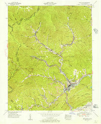
 - 1954 Map of Harlan, 1956 Print
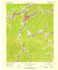 1954 Harlan1956 Print · USGSHarlan County's coal-country landscape is documented here in the mid-fifties as the rail lines and rivers shaped local commerce. Researchers can trace family roots through settlements like Pansy, Bardo, and Liggett, or locate the Resthaven Cem and several rural schools.4 unique versions available
 - 1954 Map of Nolansburg, 1956 Print
 1954 Nolansburg1956 Print · USGSHarlan and Letcher counties are captured in the mid-fifties, showing the industrial pulse of the Poor Fork valley. Researchers can trace family sites like Nolan Cem and Creech Chapel or locate the old Nolansburg Sch and Harlan Airport.4 unique versions available
 - 1954 Map of Louellen, 1956 Print
 1954 Louellen1956 Print · USGSEastern Kentucky coal country is captured here during the mid-fifties, dominated by the L & N railroad. Researchers can trace coal camp life through Louellen, Highsplint, and remote sites like Bear Branch Sch or Hurricane Gap Ch.4 unique versions available
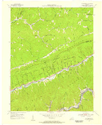
 - 1954 Map of Roxana, 1956 Print
 1954 Roxana1956 Print · USGSThe Kentucky mountains in the early fifties reveal a landscape of isolated hollows and ridge-line borders before modern development. Traced by the Louisville and Nashville rail, you can locate family landmarks like the Hot Spot Premium PO, Tolson Branch Ch, and numerous neighborhood schools.3 unique versions available
 - 1954 Map of Wallins Creek, 1956 Print
 1954 Wallins Creek1956 Print · USGSHarlan County's mountain hollows and river settlements are captured here in the mid-fifties, during the height of the rail-and-river economy. Genealogists can trace family homes near Wallins Creek or locate old school sites like Toggle Sch and Jesses Creek Sch.2 unique versions available
 - 1954 Map of Balkan, 1956 Print
 1954 Balkan1956 Print · USGSSoutheastern Kentucky is captured here in the mid-1950s as coal and rail dominated the valleys along Pine Mountain. Researchers can locate family roots at Kettle Island and Hulen (Felder Sta) or trace the Louisville and Nashville line past Balkan.2 unique versions available
 - 1954 Map of Leatherwood, 1967 Print
 1954 Leatherwood1967 Print · USGSLeatherwood and the surrounding Leslie County hollows appear here in the early fifties, showing the mountain landscape before many small communities changed. Local historians can trace the Louisville and Nashville rail line or locate vanished neighborhood landmarks like Livingston Sch and Yeaddiss.2 unique versions available
 - 1955 Map of Johnson City
 1955 Johnson City1955 Print · USGSEast Tennessee and the bordering highlands of Virginia and Kentucky appear here during the post-war industrial boom. You can trace the complex network of mountain ridges and new TVA lakes, from Johnson City to the coalfields near Middlesboro and Lynch.
 - 1955 Map of Pennington Gap, 1956 Print
 1955 Pennington Gap1956 Print · USGSPennington Gap and the surrounding coal camps of Lee County are shown at the height of the mid-century rail and mining era. Researchers can trace family roots at the Disney Sch, locate the Holmes Mill Church, or follow the Southern Ry through St Charles.5 unique versions available
 - 1955 Map of Keokee, 1956 Print
 1955 Keokee1956 Print · USGSThe Virginia-Kentucky state line was a rugged landscape of rail-fed mountain towns and valley farms in the mid-fifties. Genealogists and historians can trace the route of The Lonesome Pine Trail past Dryden or locate landmarks like Robbins Chapel School and Darnell Town.6 unique versions available
 - 1955 Map of Appalachia, 1956 Print
 1955 Appalachia1956 Print · USGSThe coal country of the Kentucky and Virginia border comes into focus in the mid-1950s, showing a landscape defined by mountain mines and rail hubs. Researchers can trace the industrial layout of Stonega and Appalachia, alongside local landmarks like Osaka Sch and Kilbourn Cem.6 unique versions available
 - 1957 Map of Johnson City, 1966 Print
 1957 Johnson City1966 Print · USGSUpper East Tennessee and Southwest Virginia are shown here during the mid-sixties transition of the Appalachians. Researchers can trace the industrial rail hubs of Kingsport, the sprawling waters of Cherokee Lake, and the historic Cumberland Gap.
 - 1957 Map of Jenkins, 1974 Print
 1957 Jenkins1974 Print · USGSThe Cumberland Plateau in the mid-twentieth century reveals a complex landscape of winding river valleys and deep-seated industry. Genealogists and historians can trace the development of Hazard, Jenkins, and Pikeville alongside extensive Numerous Oil and Gas Fields and the routes of the Chesapeake & Ohio Railway.
End of results
Showing maps 1-19 of 19
Top cities of Harlan County
- Cumberland historical maps
- Harlan historical maps
- Evarts historical maps
- Lynch historical maps
- Loyall historical maps
- Benham historical maps
See more
Frequently asked questions
- What are the different types of historical maps available for Harlan County?
- What is the oldest map of Harlan County?
- Where can I purchase historical maps of Harlan County for my home or office?
- Where can I download high-res historical maps of Harlan County?
- Are there historical topographic maps available for Harlan County?
- Is there historical aerial imagery available for Harlan County?
- Where are historical maps of Harlan County sourced from?