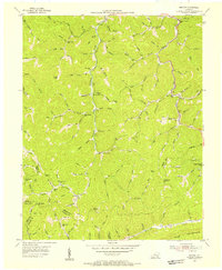
1954 Map of Helton
USGS Topo · Published 1955About this map
Middle Fork Kentucky River and Beech Fork carve through this section of the Cumberland Plateau, where settlement follows the narrow creek beds. The map reveals a landscape defined by an extensive network of rural schools, including Marion Branch Sch, Beech Fork Sch, and Saylor Sch, many of which were likely centers of their respective hollows. Toward the southern edge of the sheet, the steep rise of Pine Mountain creates a natural barrier at the borders of Leslie, Harlan, and Bell Counties.
Find a feature on this map
107 named features on this map. Tap any name to fly to it.
Don’t see what you’re looking for? This feature index may not catch every label — zoom into the map to look around manually.
Map Details
Editions of this 1954 Helton Map
2 editions found
Other maps of this area

1886 · Cumberland Gap
USGS Topo · 1:125,000

1887 · Jonesville
USGS Topo · 1:125,000

1888 · Cumberland Gap
USGS Topo · 1:125,000

1891 · Manchester
USGS Topo · 1:125,000

1891 · Cumberland Gap
USGS Topo · 1:125,000

1891 · Hazard
USGS Topo · 1:125,000

1891 · Jonesville
USGS Topo · 1:125,000

1903 · Harlan
USGS Topo · 1:48,000

1903 · Pineville
USGS Topo · 1:48,000

1916 · Harlan
USGS Topo · 1:48,000