1970s Maps of Harlan County, Kentucky
Explore 16 historic maps of Harlan County from the 1970s. These maps offer a rare glimpse into what life looked like during the 1970s — showing old roads, neighborhoods, homes, and landmarks that have changed or disappeared over time.
Whether you're researching your family's past, planning a metal detecting trip, or studying how Harlan County's landscape evolved across the 1970s, these high-resolution maps are a powerful tool for exploring the history of this region.
- Focus on a specific era: All maps on this page are from the 1970s, giving you a focused view of this time period.
- See what’s changed: Compare century-old streets, trails, and buildings to today's modern landscape using overlays and satellite layers.
- Research with precision: Use these maps for genealogy, historical research, land use analysis, or educational projects.
- View, download, or print: Maps are fully viewable online in high resolution, and can be downloaded or printed for your own records.
Start exploring Harlan County's history through authentic maps from the 1970s. This is your window into the past.
Harlan County, KY maps
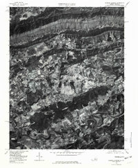
(16)- 1974 Map of Balkan, 1975 Print
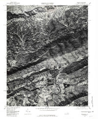
 1974 Balkan1975 Print · USGSBell County’s coal and river valleys are captured here in the mid-seventies as the rail lines served mountain settlements. Trace family roots and local industry through features like Blackmont, the Balkan mines, and Mill Creek Ch.
 - 1974 Map of Wallins Creek, 1975 Print
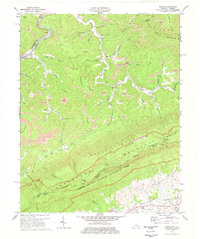
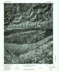
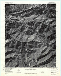
 1974 Wallins Creek1975 Print · USGSThe coal valleys of Harlan County are in full production in the 1970s, as the railroad follows the river through deep mountain gaps. Genealogists and historians can trace family locations and mine sites near Wallins Creek, Tacky Town, and Wilhoit.
 - 1974 Map of Varilla, 1977 Print
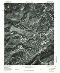
 1974 Varilla1977 Print · USGSBell and Harlan counties come alive in the mid-1970s as coal extraction and mountain life intersect near the Virginia border. Genealogists and historians can trace family roots through sites like Varilla Cem, Oakdale Ch, and the remote settlement at Cubage.3 unique versions available
 - 1974 Map of Helton, 1977 Print
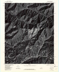
 1974 Helton1977 Print · USGSEastern Kentucky's coal and river valleys are captured here in the mid-1970s, as industry reshaped the traditional hollows of the Cumberland Plateau. Genealogists and local historians can trace family locations near Saylor Ch, Spruce Pine, and the banks of the Middle Fork Kentucky River.2 unique versions available
 - 1976 Map of Hubbard Springs, 1981 Print
 1976 Hubbard Springs1981 Print · USGSLee County's rural character is captured in the mid-seventies, showing the valley floor between the mountains and the river before modern development. Genealogists and local historians can locate family holdings near Hubbard Springs, Hockett, and along the winding Powell River.
 - 1976 Map of Ewing, 1981 Print
 1976 Ewing1981 Print · USGSThe Virginia-Kentucky borderlands in the late seventies are revealed here through aerial imagery of the Cumberland Mountain ridge. Genealogists can trace valley homesteads near Ewing and Caylor or follow the route through Ely Gap.
 - 1976 Map of Varilla, 1981 Print
 1976 Varilla1981 Print · USGSBell County, Kentucky, and the Virginia borderlands are captured in this mid-seventies aerial survey at the height of the mountain economy. Researchers can identify homesites and land-clearing patterns near Varilla, Oaks, and along Brownies Creek.
 - 1976 Map of Appalachia, 1981 Print
 1976 Appalachia1981 Print · USGSThe coal country of Wise County is captured in the mid-seventies, showing the density of mountain hollow settlements. Genealogists and researchers can trace the specific layouts of coal towns like Roda, Stonega, and Derby along the banks of Callahan Creek.
 - 1976 Map of Evarts, 1981 Print
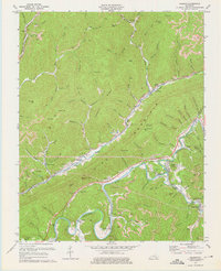
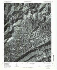
 1976 Evarts1981 Print · USGSHarlan County, Kentucky, is shown during the mid-seventies, capturing the dense valley settlements and industrial activity of the Cumberland Mountains. Trace family roots and land use across Evarts, Kenvir, and Cawood along the winding Cumberland River forks.
 - 1976 Map of Keokee, 1981 Print
 1976 Keokee1981 Print · USGSThe Virginia and Kentucky borderlands come into sharp focus in the mid-1970s, showing the intersection of ridge-top forests and valley settlements. Researchers can trace the development of riverside communities like Dryden and Keokee along the North Fork Powell River.
 - 1976 Map of Pennington Gap, 1981 Print
 1976 Pennington Gap1981 Print · USGSPennington Gap and its surrounding mountain hollows are captured in the mid-seventies just as the regional landscape was maturing. Researchers can trace the layout of valley settlements like St Charles and Bonny Blue or follow the path of the North Fork Powell River.
 - 1976 Map of Rose Hill, 1981 Print
 1976 Rose Hill1981 Print · USGSLee County, Virginia, is captured in the mid-seventies as a landscape of mountain ridges and valley farms. Researchers can trace rural family land in Rose Hill or follow the terrain from Cumberland Mountain down to Henegartown.
 - 1976 Map of Benham, 1981 Print
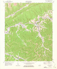
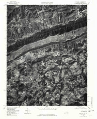
 1976 Benham1981 Print · USGSHarlan County's coal towns and river valleys are shown in detail during the mid-seventies in this aerial-based survey. Genealogists and researchers can trace the dense footprints of Benham, Lynch, and Cumberland along the winding Looney Creek.
 - 1977 Map of Middlesboro, 1983 Print
 1977 Middlesboro1983 Print · USGSThe tri-state border region of Kentucky, Tennessee, and Virginia is shown here in the late seventies as the rail-and-river economy hummed through the gaps. Trace local family roots and transit routes through Middlesboro, Harlan, and Cumberland Gap National Historical Park.
 - 1977 Map of Pikeville, 1983 Print
 1977 Pikeville1983 Print · USGSThe Central Appalachian coalfields and the rugged borders of Kentucky and Virginia come into focus during the late seventies. Researchers can trace the rail networks of the C & O and L & N through towns like Jenkins, Whitesburg, and Pikeville.
 - 1977 Map of Hazard, 1983 Print
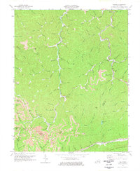
 1977 Hazard1983 Print · USGSEastern Kentucky's coal country comes into sharp focus during the late seventies, showing the deep-set river valleys and mountain gaps that shaped regional life. Genealogists can trace family connections through river-bottom settlements like Oneida, Krypton, and Bulan or follow the Seaboard System rail lines.
End of results
Showing maps 1-16 of 16
Top cities of Harlan County
- Cumberland historical maps
- Harlan historical maps
- Evarts historical maps
- Lynch historical maps
- Loyall historical maps
- Benham historical maps
See more
Frequently asked questions
- What are the different types of historical maps available for Harlan County?
- What is the oldest map of Harlan County?
- Where can I purchase historical maps of Harlan County for my home or office?
- Where can I download high-res historical maps of Harlan County?
- Are there historical topographic maps available for Harlan County?
- Is there historical aerial imagery available for Harlan County?
- Where are historical maps of Harlan County sourced from?