1960s Maps of Hopkins County, Kentucky
Explore 12 historic maps of Hopkins County from the 1960s. These maps offer a rare glimpse into what life looked like during the 1960s — showing old roads, neighborhoods, homes, and landmarks that have changed or disappeared over time.
Whether you're researching your family's past, planning a metal detecting trip, or studying how Hopkins County's landscape evolved across the 1960s, these high-resolution maps are a powerful tool for exploring the history of this region.
- Focus on a specific era: All maps on this page are from the 1960s, giving you a focused view of this time period.
- See what’s changed: Compare century-old streets, trails, and buildings to today's modern landscape using overlays and satellite layers.
- Research with precision: Use these maps for genealogy, historical research, land use analysis, or educational projects.
- View, download, or print: Maps are fully viewable online in high resolution, and can be downloaded or printed for your own records.
Start exploring Hopkins County's history through authentic maps from the 1960s. This is your window into the past.
Hopkins County, KY maps
(12)- 1961 Map of Evansville
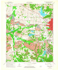
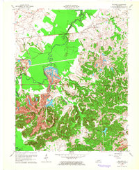
 1961 Evansville1961 Print · USGSThe Ohio River valley and its surrounding coalfields are captured here during the late fifties and early sixties. Trace the industrial rail networks of the Illinois Central RR and explore regional landmarks like Mammoth Cave National Park and Angel Mounds State Memorial.2 unique versions available
 - 1962 Map of Madisonville West, 1964 Print
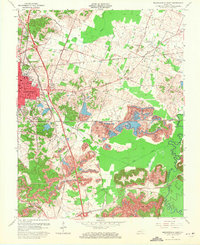
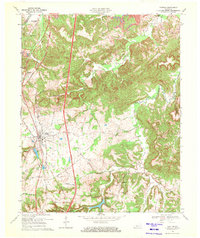
 1962 Madisonville West1964 Print · USGSMid-century Hopkins County is defined here by the expansion of coal operations and suburban growth near Madisonville. Genealogists and historians can trace rail-side settlements like Manitou or locate family sites at Richland Cem and Carter Chapel.2 unique versions available
 - 1963 Map of Nortonville, 1964 Print
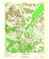 1963 Nortonville1964 Print · USGSMid-century Nortonville and Mortons Gap emerge here at a crossroads of coal production and new parkway construction. Genealogists and historians can trace family locations near McIntosh Chapel, Furgerson Cem, and the historic Illinois Central rail line.
 - 1963 Map of Saint Charles, 1964 Print
 1963 Saint Charles1964 Print · USGSHopkins County coal country is captured here in the early sixties, showing the expansion of the Western Kentucky Parkway alongside established rail lines. Researchers can trace family sites at Christian Privilege Cem, Southard Ch, and the old mining community at Ilsley.
 - 1963 Map of Graham, 1964 Print
 1963 Graham1964 Print · USGSWestern Kentucky in the early sixties was a landscape defined by the arrival of major parkways and the expansion of the coal and oil industries. Genealogists and historians can trace family locations near Yeargins Chapel Cem, the settlement of McNary, and the path of the Illinois Central railroad.2 unique versions available
 - 1963 Map of Millport, 1964 Print
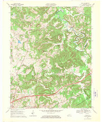
 1963 Millport1964 Print · USGSMuhlenberg County's coal and rail corridor is vividly detailed here in the early sixties, showing the heavy industrial shift of the Kentucky interior. Genealogists and researchers can locate family landmarks like Salem Cem and Pond Ch or trace the extensive Strip Mine operations near Earle and Stringtown.3 unique versions available
 - 1963 Map of Madisonville East, 1971 Print
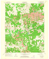
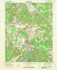
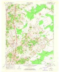
 1963 Madisonville East1971 Print · USGSThe coal country of eastern Hopkins County is captured here in the early sixties, as surface mining began to reshape the land. Genealogists and historians can trace the foundations of Madisonville, the grounds of the Tuberculosis Hospital, and the rural community at Bethlehem Ch.
 - 1967 Map of Olney, 1970 Print
 1967 Olney1970 Print · USGSCaldwell County in the late sixties shows a landscape where the new Western Kentucky Parkway meets established river life. Researchers can locate numerous family cemeteries like Creekmur Bridge Cem and trace the old Illinois Central Railroad as it passes near Lewistown.
 - 1968 Map of Dawson Springs, 1970 Print
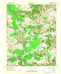
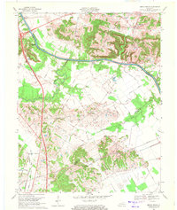
 1968 Dawson Springs1970 Print · USGSDawson Springs and the surrounding Kentucky coalfields are shown here in the late sixties as new highways began to reshape the landscape. Local researchers can trace old family names and sites from the Outwood Hospital to rural landmarks like Walnut Grove Ch and Lick Creek Cem.2 unique versions available
 - 1969 Map of Crofton, 1971 Print
 1969 Crofton1971 Print · USGSChristian County during the late sixties shows the emergence of the Pennyrile Parkway alongside the older Louisville and Nashville tracks. Researchers can locate family sites at Foster Field Cem, visit the Macedonia Ch, or trace the development of Crofton.
 - 1969 Map of Hanson, 1971 Print
 1969 Hanson1971 Print · USGSNorth of Madisonville in the late sixties, this Hopkins and Webster County landscape shows a mix of coal-country industry and traditional rural life. Researchers can locate family landmarks like Pritchetts Chapel, Slaughters Lake, and the West Lawn Cem.
 - 1969 Map of Beech Grove, 1971 Print
 1969 Beech Grove1971 Print · USGSThe Green River and the rural borderlands of McLean and Webster counties are captured here in the late sixties. Genealogists and historians can locate family landmarks such as Onton Cem, the Steamboat Landing, and Sassafras Grove Ch.2 unique versions available
End of results
Showing maps 1-12 of 12
Top cities of Hopkins County
- Madisonville historical maps
- Dawson Springs historical maps
- Earlington historical maps
- Nortonville historical maps
- Mortons Gap historical maps
- White Plains historical maps
See more
Frequently asked questions
- What are the different types of historical maps available for Hopkins County?
- What is the oldest map of Hopkins County?
- Where can I purchase historical maps of Hopkins County for my home or office?
- Where can I download high-res historical maps of Hopkins County?
- Are there historical topographic maps available for Hopkins County?
- Is there historical aerial imagery available for Hopkins County?
- Where are historical maps of Hopkins County sourced from?