2020s Maps of Hopkins County, Kentucky
Explore 19 historic maps of Hopkins County from the 2020s. These maps offer a rare glimpse into what life looked like during the 2020s — showing old roads, neighborhoods, homes, and landmarks that have changed or disappeared over time.
Whether you're researching your family's past, planning a metal detecting trip, or studying how Hopkins County's landscape evolved across the 2020s, these high-resolution maps are a powerful tool for exploring the history of this region.
- Focus on a specific era: All maps on this page are from the 2020s, giving you a focused view of this time period.
- See what’s changed: Compare century-old streets, trails, and buildings to today's modern landscape using overlays and satellite layers.
- Research with precision: Use these maps for genealogy, historical research, land use analysis, or educational projects.
- View, download, or print: Maps are fully viewable online in high resolution, and can be downloaded or printed for your own records.
Start exploring Hopkins County's history through authentic maps from the 2020s. This is your window into the past.
Hopkins County, KY maps
(19)- 2022 Map of Slaughters, 2022 Print
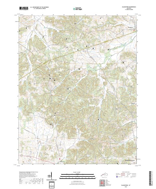 2022 Slaughters2022 Print · USGSThe borderlands of Webster and Hopkins counties are captured here in the early twenty-first century, showing a landscape deeply tied to family heritage. Genealogists can trace hundreds of names through sites like Trice-Strum Cem, Groves Cem, and the historic Veazey settlement.
 - 2022 Map of Dalton, 2022 Print
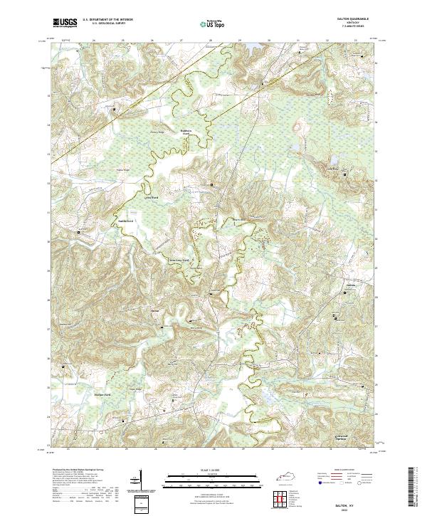 2022 Dalton2022 Print · USGSWestern Kentucky's river-driven geography is on full display in this modern survey of the Tradewater River corridor. Researchers can trace ancestral connections through numerous rural burial grounds like Holloman Cem and historic river crossings such as Utley Ford or Tom Gray Ford.
 - 2022 Map of Dawson Springs SE, 2022 Print
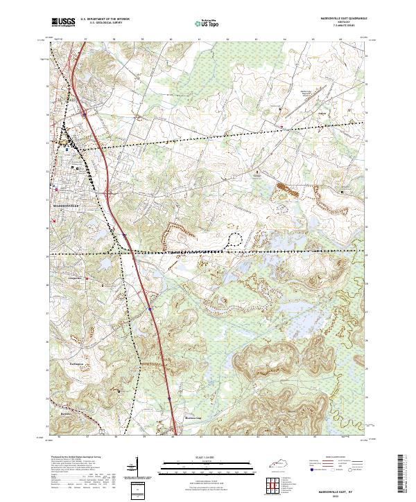
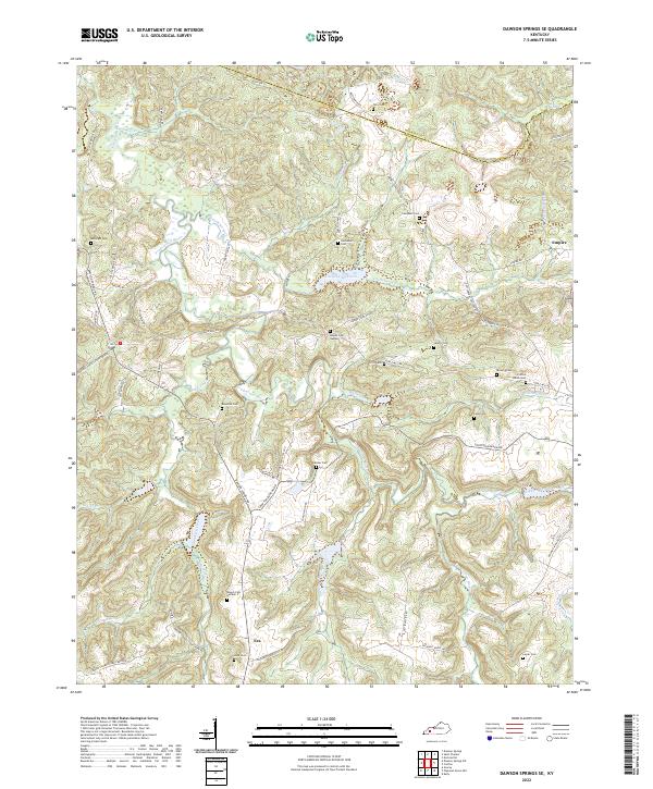 2022 Dawson Springs SE2022 Print · USGSChristian and Hopkins counties are depicted here in the early 2020s, showing a landscape defined by the Tradewater River and rural outposts. Genealogists can trace family lines through numerous burial sites like Crofton Amish Cem and McKnight Cem.
 - 2022 Map of Calhoun, 2022 Print
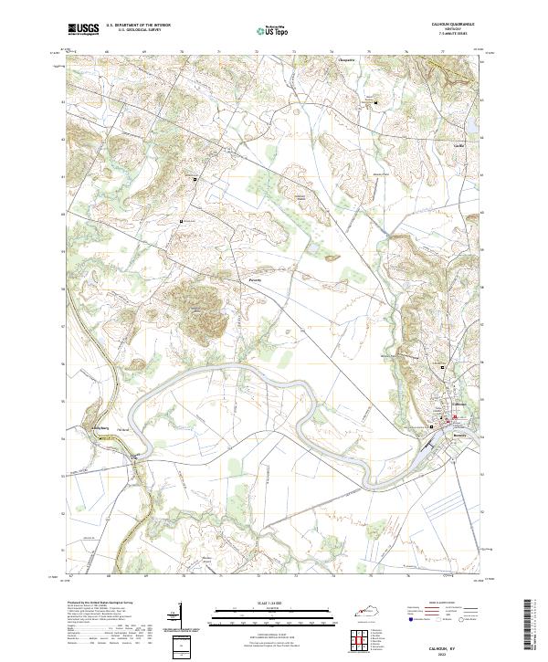 2022 Calhoun2022 Print · USGSMcLean County riverside life is centered on the winding Green River in this modern survey. Genealogists can trace family heritage through the McLean County Courthouse and numerous burial sites like the Camp Calhoun Cem and Antioch Cem.
 - 2022 Map of Sacramento, 2022 Print
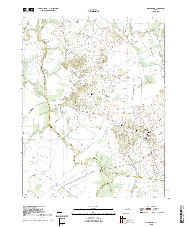 2022 Sacramento2022 Print · USGSWestern Kentucky farmland at the confluence of McLean, Hopkins, and Muhlenberg counties is detailed in this 2022 survey. Genealogists can trace family burial sites at Poplar Grove Cem and West Schoolhouse Cem near the Pond River.
 - 2022 Map of Saint Charles, 2022 Print
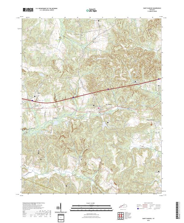 2022 Saint Charles2022 Print · USGSSettlement and industry intersect in this corner of Kentucky, where the legacy of coal mining remains visible in the landscape. Genealogists can trace family roots at New Suthards Cem, Union Temple Ch, and the small community of Ilsley.
 - 2022 Map of Madisonville West, 2022 Print
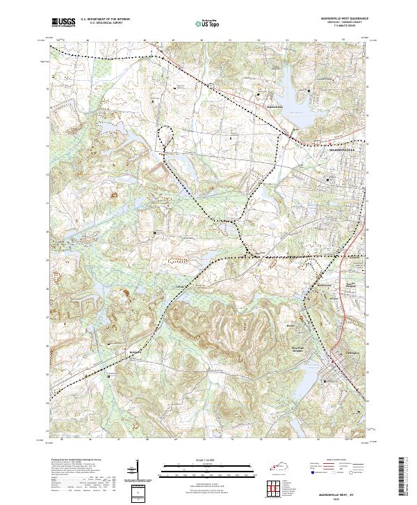 2022 Madisonville West2022 Print · USGSWestern Kentucky's coal country comes to life in this detailed survey, highlighting the expansion of Madisonville and Earlington. Trace family roots at Odd Fellows Cem or explore landmarks like Lake Peewee and the Shake Rag Hills.
 - 2022 Map of Millport, 2022 Print
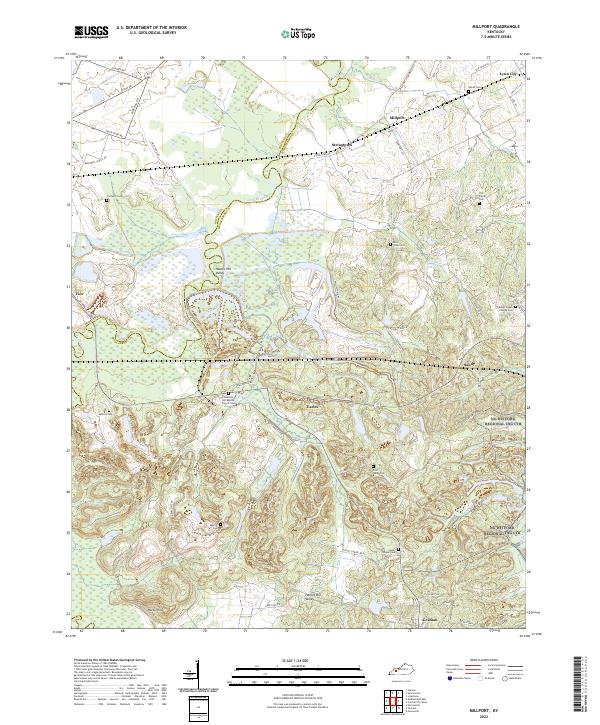 2022 Millport2022 Print · USGSMuhlenberg and Hopkins Counties are captured here at the start of the 2020s, where the winding Pond River divides the landscape. Genealogists can trace family roots through numerous burial sites like Salem Cem, East Union Cem, and McNary Cem.
 - 2022 Map of Coiltown, 2022 Print
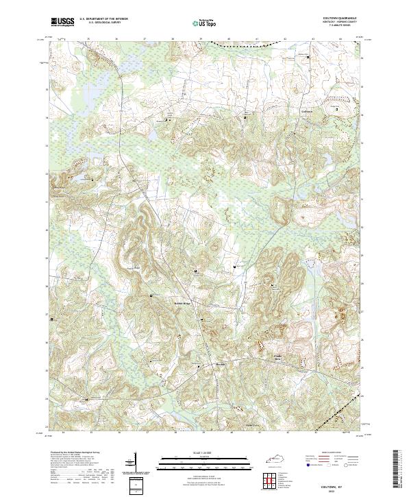 2022 Coiltown2022 Print · USGSHopkins County in the early 2020s reveals a landscape of enduring rural settlements and deep genealogical roots. Researchers can trace family history through numerous burial sites like Old Beulah Cem and Silent Run Cem near Rabbit Ridge.
 - 2022 Map of Olney, 2022 Print
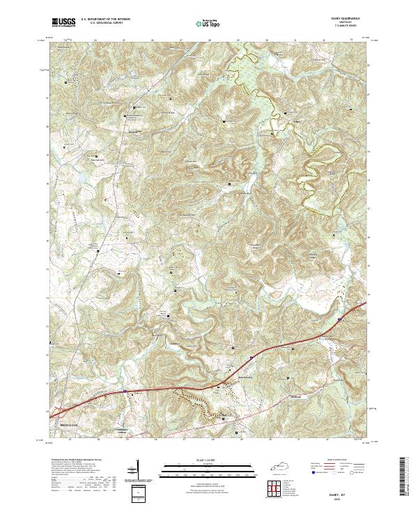 2022 Olney2022 Print · USGSCaldwell County, Kentucky, near the Tradewater River, maintained its rural character into the twenty-first century. Genealogists can trace family names across dozens of sites like Prospect Cem, McNealy Cem, and the small crossroads of Needmore.
 - 2022 Map of Nebo, 2022 Print
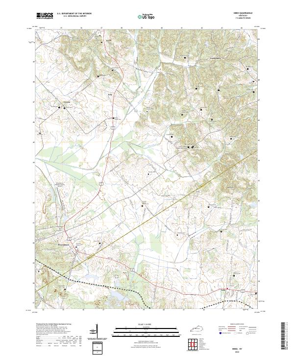 2022 Nebo2022 Print · USGSWestern Kentucky's rural landscape at the junction of Webster and Hopkins counties is shown in modern detail. Genealogists can locate dozens of family burial sites such as McCoy-Gardner Cem and trace the roads connecting Providence and Nebo.
 - 2022 Map of Providence, 2022 Print
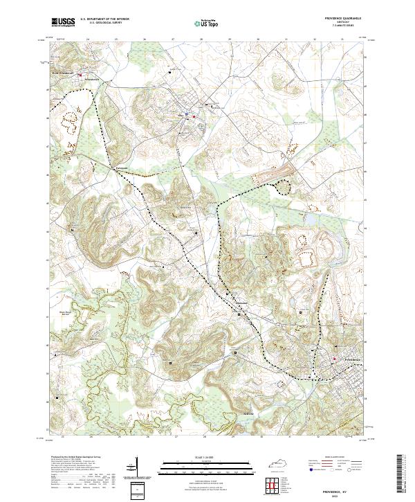 2022 Providence2022 Print · USGSProvidence and the surrounding Webster County coalfields are captured here in the early twenty-first century. Researchers can trace historic industrial sites like the Othawia Mine or locate family burial plots at Odd Fellows Cem and New Hopewell Cem.
 - 2022 Map of Beech Grove, 2022 Print
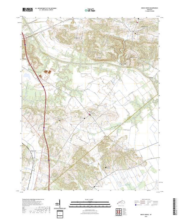 2022 Beech Grove2022 Print · USGSMcLean and Webster Counties are documented here in the early 2020s, centered on the Green River and the rural communities of Beech Grove and Onton. Researchers can trace local lineage through several cemeteries including Saint Benedict Cem and the Lynn Family Cem.
 - 2022 Map of Crofton, 2022 Print
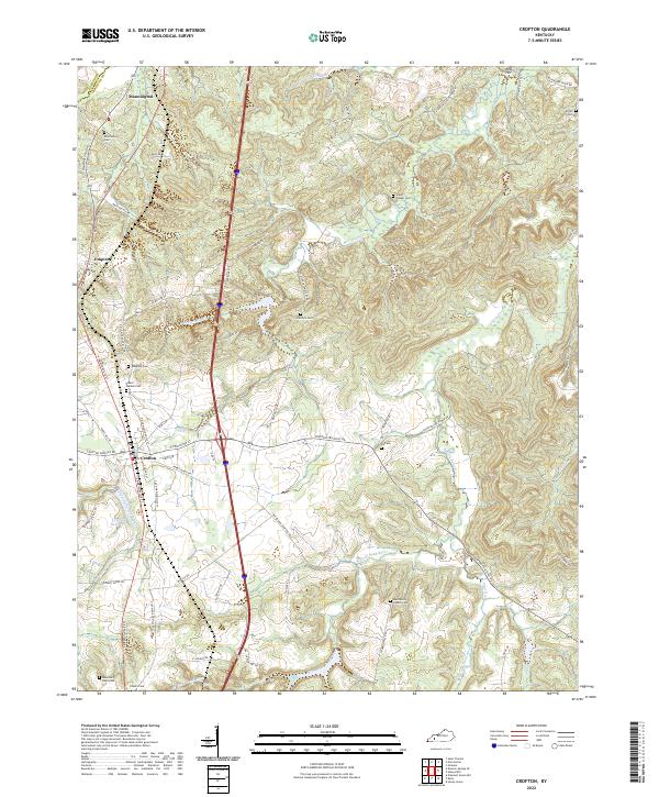 2022 Crofton2022 Print · USGSNorthern Christian County and the border of Hopkins County appear here in the early 2020s. Genealogists can trace family landmarks across numerous sites like Petersburg Cem, Macedonia Church Cem, and the waters of McFarland Cr.
 - 2022 Map of Nortonville, 2022 Print
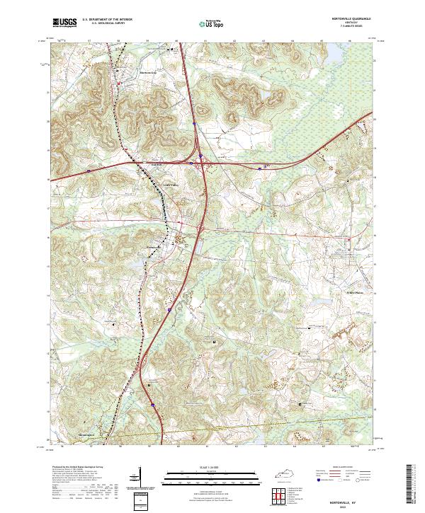 2022 Nortonville2022 Print · USGSThe intersection of modern highways and old county roads in southwestern Kentucky reveals a landscape of enduring rural communities. Genealogists can trace family names through numerous burial sites like Morton Cem and Fox Cem, or locate homesteads near Mortons Gap and White Plains.
 - 2022 Map of Madisonville East, 2022 Print
 2022 Madisonville East2022 Print · USGSHopkins County, Kentucky, is shown in the modern era as a landscape of river-fed lowlands and established communities. Genealogists can trace family roots through several local burial grounds, including Eastside Odd Fellows Cem and Grapevine Cem.
 - 2022 Map of Dawson Springs, 2022 Print
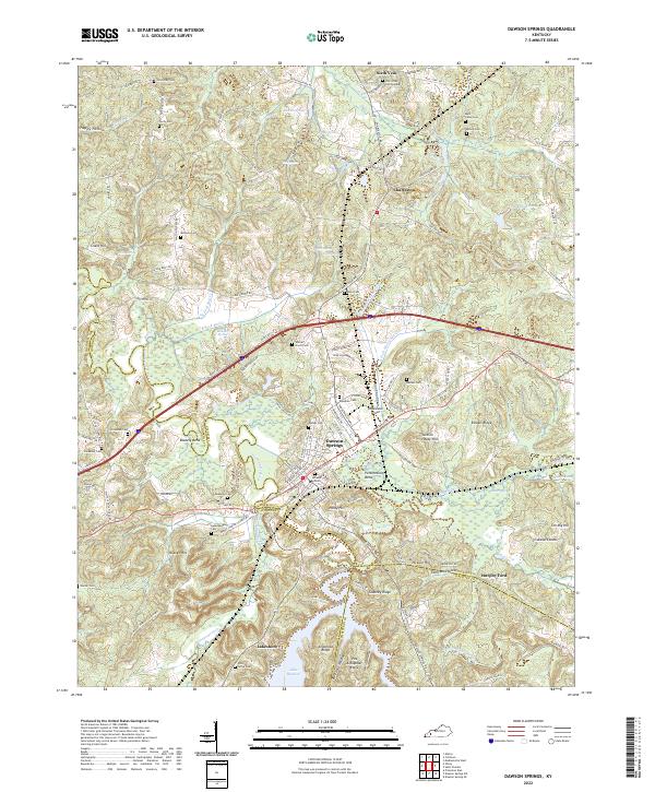 2022 Dawson Springs2022 Print · USGSDawson Springs and the surrounding river valleys are captured here in the early twenty-first century as the region manages its complex water and rail networks. Genealogists can locate numerous family burial sites like Walnut Grove Cem and Piney Grove Cem near the shores of Lake Beshear.
 - 2022 Map of Hanson, 2022 Print
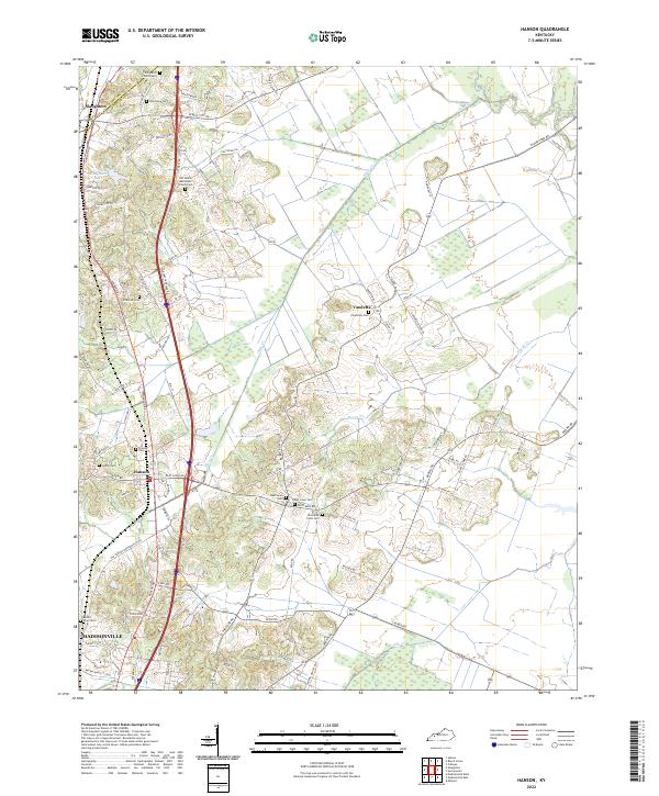 2022 Hanson2022 Print · USGSNorth of Madisonville in the early 2020s, this landscape shows the intersection of modern transit and deep rural history. Researchers can locate numerous family burial sites like Old Ashby Farm Cem and Hanson Cem while tracing the winding path of Otter Cr.
 - 2022 Map of Graham, 2022 Print
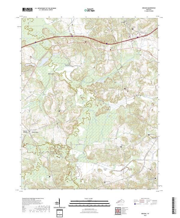 2022 Graham2022 Print · USGSWestern Kentucky's rural landscape is captured here at the junction of three counties, where river bottomlands meet established uplands. You can trace family roots at Graham Hill Cem or explore the geography around McNary, Bakersport, and the Pond River.
End of results
Showing maps 1-19 of 19
Top cities of Hopkins County
- Madisonville historical maps
- Dawson Springs historical maps
- Earlington historical maps
- Nortonville historical maps
- Mortons Gap historical maps
- White Plains historical maps
See more
Frequently asked questions
- What are the different types of historical maps available for Hopkins County?
- What is the oldest map of Hopkins County?
- Where can I purchase historical maps of Hopkins County for my home or office?
- Where can I download high-res historical maps of Hopkins County?
- Are there historical topographic maps available for Hopkins County?
- Is there historical aerial imagery available for Hopkins County?
- Where are historical maps of Hopkins County sourced from?