2020s Maps of Lawrence County, Kentucky
Explore 17 historic maps of Lawrence County from the 2020s. These maps offer a rare glimpse into what life looked like during the 2020s — showing old roads, neighborhoods, homes, and landmarks that have changed or disappeared over time.
Whether you're researching your family's past, planning a metal detecting trip, or studying how Lawrence County's landscape evolved across the 2020s, these high-resolution maps are a powerful tool for exploring the history of this region.
- Focus on a specific era: All maps on this page are from the 2020s, giving you a focused view of this time period.
- See what’s changed: Compare century-old streets, trails, and buildings to today's modern landscape using overlays and satellite layers.
- Research with precision: Use these maps for genealogy, historical research, land use analysis, or educational projects.
- View, download, or print: Maps are fully viewable online in high resolution, and can be downloaded or printed for your own records.
Start exploring Lawrence County's history through authentic maps from the 2020s. This is your window into the past.
Lawrence County, KY maps
(17)- 2022 Map of Blaine, 2022 Print
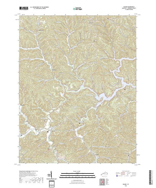 2022 Blaine2022 Print · USGSLawrence County, Kentucky, is captured here in the early 2020s, showing a landscape defined by deep hollows and ancestral family settlements. Genealogists and local historians can locate numerous small burial sites including Swetnam Cem, Sparks Cem, and Hayes Cem near the town of Blaine.
 - 2022 Map of Burnaugh, 2022 Print
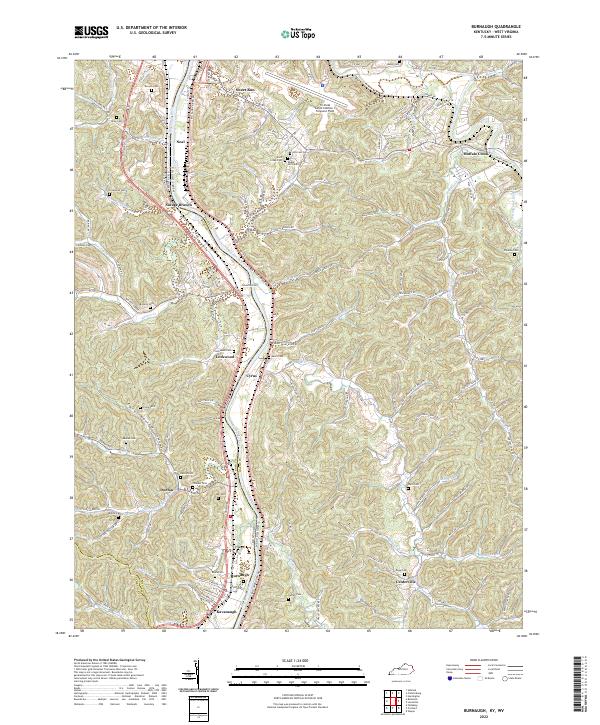 2022 Burnaugh2022 Print · USGSThe Big Sandy River valley at the Kentucky and West Virginia border is shown here as it appears today. Researchers can locate many family burial sites like Lockwood Cem and Thacker Cem near settlements at Burnaugh and Cyrus.
 - 2022 Map of Redbush, 2022 Print
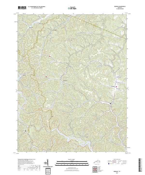 2022 Redbush2022 Print · USGSIn the early twenty-first century, these rural Kentucky highlands near the Johnson and Lawrence county line maintain their traditional ridge-and-hollow settlement patterns. Researchers can locate family landmarks such as Salyers Cem and Jenkins Cem or trace the early paths of Keaton and Flatgap.
 - 2022 Map of Adams, 2022 Print
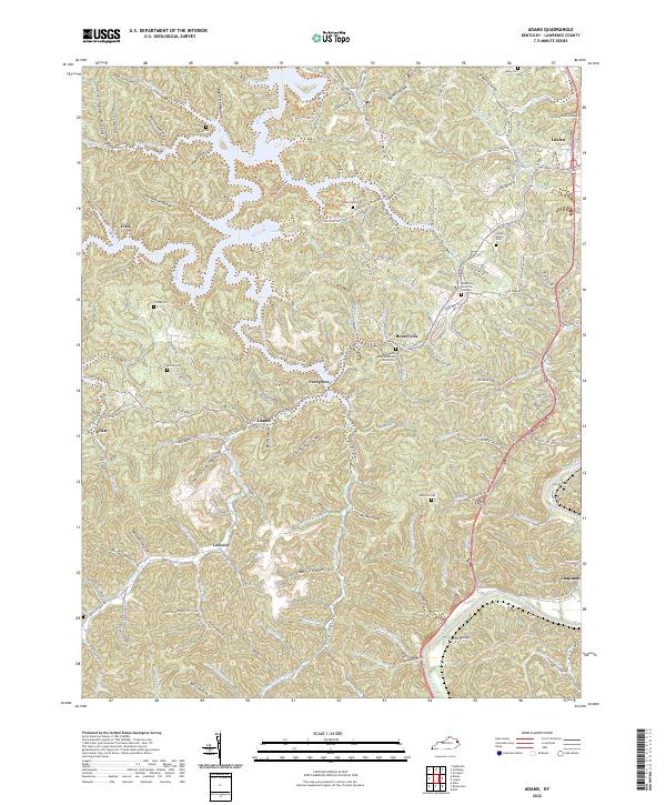 2022 Adams2022 Print · USGSLawrence County in the early twenty-first century remains defined by the winding waters of Blaine Creek and its network of namesake hollows. Genealogists can locate several small family burial sites like Prince Cem and Hutchison Cem near the communities of Evergreen and Irad.
 - 2022 Map of Fallsburg, 2022 Print
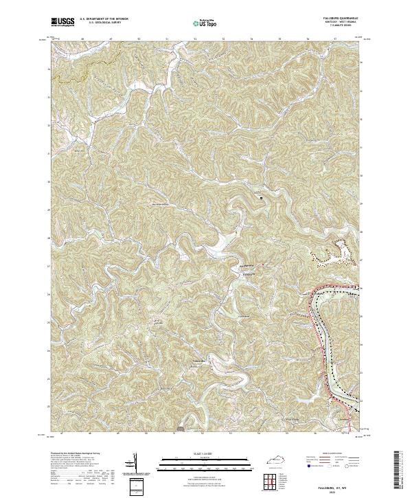 2022 Fallsburg2022 Print · USGSLawrence County, Kentucky, and the West Virginia border meet along the Big Sandy River in this modern survey of the Appalachian foothills. Researchers can trace family roots through the Patton Memorial Cem or locate old home sites near Fallsburg, Fullers, and Stringtown.
 - 2022 Map of Boltsfork, 2022 Print
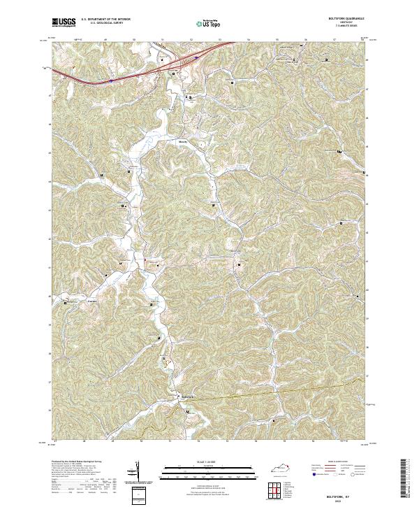 2022 Boltsfork2022 Print · USGSEastern Kentucky's rugged creek valleys and family burial grounds are meticulously documented in this contemporary survey of Boyd County. Genealogists and local historians can trace hundreds of rural landmarks including Boltsfork, the Queen Cem, and the East Fork Little Sandy River.
 - 2022 Map of Mazie, 2022 Print
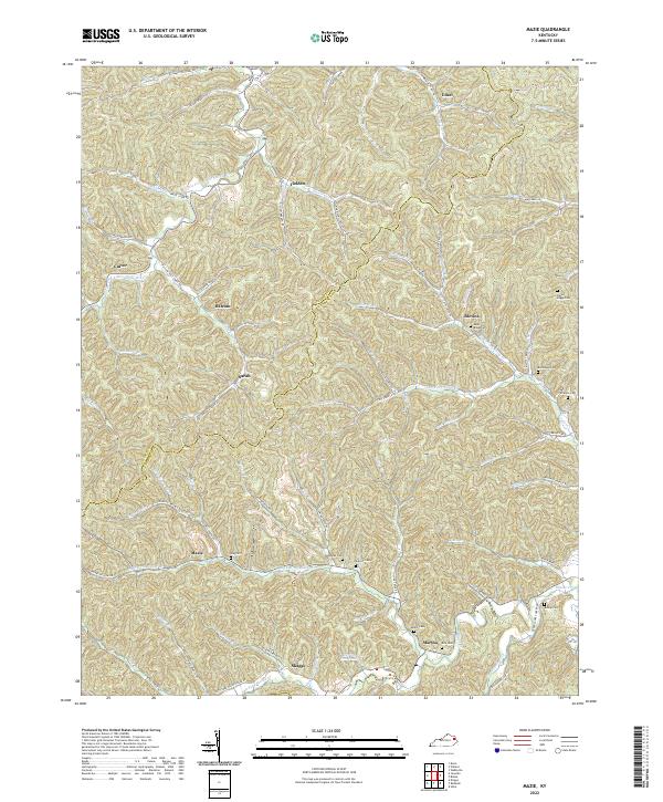 2022 Mazie2022 Print · USGSThe borderlands of Elliott and Lawrence Counties in eastern Kentucky remain a network of narrow valleys and family settlements. Local researchers can trace family lines through numerous burial sites like Hay Cem, Sparks Cem, and the cluster of Boggs family cemeteries.
 - 2022 Map of Richardson, 2022 Print
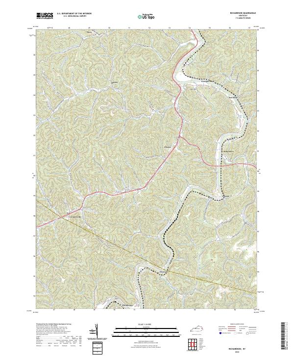 2022 Richardson2022 Print · USGSEastern Kentucky's narrow valleys and ridge-top borders come into focus in this recent survey. Genealogists and local historians can trace family-named landmarks from Butcher Cem to settlements like Lowmansville and Richardson.
 - 2022 Map of Sitka, 2022 Print
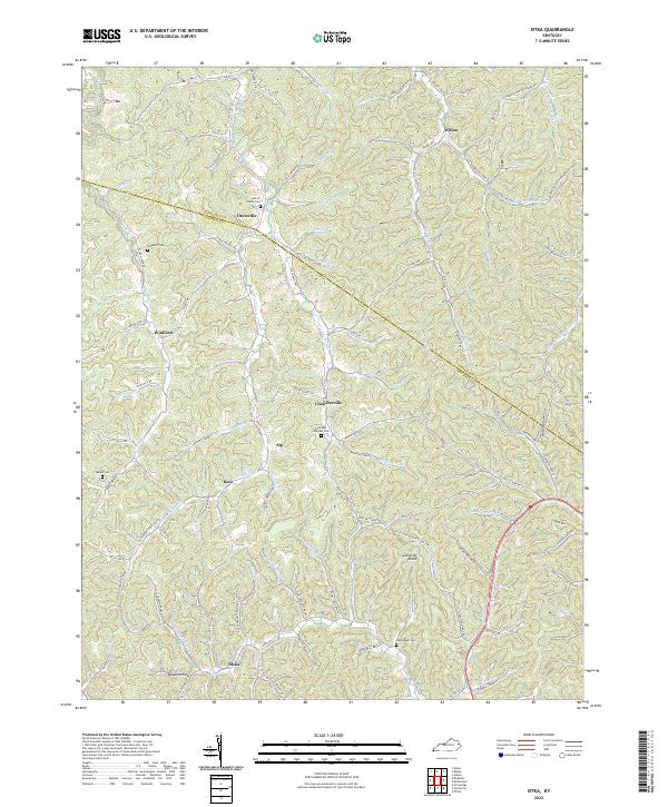 2022 Sitka2022 Print · USGSThe foothills of Johnson and Lawrence Counties are shown here during the early twenty-first century, featuring a landscape carved by winding hollows. Researchers can locate family landmarks like the Stambaugh Cem and old crossroads at Chandlerville and Wilbur.
 - 2022 Map of Webbville, 2022 Print
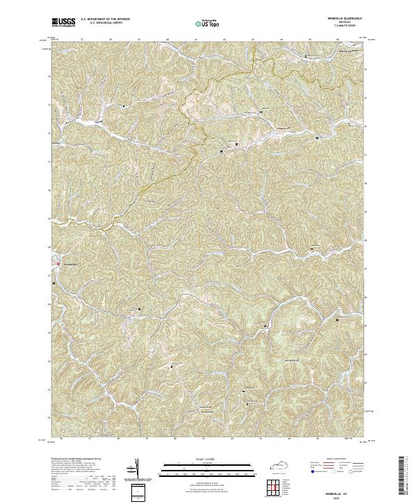 2022 Webbville2022 Print · USGSEastern Kentucky's ridge-and-hollow terrain is meticulously documented here during the early twenty-first century. Genealogists can trace family footprints across numerous sites like the James C Webb Cem, Jordan Cem, and the settlement of Webbville.
 - 2022 Map of Louisa, 2022 Print
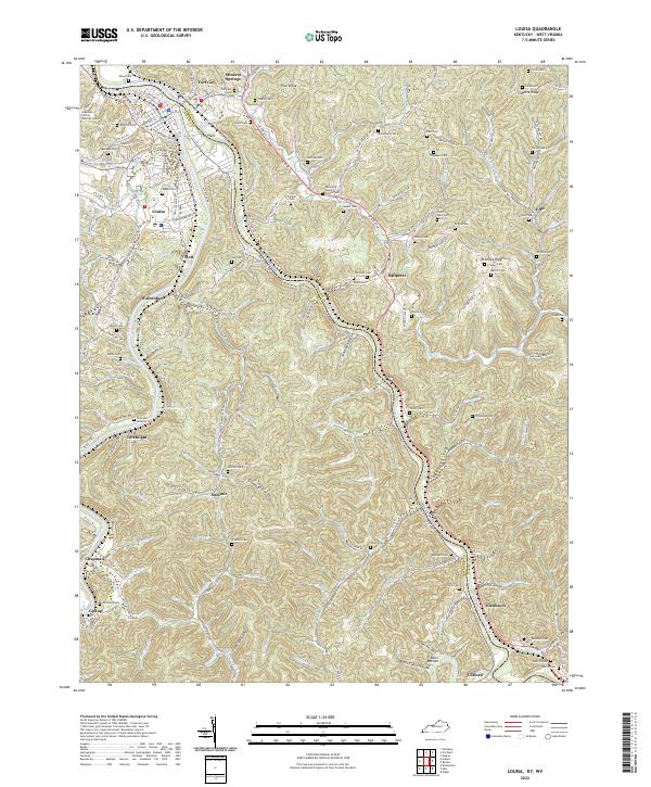 2022 Louisa2022 Print · USGSLouisa and the surrounding river forks sit at the center of this Kentucky-West Virginia border study from 2022. Researchers can find dozens of family burial sites such as Preece Cem and Bartram Cem tucked between The Point and Frazier Bottom.
 - 2022 Map of Willard, 2022 Print
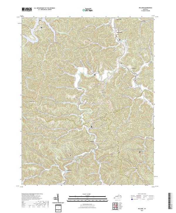 2022 Willard2022 Print · USGSThe creek-side settlements of eastern Kentucky are meticulously detailed here in the early twenty-first century. Genealogists and local historians can trace family ties through numerous hilltop burial grounds like Boggs Cem and Hensley Cem, or locate the historic center of Willard.
 - 2022 Map of Milo, 2022 Print
 2022 Milo2022 Print · USGSMartin County, Kentucky, at the start of the 2020s, reveals a deeply dissected landscape where family and community history is etched into every hollow. Researchers can trace ancestral locations near the Castle School, Buffalo Horn Cem, and Stidham.
 - 2022 Map of Isonville, 2022 Print
 2022 Isonville2022 Print · USGSElliott County in the early twenty-first century remains a landscape of tightly wound hollows and family-held ridges. Genealogists and local historians can trace ancestral sites across Sandy Hook and Isonville, identifying landmarks like the Elliott County Courthouse and numerous burial grounds including Watson Cem and Burton Cem.
 - 2022 Map of Dingus, 2022 Print
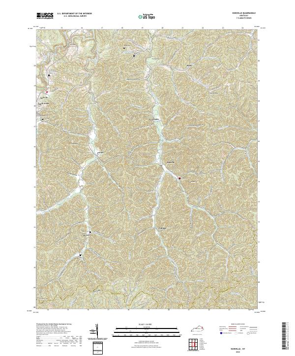
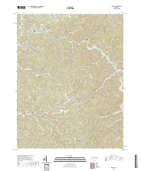 2022 Dingus2022 Print · USGSThe rural communities of Morgan County are documented here in the early twenty-first century, showing the persistent settlement patterns of the eastern Kentucky hills. Researchers can locate family landmarks such as Skaggs Cem, Dingus, and the crossing at Peddler Gap.
 - 2023 Map of Webb, 2023 Print
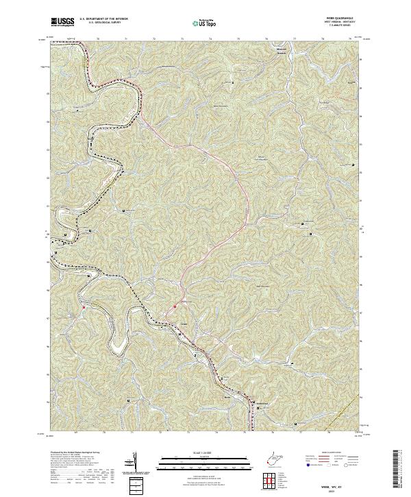 2023 Webb2023 Print · USGSThe Tug Fork valley and the rugged ridges of Wayne County are captured in this recent survey. Local historians can trace family lineage through numerous upland burial sites like Sammons Cem and explore communities at Webb, Crum, and Stonecoal.
 - 2023 Map of Prichard, 2023 Print
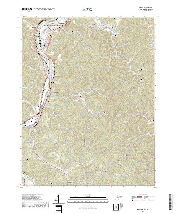 2023 Prichard2023 Print · USGSThe West Virginia and Kentucky borderlands come alive in the 2020s along the Big Sandy River. Genealogists can trace family landmarks like Bellomy Chapel Cem, Hubbardstown, and the Hatton - Burk Cem among the winding Appalachian hollows.
End of results
Showing maps 1-17 of 17
Top cities of Lawrence County
Frequently asked questions
- What are the different types of historical maps available for Lawrence County?
- What is the oldest map of Lawrence County?
- Where can I purchase historical maps of Lawrence County for my home or office?
- Where can I download high-res historical maps of Lawrence County?
- Are there historical topographic maps available for Lawrence County?
- Is there historical aerial imagery available for Lawrence County?
- Where are historical maps of Lawrence County sourced from?