Old Maps of Lawrence County, Kentucky for Academic Research
Study the evolution of Lawrence County with 154 high-resolution historic maps. Whether you're teaching, researching, or modeling changes in land use, these maps provide essential visual documentation of urban, environmental, and geographic change.
- Analyze long-term change: Track patterns in development, transportation, and natural features.
- Ideal for environmental or urban studies: Support academic projects with primary historical map data.
- Use in the classroom or lab: Educators and researchers rely on these maps to bring historical context to life.
These maps are a powerful tool for teaching, research, and visualizing how Lawrence County has changed over the decades.
Lawrence County, KY maps
(154)- 1886 Map of Prestonsburg
 1886 Prestonsburg1886 Print · USGSEastern Kentucky's river-and-rail economy is captured here in the late nineteenth century as steam power reached deep into the mountains. Genealogists can trace family homesteads near Prestonburgh, Paintsville, and early settlements like Peach Orchard or Boon's Camp.
 - 1887 Map of Warfield
 1887 Warfield1887 Print · USGSThe West Virginia and Kentucky borderlands come into focus in the late nineteenth century along the winding Tug Fork of Big Sandy River. Genealogists and historians can trace early valley life through sites like Warfield, Chapmansville, and the remote White Post settlement.
 - 1889 Map of Salyersville, 1949 Print
 1889 Salyersville1949 Print · USGSEastern Kentucky at the close of the nineteenth century reveals a complex landscape of river-valley settlements and highland hollows. Genealogists can trace early homesteads and communities like Salyersville, Hazel Green, and Jackson along the winding Licking River and Quicksand Creek.
 - 1891 Map of Salyersville
 1891 Salyersville1891 Print · USGSEastern Kentucky's rugged plateau is captured in the late nineteenth century as small river towns and remote hollows defined the region. Genealogists can trace family roots through mountain settlements like Salyersville, Hazel Green, and Maytown along the Licking River.2 unique versions available
 - 1891 Map of Warfield
 1891 Warfield1891 Print · USGSThe Tug Fork valley in the 1880s is captured here at the intersection of Kentucky and West Virginia. Researchers can trace the early Appalachian landscape through riverfront settlements like Warfield and White Post, or find family-named hubs such as Hatfield and Mate.7 unique versions available
 - 1892 Map of Prestonsburg
 1892 Prestonsburg1892 Print · USGSEastern Kentucky is shown in the late nineteenth century as a landscape of river-centered trade and early mountain settlement. Genealogists and historians can trace family-named locations like Laynesville, Oil Spring, and the post office at Eden (Inez P.O.).4 unique versions available
 - 1899 Map of Salyersville
 1899 Salyersville1899 Print · USGSEastern Kentucky's mountain communities were well-established along the winding river forks at the turn of the century. Genealogists and local historians can trace family-named landmarks and old settlements like Hazel Green, Ezel, and West Liberty along the Licking River.4 unique versions available
 - 1901 Map of Ceredo, 1953 Print
 1901 Ceredo1953 Print · USGSThe tri-state convergence of West Virginia, Ohio, and Kentucky comes alive in this early 20th-century survey of the Ohio River valley. Genealogists and rail historians can trace the vital transport networks of Kenova and Ceredo, alongside family-named landmarks like Walker Br and Rice Run.2 unique versions available
 - 1903 Map of Kenova
 1903 Kenova1903 Print · USGSThe tri-state river junction at Ashland and Kenova was a bustling industrial hub after the turn of the century. Trace early rail lines and mining settlements like Coalton and Boghead, or locate family landmarks along the Little Sandy River and Means Tunnel.5 unique versions available
 - 1904 Map of Kenova
 1904 Kenova1904 Print · USGSThe tri-state confluence of the Ohio River and Big Sandy River hums with early industrial activity at the start of the century. Genealogists can trace rail-side settlements and remote homesteads along Blaine Creek and near Mt Savage or Webbville.
 - 1910 Map of Naugatuck
 1910 Naugatuck1910 Print · USGSMingo and Wayne Counties come into focus in the early twentieth century as the coal and timber industry transformed these hollows. Genealogists and researchers can trace the Norfolk and Western rail line through early settlements like Kermit, Breeden, and Naugatuck.
 - 1911 Map of Louisa
 1911 Louisa1911 Print · USGSThe West Virginia borderlands along the Big Sandy River come to life in this early twentieth-century study of Wayne County. Trace family roots and vanished rail stops like Fort Gay, Glenhayes, and Saltpeter along the Norfolk and Western Railway line.
 - 1912 Map of Naugatuck
 1912 Naugatuck1912 Print · USGSMingo and Wayne County borderlands are shown here in the early twentieth century, as the river-and-rail economy transformed these Appalachian hollows. Genealogists and historians can trace family-named sites along the Tug Fork and Norfolk and Western Ry, including Kermit, Naugatuck, and Breeden.
 - 1913 Map of Ceredo
 1913 Ceredo1913 Print · USGSThe confluence of the Ohio and Big Sandy rivers comes alive in this pre-war survey of the West Virginia-Ohio borderlands. Genealogists and rail historians can trace the early footprints of Kenova, Ceredo, and the winding path of Twelvepole Creek.4 unique versions available
 - 1913 Map of Louisa
 1913 Louisa1913 Print · USGSThe river borders of West Virginia and Kentucky come alive in this pre-World War I survey of the Big Sandy valley. Genealogists can trace family footprints in Fort Gay, Saltpeter, and Glenhayes or locate the rural Buck Church.3 unique versions available
 - 1914 Map of Inez
 1914 Inez1914 Print · USGSThe Big Sandy River valley in the early twentieth century was a landscape of coal-country settlements and riverside rail stops. Researchers can trace the development of small communities like Whitehouse and Inez or locate vanished landmarks like Wells Chapel and Graves Shoals Sta.
 - 1915 Map of Paintsville
 1915 Paintsville1915 Print · USGSEastern Kentucky during the first World War is captured here as the river-and-rail economy takes hold. Genealogists can trace family names through dozens of rural school districts and communities like Flatgap, Van Lear, and Staffordsville.
 - 1915 Map of Naugatuck
 1915 Naugatuck1915 Print · USGSThe Tug Fork valley in the early twentieth century appears in fine detail here along the Kentucky and West Virginia border. Genealogists and historians can trace early settlements and valley schools including Warfield, Naugatuck, and the Priest School.
 - 1916 Map of Inez
 1916 Inez1916 Print · USGSMartin and Lawrence Counties are shown here during a period of rural growth and river-based transport. Genealogists can locate specific homesteads near Wells Chapel, track old post offices like Graves Shoals, or find local landmarks such as Sandlick School.3 unique versions available
 - 1917 Map of Paintsville
 1917 Paintsville1917 Print · USGSEastern Kentucky during the first World War is meticulously documented here, showing the densely packed hollows of Johnson County. Genealogists can trace family roots through numerous numbered schools and rural settlements like Oil Springs, Flat Gap, and Hager Hill PO Johnson Sta.3 unique versions available
 - 1917 Map of Naugatuck
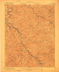 1917 Naugatuck1917 Print · USGSThe Tug Fork borderlands of Mingo and Wayne counties were defined by the rail-and-river economy during the early twentieth century. Genealogists and historians can trace riverside settlements like Kermit and Naugatuck, or search for upland landmarks such as Priest School and the Breeden Breading Post Office.3 unique versions available
 - 1926 Map of Naugatuck, 1957 Print
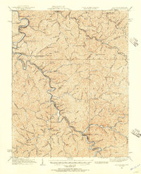 1926 Naugatuck1957 Print · USGSThe Tug Fork valley hums with activity in the 1920s as the rail-and-river economy shapes the West Virginia and Kentucky border. Genealogists and historians can trace numerous rural schools and early settlements like Kermit, Warfield, and the Cassie post office.
 - 1928 Map of Naugatuck
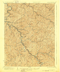 1928 Naugatuck1928 Print · USGSThe Tug Fork valley at the close of the 1920s reveals a landscape defined by the Norfolk and Western RR and riverside coal towns. Genealogists can trace family footprints through remote schoolhouses like The Bend Sch and rural post offices at Cassie Po and Kermit.2 unique versions available
 - 1939 Map of Louisa
 1939 Louisa1939 Print · USGSThe borderlands of West Virginia and Kentucky are captured here in the late thirties, centered on the river junctions. Researchers can trace family ties at small rural sites like Double Cabin Sch, Elijah Ch, and the settlement of Fort Gay.3 unique versions available
 - 1950 Map of Isonville, 1952 Print
 1950 Isonville1952 Print · USGSMid-century Elliott County is mapped here during a period of active rural life and early oil exploration. Researchers can trace ancestral locations through numerous schools like Fairview Sch and landmarks including Peters Hill Lookout Tower and Isonville.
Showing maps 1-25 of 154
Top cities of Lawrence County
Frequently asked questions
- What are the different types of historical maps available for Lawrence County?
- What is the oldest map of Lawrence County?
- Where can I purchase historical maps of Lawrence County for my home or office?
- Where can I download high-res historical maps of Lawrence County?
- Are there historical topographic maps available for Lawrence County?
- Is there historical aerial imagery available for Lawrence County?
- Where are historical maps of Lawrence County sourced from?