Old Maps of Madison County, Kentucky for Academic Research
Study the evolution of Madison County with 119 high-resolution historic maps. Whether you're teaching, researching, or modeling changes in land use, these maps provide essential visual documentation of urban, environmental, and geographic change.
- Analyze long-term change: Track patterns in development, transportation, and natural features.
- Ideal for environmental or urban studies: Support academic projects with primary historical map data.
- Use in the classroom or lab: Educators and researchers rely on these maps to bring historical context to life.
These maps are a powerful tool for teaching, research, and visualizing how Madison County has changed over the decades.
Madison County, KY maps
(119)- 1892 Map of Richmond
 1892 Richmond1892 Print · USGSMadison and Clark counties are mapped here in the late nineteenth century, centered on the growing railroad hub of Richmond. Genealogists can trace family land and travel routes through historic crossings like Boonesboro, river towns like Ford, and high points such as Combs Mtn.
 - 1897 Map of Richmond
 1897 Richmond1897 Print · USGSMadison and Clark counties are mapped here during a decade of rapid railroad expansion and river-based commerce. Genealogists can trace family names and extinct locales from Boonesboro to the industrial Stone Quarry and the hub at Winchester.5 unique versions available
 - 1905 Map of Harrodsburg
 1905 Harrodsburg1905 Print · USGSCentral Kentucky's Bluegrass region is captured here in the early twentieth century, showing a landscape defined by the deep gorges of the Kentucky River. Researchers can trace the era's vital rail networks and river commerce through features like Lock No 7 and the Louisville and Nashville RR.3 unique versions available
 - 1952 Map of Alcorn
 1952 Alcorn1952 Print · USGSThe valleys and hollows of eastern Kentucky appear here in the early fifties, showing a network of small settlements and family farms. Researchers can locate family roots at Hade Rose Cem or trace the early paths through Sinking Valley and Alcorn.3 unique versions available
 - 1952 Map of Berea, 1953 Print
 1952 Berea1953 Print · USGSThe college town of Berea and its surrounding hill country are captured here in the early fifties. Genealogists and local historians can trace family-named sites across the ridges, from Wallace Chapel to the Macedonia Ch Abney Cem and Scaffold Cane School.
 - 1952 Map of Valley View, 1953 Print
 1952 Valley View1953 Print · USGSThe Kentucky River meanders through the Madison and Jessamine county lines in the early fifties, anchored by the river landing at Valley View. Genealogists and local historians can trace rural schoolhouses like Newby Sch and several country churches, including Taylors Chapel and Antioch Ch.3 unique versions available
 - 1952 Map of Union City, 1953 Print
 1952 Union City1953 Print · USGSMadison County in the early fifties is captured here just as rural life centered on the local ridges and creek valleys. Genealogists can trace family roots through landmarks like Union City, Flatwoods Cem, and Old Cain Springs Ch.4 unique versions available
 - 1952 Map of Little Hickman, 1953 Print
 1952 Little Hickman1953 Print · USGSJessamine County and the winding Kentucky River are captured here in the early fifties, documenting a landscape of tight-knit rural communities. Genealogists and historians can locate family landmarks like Roberts Chapel, Daniel Boones Cave, and the Camp Nelson National Cem.6 unique versions available
 - 1952 Map of Palmer, 1953 Print
 1952 Palmer1953 Print · USGSThe Kentucky River meanders through the limestone ridges of Estill, Madison, and Clark Counties during the early fifties. Genealogists can trace family landmarks and schools including The Bend Sch, the Alexander Sch, and dozens of family plots like the Gatman Cem.3 unique versions available
 - 1952 Map of Buckeye, 1953 Print
 1952 Buckeye1953 Print · USGSGarrard County's high ridges and river bends are captured here in the early fifties, showing a rural landscape of crossroads hamlets and family farmsteads. Researchers can locate community centers like Teatersville and Bourne or trace rural churches such as Mt Hebron Ch.
 - 1952 Map of Paint Lick, 1953 Print
 1952 Paint Lick1953 Print · USGSGarrard County's rolling hills and winding creeks are documented here in the early fifties, showing a landscape of small farmsteads and rural crossroads. Local historians can trace family roots through numerous sites like Old Paint Lick Ch, Carpenter Cem, and Oakdale Sch.2 unique versions available
 - 1952 Map of Coletown, 1953 Print
 1952 Coletown1953 Print · USGSFayette and Jessamine counties are captured here in the early fifties, showing a rural landscape defined by historic pikes and the winding Kentucky River. Researchers can trace old family sites and crossroads communities like Coletown, Jonestown, and the Eldridge Cem.
 - 1952 Map of Kirksville, 1953 Print
 1952 Kirksville1953 Print · USGSMadison and Garrard counties appear here in the early fifties, showing a landscape of ridge-top farms and deep creek valleys. Researchers can trace family history through local landmarks like Kirksville Sch, Sebastian Cem, and Freedom Ch.3 unique versions available
 - 1952 Map of Ford, 1954 Print
 1952 Ford1954 Print · USGSThe Kentucky River corridor and its surrounding uplands appear here in the early fifties, showing a landscape defined by sharp river bends and family-run farms. Genealogists can trace rural roots through Durbin Memorial Ch and family plots like Younger Cem and Evans Cem.
 - 1952 Map of Winchester, 1954 Print
 1952 Winchester1954 Print · USGSIn the early fifties, Winchester flourished as a rail hub where the Chesapeake and Ohio met the Louisville and Nashville. Genealogists can locate rural institutions like the Julius Rosenwald Sch, Old Stone Ch, and the outlying settlement of Flanagan near the Kentucky River.
 - 1952 Map of Richmond North, 1954 Print
 1952 Richmond North1954 Print · USGSMadison County at the start of the 1950s shows the winding Kentucky River and the rural communities surrounding Richmond. Genealogists and historians can trace old property lines near Boonesboro, find Mt Pleasant Ch, or follow the Louisville and Nashville rail line.
 - 1952 Map of Bighill, 1954 Print
 1952 Bighill1954 Print · USGSMadison and Jackson counties are captured in the early fifties, showing a rural landscape organized around deep hollows and high knobs. Local historians can trace family locations near New Liberty Ch, Hardin Cem, and vanished schools like Log Cabin Sch.4 unique versions available
 - 1952 Map of Panola, 1954 Print
 1952 Panola1954 Print · USGSMadison and Estill counties appear here in the early fifties, where the Kentucky River valley gives way to the deep ridges of the Cumberland Plateau. Researchers can trace family history through numerous rural landmarks like Hubbard Cem, Cedar Grove Ch, and the many schools including Hoys Fork Sch.3 unique versions available
 - 1952 Map of Moberly, 1961 Print
 1952 Moberly1961 Print · USGSMadison County at the start of the fifties shows a landscape of military readiness and rural tradition. Genealogy researchers can trace family roots through Flatwoods Cem, Goodloe Chapel, and schools like Speedwell Sch or Brassfield Sch.2 unique versions available
 - 1953 Map of Richmond South, 1954 Print
 1953 Richmond South1954 Print · USGSMadison County at mid-century reveals the growth of Richmond alongside the sprawling Blue Grass Ordnance Depot. Genealogists can locate rural communities like Peytontown and Buggytown or trace the Louisville and Nashville rail line.
 - 1954 Map of Moberly
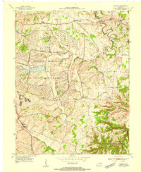 1954 Moberly1954 Print · USGSMadison County in the early fifties reveals a landscape defined by the massive Blue Grass Ordnance Depot. Genealogists and historians can trace old community landmarks like Goodloe Chapel, Reeds Crossing, and the Port Richmond Airfield.
 - 1957 Map of Winchester, 1968 Print
 1957 Winchester1968 Print · USGSCentral Kentucky's landscape in the mid-twentieth century features the sprawling Fort Knox and the early parkway system. Genealogists and historians can trace rail lines like the Southern Railway and find landmarks from Bernheim Forest to Pilot Knob.3 unique versions available
 - 1959 Map of Coletown, 1960 Print
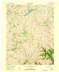 1959 Coletown1960 Print · USGSFayette County at the close of the 1950s shows the growing city of Lexington expanding south toward the Kentucky River. Genealogists and local historians can locate several family landmarks and community centers including Walnut Hill Ch, Shelby Sch, and the Eldridge Cem.
 - 1959 Map of Winchester, 1960 Print
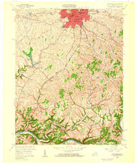 1959 Winchester1960 Print · USGSWinchester and the surrounding Bluegrass countryside are caught here in the late fifties as suburban growth began to reach beyond the historic city center. Genealogists can trace family footprints at Old Stone Ch, Providence Ch, and the rural settlement of Flanagan.
 - 1960 Map of Winchester
 1960 Winchester1960 Print · USGSCentral Kentucky's diverse landscape is shown here at mid-century, from the bluegrass plains to the rugged Pottsville Escarpment. Genealogists and historians can trace the rail-and-river network connecting towns like Bardstown and Stanford alongside landmarks like Lake Cumberland.
Showing maps 1-25 of 119
Top cities of Madison County
Frequently asked questions
- What are the different types of historical maps available for Madison County?
- What is the oldest map of Madison County?
- Where can I purchase historical maps of Madison County for my home or office?
- Where can I download high-res historical maps of Madison County?
- Are there historical topographic maps available for Madison County?
- Is there historical aerial imagery available for Madison County?
- Where are historical maps of Madison County sourced from?