2020s Maps of Richmond, Kentucky
Explore 4 historic maps of Richmond from the 2020s. These maps offer a rare glimpse into what life looked like during the 2020s — showing old roads, neighborhoods, homes, and landmarks that have changed or disappeared over time.
Whether you're researching your family's past, planning a metal detecting trip, or studying how Richmond's landscape evolved across the 2020s, these high-resolution maps are a powerful tool for exploring the history of this region.
- Focus on a specific era: All maps on this page are from the 2020s, giving you a focused view of this time period.
- See what’s changed: Compare century-old streets, trails, and buildings to today's modern landscape using overlays and satellite layers.
- Research with precision: Use these maps for genealogy, historical research, land use analysis, or educational projects.
- View, download, or print: Maps are fully viewable online in high resolution, and can be downloaded or printed for your own records.
Start exploring Richmond's history through authentic maps from the 2020s. This is your window into the past.
Richmond, KY maps
(4)- 2022 Map of Moberly, 2022 Print
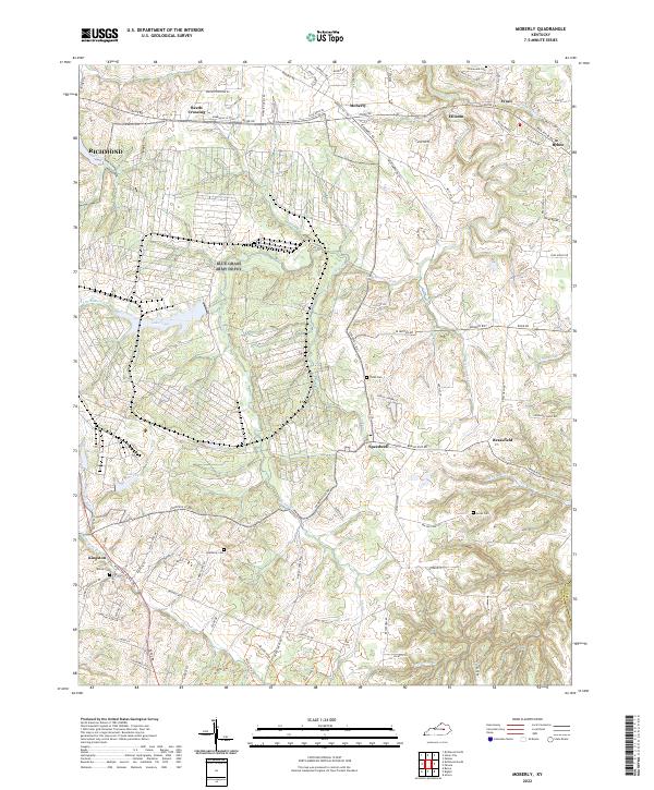 2022 Moberly2022 Print · USGSMadison County's rural landscape is captured here in the early 2020s, showing a network of small settlements and family farms. Genealogists can locate several local burial grounds, including Jones Cem and Moody Cem, alongside historic hubs like Bybee and Brassfield.
 - 2022 Map of Berea, 2022 Print
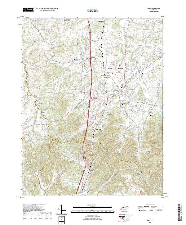 2022 Berea2022 Print · USGSMadison County transitions from the historic campus of Berea College into the rugged knobs and hollows of the Cumberland Plateau. Genealogists can trace family landmarks and burial sites like Todd Cem, Davis-Witt Cem, and the old settlement of Wallaceton.
 - 2022 Map of Richmond North, 2022 Print
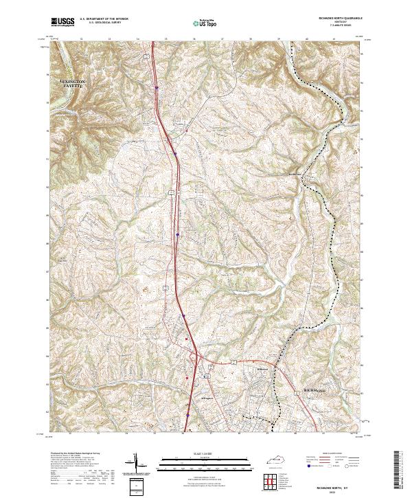 2022 Richmond North2022 Print · USGSMadison County's northern landscape transitions from the growing city of Richmond to the river bluffs during the early 2020s. Researchers can trace the modern development around Hillerest or explore the rural valley networks near Redhouse and the Kentucky River.
 - 2022 Map of Richmond South, 2022 Print
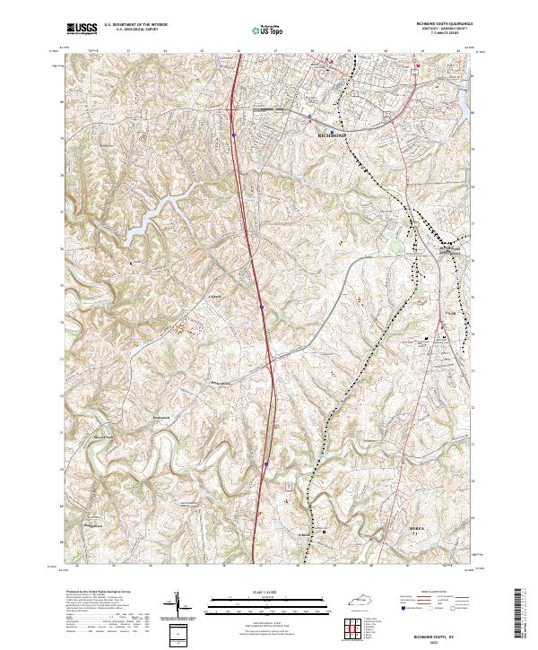 2022 Richmond South2022 Print · USGSMadison County, Kentucky, thrives in the modern era as a hub of education and transport between the population centers. Researchers can trace family sites at Haines Cemetery or explore the rural outskirts of Peytontown, Caleast, and Buggytown.
End of results
Showing maps 1-4 of 4
Top cities near Richmond
Top neighborhoods of Richmond
Frequently asked questions
- What are the different types of historical maps available for Richmond?
- What is the oldest map of Richmond?
- Where can I purchase historical maps of Richmond for my home or office?
- Where can I download high-res historical maps of Richmond?
- Are there historical topographic maps available for Richmond?
- Is there historical aerial imagery available for Richmond?
- Where are historical maps of Richmond sourced from?