Old Maps of Richmond, Kentucky for Metal Detecting
Plan your next treasure hunt with 35 historic maps of Richmond. Find old homesites, ghost towns, trails, and gathering spots that may be lost to time — perfect for identifying promising metal detecting locations.
- Locate forgotten sites: Uncover places like long-lost settlements, abandoned rail lines, or gathering spots.
- Plan better hunts: Use map overlays combined with LiDAR or satellite views to narrow in on historically rich areas.
- Made for detectorists: Thousands of hobbyists use these maps to discover relics, coins, and hidden history.
Use these historic maps to boost your research and find new opportunities beneath the surface of Richmond.
Richmond, KY maps
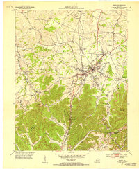
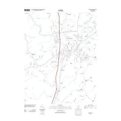
(35)- 1892 Map of Richmond
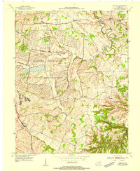
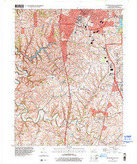
 1892 Richmond1892 Print · USGSMadison and Clark counties are mapped here in the late nineteenth century, centered on the growing railroad hub of Richmond. Genealogists can trace family land and travel routes through historic crossings like Boonesboro, river towns like Ford, and high points such as Combs Mtn.
 - 1897 Map of Richmond
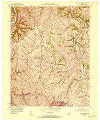
 1897 Richmond1897 Print · USGSMadison and Clark counties are mapped here during a decade of rapid railroad expansion and river-based commerce. Genealogists can trace family names and extinct locales from Boonesboro to the industrial Stone Quarry and the hub at Winchester.5 unique versions available
 - 1952 Map of Berea, 1953 Print
 1952 Berea1953 Print · USGSThe college town of Berea and its surrounding hill country are captured here in the early fifties. Genealogists and local historians can trace family-named sites across the ridges, from Wallace Chapel to the Macedonia Ch Abney Cem and Scaffold Cane School.
 - 1952 Map of Richmond North, 1954 Print
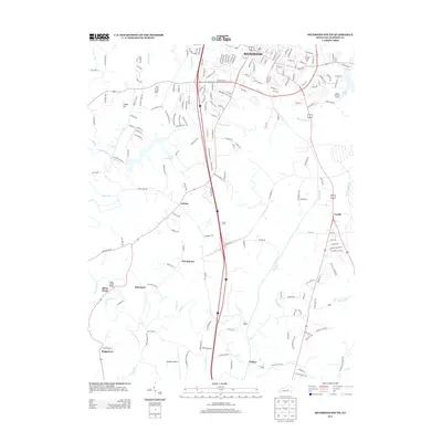
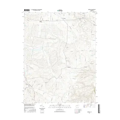
 1952 Richmond North1954 Print · USGSMadison County at the start of the 1950s shows the winding Kentucky River and the rural communities surrounding Richmond. Genealogists and historians can trace old property lines near Boonesboro, find Mt Pleasant Ch, or follow the Louisville and Nashville rail line.
 - 1952 Map of Moberly, 1961 Print
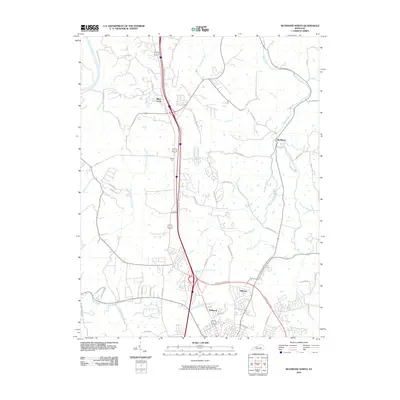
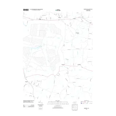
 1952 Moberly1961 Print · USGSMadison County at the start of the fifties shows a landscape of military readiness and rural tradition. Genealogy researchers can trace family roots through Flatwoods Cem, Goodloe Chapel, and schools like Speedwell Sch or Brassfield Sch.2 unique versions available
 - 1953 Map of Richmond South, 1954 Print
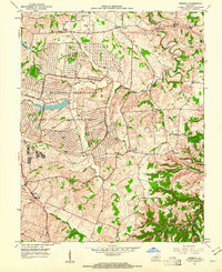
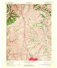
 1953 Richmond South1954 Print · USGSMadison County at mid-century reveals the growth of Richmond alongside the sprawling Blue Grass Ordnance Depot. Genealogists can locate rural communities like Peytontown and Buggytown or trace the Louisville and Nashville rail line.
 - 1954 Map of Moberly
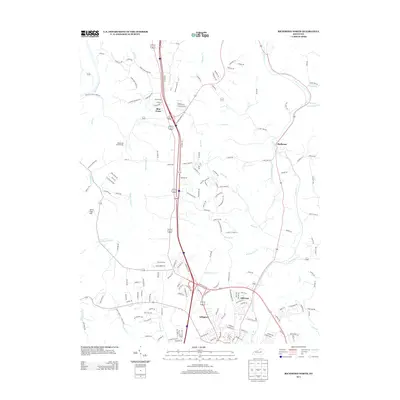
 1954 Moberly1954 Print · USGSMadison County in the early fifties reveals a landscape defined by the massive Blue Grass Ordnance Depot. Genealogists and historians can trace old community landmarks like Goodloe Chapel, Reeds Crossing, and the Port Richmond Airfield.
 - 1957 Map of Winchester, 1968 Print
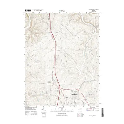
 1957 Winchester1968 Print · USGSCentral Kentucky's landscape in the mid-twentieth century features the sprawling Fort Knox and the early parkway system. Genealogists and historians can trace rail lines like the Southern Railway and find landmarks from Bernheim Forest to Pilot Knob.3 unique versions available
 - 1960 Map of Winchester
 1960 Winchester1960 Print · USGSCentral Kentucky's diverse landscape is shown here at mid-century, from the bluegrass plains to the rugged Pottsville Escarpment. Genealogists and historians can trace the rail-and-river network connecting towns like Bardstown and Stanford alongside landmarks like Lake Cumberland.
 - 1965 Map of Richmond North, 1966 Print
 1965 Richmond North1966 Print · USGSMadison County during the mid-sixties shows a landscape of established farmsteads and growing suburban fringes north of the county seat. Genealogists and local historians can trace family land near White Hall, Mt Nebo Ch, and the Daniel Boone Sch.3 unique versions available
 - 1965 Map of Richmond South, 1967 Print
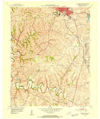
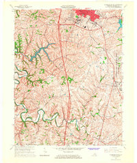 1965 Richmond South1967 Print · USGSMadison County's landscape in the mid-sixties shows the growing city of Richmond alongside the massive Lexington-Blue Grass Army Depot. Local historians can trace old community hubs like Peytontown, Crooksville, and the campus of Eastern Kentucky University.3 unique versions available
 - 1970 Map of Berea, 1972 Print
 1970 Berea1972 Print · USGSBerea and the surrounding Kentucky hills appear here at the start of the 1970s, showing the intersection of academic, rail, and rural life. Researchers can trace family sites at the Silver Creek Cem, visit Berea College, or follow the Louisville and Nashville through Boone Gap.5 unique versions available
 - 1986 Map of Harrodsburg
 1986 Harrodsburg1986 Print · USGSCentral Kentucky in the mid-eighties reveals a landscape defined by the winding Kentucky River and the bustling county seats of the Bluegrass. Genealogists and historians can trace the evolution of Harrodsburg, Danville, and Nicholasville alongside the Lexington Blue Grass Army Depot.
 - 1991 Map of Harrodsburg
 1991 Harrodsburg1991 Print · USGSThe heart of the Bluegrass region comes alive in the late twentieth century, showing the deep river gorges and limestone uplands of central Kentucky. Genealogists and local historians can locate Shakertown, the sprawling Lexington Blue Grass Army Depot, and Berea College.
 - 1997 Map of Richmond South, 2000 Print
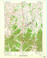
 1997 Richmond South2000 Print · USGSMadison County south of Richmond shows a fascinating mix of academic growth and military industry in the late nineties. Local researchers can locate family-named landmarks and rural outposts like Paytontown, Buggytown, and the grounds of Eastern Kentucky University.
 - 2010 Map of Berea, 2010 Print
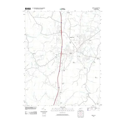 2010 Berea2010 Print · USGSCovers Richmond, including Berea, Farristown, and other nearby areas
 - 2010 Map of Richmond South, 2010 Print
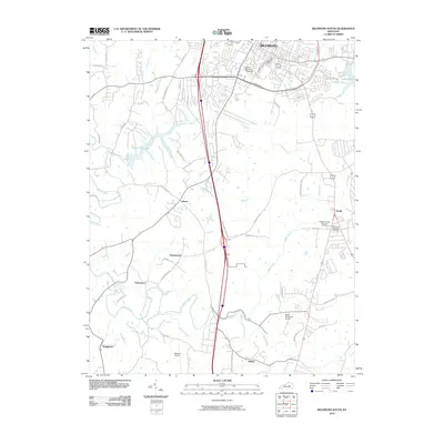 2010 Richmond South2010 Print · USGSCovers Richmond, including Berea, Buggytown, and other nearby areas
 - 2010 Map of Moberly, 2010 Print
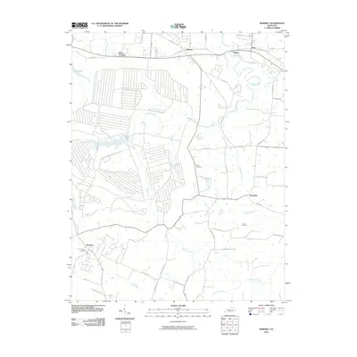 2010 Moberly2010 Print · USGSCovers Richmond, including Reeds Crossing, Waco, and other nearby areas
 - 2010 Map of Richmond North, 2010 Print
 2010 Richmond North2010 Print · USGSCovers Richmond, including Lexington, Redhouse, and other nearby areas
 - 2013 Map of Richmond North, 2013 Print
 2013 Richmond North2013 Print · USGSCovers Richmond, including Lexington, Redhouse, and other nearby areas
 - 2013 Map of Richmond South, 2013 Print
 2013 Richmond South2013 Print · USGSCovers Richmond, including Berea, Buggytown, and other nearby areas
 - 2013 Map of Berea, 2013 Print
 2013 Berea2013 Print · USGSCovers Richmond, including Berea, Farristown, and other nearby areas
 - 2013 Map of Moberly, 2013 Print
 2013 Moberly2013 Print · USGSCovers Richmond, including Reeds Crossing, Waco, and other nearby areas
 - 2016 Map of Moberly, 2016 Print
 2016 Moberly2016 Print · USGSCovers Richmond, including Reeds Crossing, Waco, and other nearby areas
 - 2016 Map of Richmond North, 2016 Print
 2016 Richmond North2016 Print · USGSCovers Richmond, including Lexington, Redhouse, and other nearby areas
Showing maps 1-25 of 35
Top cities near Richmond
Top neighborhoods of Richmond
Frequently asked questions
- What are the different types of historical maps available for Richmond?
- What is the oldest map of Richmond?
- Where can I purchase historical maps of Richmond for my home or office?
- Where can I download high-res historical maps of Richmond?
- Are there historical topographic maps available for Richmond?
- Is there historical aerial imagery available for Richmond?
- Where are historical maps of Richmond sourced from?