1990s Maps of Magoffin County, Kentucky
Explore 6 historic maps of Magoffin County from the 1990s. These maps offer a rare glimpse into what life looked like during the 1990s — showing old roads, neighborhoods, homes, and landmarks that have changed or disappeared over time.
Whether you're researching your family's past, planning a metal detecting trip, or studying how Magoffin County's landscape evolved across the 1990s, these high-resolution maps are a powerful tool for exploring the history of this region.
- Focus on a specific era: All maps on this page are from the 1990s, giving you a focused view of this time period.
- See what’s changed: Compare century-old streets, trails, and buildings to today's modern landscape using overlays and satellite layers.
- Research with precision: Use these maps for genealogy, historical research, land use analysis, or educational projects.
- View, download, or print: Maps are fully viewable online in high resolution, and can be downloaded or printed for your own records.
Start exploring Magoffin County's history through authentic maps from the 1990s. This is your window into the past.
Magoffin County, KY maps
(6)- 1992 Map of Handshoe
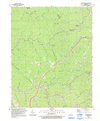 1992 Handshoe1992 Print · USGSKnott County, Kentucky, is shown in the early nineties as a landscape of deep hollows and coal-country settlements. Genealogists can trace family landmarks and burials at Click Cem or explore the mountain crossroads of Mousie and Handshoe.
 - 1992 Map of Dingus
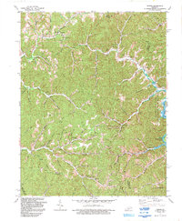 1992 Dingus1992 Print · USGSMorgan County's rural heartland is captured here in the early nineties, showing a landscape shaped by coal mining and the waters of Paintsville Lake. Researchers can trace remote family cemeteries, mountain churches like New Salem Ch, and old settlements from Crockett to Silverhill.
 - 1992 Map of Ivyton
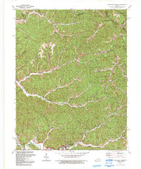
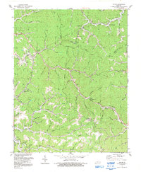 1992 Ivyton1992 Print · USGSThe Magoffin County hollows are captured here in the early nineties, showing a landscape of small settlements and energy production. Researchers can trace family history through dozens of named burial sites like Trimble Cem and old community centers like Ivyton or Bethel Ch.
 - 1992 Map of David
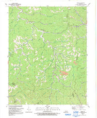 1992 David1992 Print · USGSEastern Kentucky's headwater country is shown in the early nineties, where the Licking River meets the Floyd County line. Genealogists can trace family names near Fredville, the John Arnett Sch, and churches like Little Rachel Ch.
 - 1992 Map of Salyersville North
 1992 Salyersville North1992 Print · USGSIn the early 1990s, the Licking River valley remained a landscape of dispersed family settlements and deep-hollow industry. Genealogists can locate numerous family burial sites like Footbridge Cem and trace small communities from Logville to Lickburg.
 - 1992 Map of Oil Springs
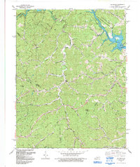 1992 Oil Springs1992 Print · USGSThe hollows of Johnson and Magoffin Counties were transitioning between traditional homesteads and modern energy development in the early nineties. Genealogists can locate family names via Old Little Paint Ch, dozens of hillside Cemeteries, and homes in Oil Springs.
End of results
Showing maps 1-6 of 6
Top cities of Magoffin County
Frequently asked questions
- What are the different types of historical maps available for Magoffin County?
- What is the oldest map of Magoffin County?
- Where can I purchase historical maps of Magoffin County for my home or office?
- Where can I download high-res historical maps of Magoffin County?
- Are there historical topographic maps available for Magoffin County?
- Is there historical aerial imagery available for Magoffin County?
- Where are historical maps of Magoffin County sourced from?