1920s Maps of Menifee County, Kentucky
Explore 2 historic maps of Menifee County from the 1920s. These maps offer a rare glimpse into what life looked like during the 1920s — showing old roads, neighborhoods, homes, and landmarks that have changed or disappeared over time.
Whether you're researching your family's past, planning a metal detecting trip, or studying how Menifee County's landscape evolved across the 1920s, these high-resolution maps are a powerful tool for exploring the history of this region.
- Focus on a specific era: All maps on this page are from the 1920s, giving you a focused view of this time period.
- See what’s changed: Compare century-old streets, trails, and buildings to today's modern landscape using overlays and satellite layers.
- Research with precision: Use these maps for genealogy, historical research, land use analysis, or educational projects.
- View, download, or print: Maps are fully viewable online in high resolution, and can be downloaded or printed for your own records.
Start exploring Menifee County's history through authentic maps from the 1920s. This is your window into the past.
Menifee County, KY maps
(2)- 1929 Map of Morehead
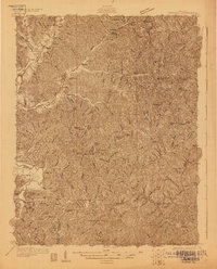 1929 Morehead1929 Print · USGSRowan and Morgan counties were centers of rail and clay production when this late-1920s survey was conducted. Local historians can locate early post offices like Elliottville PO (Hogtown) and trace the paths of the Chesapeake and Ohio through the Clack Mtn Tunnel.
 - 1929 Map of Salt Lick, 1961 Print
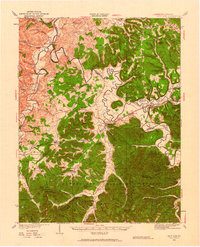 1929 Salt Lick1961 Print · USGSBath and Fleming counties are shown here as the Licking River valley was transitioning into a modern rail corridor. Genealogists and historians can trace numerous rural schoolhouses and river crossings like Moores Ferry, Arnold Chapel, and the historic Olympia Springs.
End of results
Showing maps 1-2 of 2
Top cities of Menifee County
Frequently asked questions
- What are the different types of historical maps available for Menifee County?
- What is the oldest map of Menifee County?
- Where can I purchase historical maps of Menifee County for my home or office?
- Where can I download high-res historical maps of Menifee County?
- Are there historical topographic maps available for Menifee County?
- Is there historical aerial imagery available for Menifee County?
- Where are historical maps of Menifee County sourced from?