Old Maps of Menifee County, Kentucky for Genealogy
Trace your family roots with 84 historic maps of Menifee County. These high-res maps reveal old neighborhoods, homesites, landmarks, and streets — helping you uncover where your ancestors lived and how the area evolved over time.
- Explore historic neighborhoods: Identify where your relatives may have lived in the 1800s or 1900s.
- Compare maps over time: Trace the changes in streets, buildings, and landmarks for multi-generational research.
- Perfect for genealogy & ancestry research: Used by family historians and researchers to map out lineage and migration.
These maps are an incredible resource for exploring your personal connection to Menifee County's past.
Menifee County, KY maps
(84)- 1889 Map of Salyersville, 1949 Print
 1889 Salyersville1949 Print · USGSEastern Kentucky at the close of the nineteenth century reveals a complex landscape of river-valley settlements and highland hollows. Genealogists can trace early homesteads and communities like Salyersville, Hazel Green, and Jackson along the winding Licking River and Quicksand Creek.
 - 1891 Map of Salyersville
 1891 Salyersville1891 Print · USGSEastern Kentucky's rugged plateau is captured in the late nineteenth century as small river towns and remote hollows defined the region. Genealogists can trace family roots through mountain settlements like Salyersville, Hazel Green, and Maytown along the Licking River.2 unique versions available
 - 1892 Map of Beattyville
 1892 Beattyville1892 Print · USGSThe Kentucky River and its headwaters define this late nineteenth-century survey of the rugged Cumberland Plateau. Researchers can trace the early industrial sites of Estill Furnace and Fitchburg Furnace alongside the path of the Kentucky Union Railroad.6 unique versions available
 - 1899 Map of Salyersville
 1899 Salyersville1899 Print · USGSEastern Kentucky's mountain communities were well-established along the winding river forks at the turn of the century. Genealogists and local historians can trace family-named landmarks and old settlements like Hazel Green, Ezel, and West Liberty along the Licking River.4 unique versions available
 - 1929 Map of Morehead
 1929 Morehead1929 Print · USGSRowan and Morgan counties were centers of rail and clay production when this late-1920s survey was conducted. Local historians can locate early post offices like Elliottville PO (Hogtown) and trace the paths of the Chesapeake and Ohio through the Clack Mtn Tunnel.
 - 1929 Map of Salt Lick, 1961 Print
 1929 Salt Lick1961 Print · USGSBath and Fleming counties are shown here as the Licking River valley was transitioning into a modern rail corridor. Genealogists and historians can trace numerous rural schoolhouses and river crossings like Moores Ferry, Arnold Chapel, and the historic Olympia Springs.
 - 1934 Map of Salt Lick
 1934 Salt Lick1934 Print · USGSNortheastern Kentucky’s river valleys and ridgelines are captured here in the 1930s, centered on the vital rail corridor through Salt Lick. Genealogists and historians can trace dozens of rural schoolhouses and churches, including Arnold Chapel Sch, Olympia Springs, and Moores Ferry on the Licking River.
 - 1935 Map of Morehead
 1935 Morehead1935 Print · USGSIn the mid-1930s, the mountain hollows around Morehead were connected by a dense network of country schools and the Chesapeake and Ohio railroad. Trace family sites at Blairs Mills PO, Zilpo, and the tunnels through Clack Mountain.
 - 1951 Map of Ezel, 1953 Print
 1951 Ezel1953 Print · USGSMorgan County is shown in the early fifties as a landscape of deep hollows and high timber within the Cumberland National Forest. Researchers can trace old family names and community centers through sites like Ezel, Broke Leg Falls, and Whites Branch Sch.2 unique versions available
 - 1951 Map of Hazel Green, 1953 Print
 1951 Hazel Green1953 Print · USGSHazel Green and the surrounding hollows of Wolfe and Morgan counties are shown here in the early fifties. Local historians can trace the foundations of these communities through landmarks like the Hazel Green Academy, the Flat Rock Ch, and the Sandfield Sch.
 - 1951 Map of Pomeroyton, 1953 Print
 1951 Pomeroyton1953 Print · USGSThe winding Red River corridor defines this 1950s look at Wolfe County, Kentucky. Genealogists and local historians can locate early homesteads and trace rural life around the settlements of Pomeroyton and Valeria.2 unique versions available
 - 1952 Map of Scranton, 1953 Print
 1952 Scranton1953 Print · USGSMenifee County was a landscape of remote ridges and narrow hollows in the early fifties, where small settlements like Scranton and Mariba were centers of rural life. Genealogists and historians can locate numerous family-named landmarks, such as the Bashford Cemetery and Mc Causey Ridge School.2 unique versions available
 - 1952 Map of Frenchburg, 1953 Print
 1952 Frenchburg1953 Print · USGSFrenchburg and the surrounding Menifee County ridges are captured here in the early 1950s during a period of active natural gas and oil extraction. Local historians can trace family roots through numerous remote landmarks like Refitt Cem, Dog Trot Sch, and the community at Goosetown.2 unique versions available
 - 1952 Map of Means, 1953 Print
 1952 Means1953 Print · USGSIn the early 1950s, this area of Kentucky was a land of tight-knit valley communities and dense timbered knobs. Genealogists can trace family footprints through numerous rural landmarks like Jeffersonville, Means, Myers Cem, and several one-room schools like Morris Creek Sch.2 unique versions available
 - 1952 Map of Slade, 1954 Print
 1952 Slade1954 Print · USGSThe Red River Gorge region in the early fifties shows a landscape defined by deep hollows and the early development of Natural Bridge State Park. Researchers can trace the path of the Abandoned RR Tunnel and locate old rural schools like Tin Town Sch and Walnut Grove Sch.
 - 1953 Map of Olympia, 1954 Print
 1953 Olympia1954 Print · USGSBath and Menifee Counties are captured here in the early fifties, where the railroad meets the forest edge. Researchers can find old family landmarks like Jackson Cem, the historic Bourbon Furnace (Ruins), and the rail stop at Olympia.2 unique versions available
 - 1953 Map of Bangor, 1954 Print
 1953 Bangor1954 Print · USGSRowan County in the early fifties is defined by the winding Licking River and the small upland communities of the Cumberland National Forest. Researchers can locate several rural schools like Cave Branch Sch and unusual landmarks such as Poppin Rock Tunnel.2 unique versions available
 - 1953 Map of Salt Lick, 1954 Print
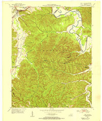 1953 Salt Lick1954 Print · USGSBath County at the start of the fifties shows a landscape where timber and rail define the community. Researchers can locate the C & O railroad through Salt Lick, the Tater Knob Lookout Tower, and burial sites like Dickerson Cem.2 unique versions available
 - 1957 Map of Huntington, 1966 Print
 1957 Huntington1966 Print · USGSThe industrial heart of the Ohio River valley is captured here in the mid-sixties, showing the growth of Huntington and Ashland. Researchers can trace the extensive rail networks of the Chesapeake and Ohio RR and locate sites like the Chief Cornstalk Hunting Ground.3 unique versions available
 - 1957 Map of Jenkins, 1974 Print
 1957 Jenkins1974 Print · USGSThe Cumberland Plateau in the mid-twentieth century reveals a complex landscape of winding river valleys and deep-seated industry. Genealogists and historians can trace the development of Hazard, Jenkins, and Pikeville alongside extensive Numerous Oil and Gas Fields and the routes of the Chesapeake & Ohio Railway.
 - 1960 Map of Jenkins
 1960 Jenkins1960 Print · USGSEastern Kentucky and the West Virginia borderlands are captured at a mid-century peak of the coal and rail era. Trace the industrial corridors of the Chesapeake and Ohio RR through mountain hubs like Hazard and Jenkins.
 - 1960 Map of Huntington
 1960 Huntington1960 Print · USGSThe tri-state river valley thrived in the late fifties as a hub of heavy industry and Appalachian rail transit. Genealogists and historians can trace the connection between river towns like Ashland and Portsmouth or locate family homesteads near Coleman Ridge.
 - 1965 Map of Hazel Green, 1967 Print
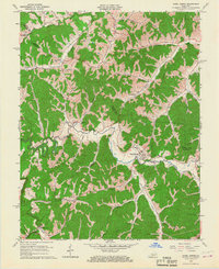 1965 Hazel Green1967 Print · USGSThe Red River Valley in the mid-1960s reveals a rural landscape defined by narrow hollows and ridge-line communities along the Morgan and Wolfe County line. Researchers can locate specific family-named landmarks and institutions like the Hazel Green Academy, Flat Rock Ch, and early Oil Wells.3 unique versions available
 - 1966 Map of Pomeroyton, 1968 Print
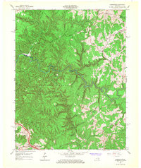 1966 Pomeroyton1968 Print · USGSThe Red River Gorge area comes to life in the mid-sixties, highlighting the rugged settlement patterns of Wolfe and Menifee Counties. Trace local landmarks like the Dessie Scott Childrens Home, Calaboose Sch, and geological wonders from Sky Bridge to Tower Rock.4 unique versions available
 - 1966 Map of Slade, 1968 Print
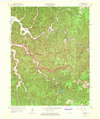 1966 Slade1968 Print · USGSThe Red River Gorge region comes alive in the mid-1960s as new highways began to meet traditional mountain settlements. Genealogists and hikers can trace old homesites near Nada, locate the Middle Fork Ch, or follow the path of the Mountain Central Railroad.2 unique versions available
Showing maps 1-25 of 84
Top cities of Menifee County
Frequently asked questions
- What are the different types of historical maps available for Menifee County?
- What is the oldest map of Menifee County?
- Where can I purchase historical maps of Menifee County for my home or office?
- Where can I download high-res historical maps of Menifee County?
- Are there historical topographic maps available for Menifee County?
- Is there historical aerial imagery available for Menifee County?
- Where are historical maps of Menifee County sourced from?