
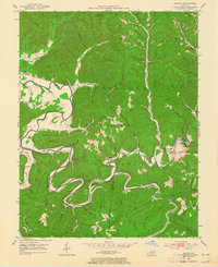
1953 Map of Bangor
USGS Topo · Published 1954About this map
The Cumberland National Forest dominates this mid-century survey of Rowan County, where the serpentine Licking River carves a deep path through the plateau. Small settlements and rural community hubs are scattered across the winding hollows, including Bangor, Alfrey, and Zilpo. The landscape is marked by a network of one-room schools such as Mt Hope Sch and Donahue Sch, which served families living along branches like Cave Br and Pound Br. Significant infrastructure of the era is represented by the Poppin Rock Tunnel near Paragon, while landmarks like Lockeegee Rock and Wilson Hill provide prominent elevation points. The river serves as a primary boundary, dividing Rowan from Menifee and Bath counties, with several fords and crossings like Cassidy Ford Hollow indicating the local transportation patterns before modern bridge networks were fully established.
Find a feature on this map
72 named features on this map. Tap any name to fly to it.
Don’t see what you’re looking for? This feature index may not catch every label — zoom into the map to look around manually.
Map Details
Editions of this 1953 Bangor Map
2 editions found
Other maps of this area

1889 · Salyersville
USGS Topo · 1:125,000

1891 · Salyersville
USGS Topo · 1:125,000

1892 · Beattyville
USGS Topo · 1:125,000

1899 · Salyersville
USGS Topo · 1:125,000

1929 · Morehead
USGS Topo · 1:48,000

1929 · Salt Lick
USGS Topo · 1:62,500

1934 · Salt Lick
USGS Topo · 1:62,500

1935 · Morehead
USGS Topo · 1:62,500

1951 · Ezel
USGS Topo · 1:24,000
1951 · West Liberty
USGS Topo · 1:24,000