2020s Maps of Menifee County, Kentucky
Explore 10 historic maps of Menifee County from the 2020s. These maps offer a rare glimpse into what life looked like during the 2020s — showing old roads, neighborhoods, homes, and landmarks that have changed or disappeared over time.
Whether you're researching your family's past, planning a metal detecting trip, or studying how Menifee County's landscape evolved across the 2020s, these high-resolution maps are a powerful tool for exploring the history of this region.
- Focus on a specific era: All maps on this page are from the 2020s, giving you a focused view of this time period.
- See what’s changed: Compare century-old streets, trails, and buildings to today's modern landscape using overlays and satellite layers.
- Research with precision: Use these maps for genealogy, historical research, land use analysis, or educational projects.
- View, download, or print: Maps are fully viewable online in high resolution, and can be downloaded or printed for your own records.
Start exploring Menifee County's history through authentic maps from the 2020s. This is your window into the past.
Menifee County, KY maps
(10)- 2022 Map of Olympia, 2022 Print
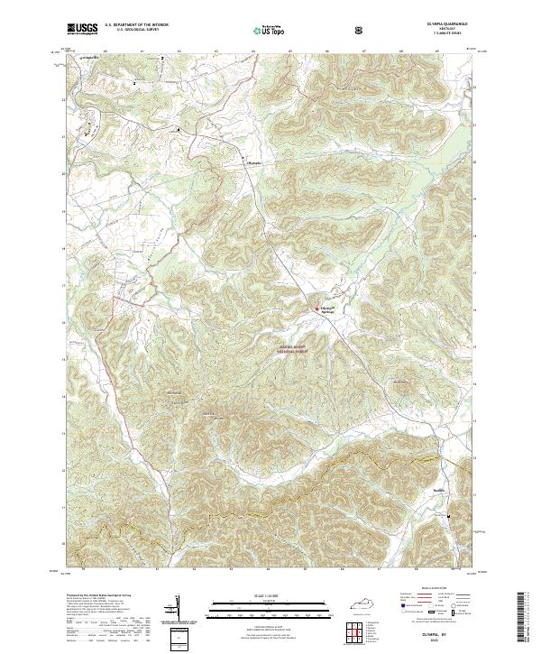 2022 Olympia2022 Print · USGSThe Bath County hills come alive in this recent survey, showing the deep hollows and forest boundaries of the eastern Kentucky landscape. Researchers can trace family sites like Shrout Cem and Terrell Cem or explore the settlements of Olympia Springs and Sudith.
 - 2022 Map of Means, 2022 Print
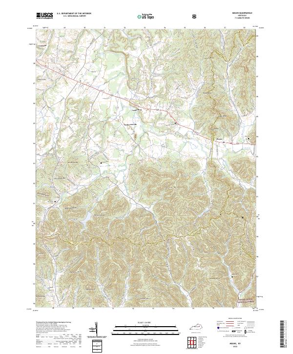 2022 Means2022 Print · USGSEastern Kentucky's rugged knob country is meticulously detailed here during the early 2020s. Researchers can trace ancestral sites at Myers Cem and Wills Cem or explore the winding reaches of Slate Creek and the Daniel Boone National Forest.
 - 2022 Map of Frenchburg, 2022 Print
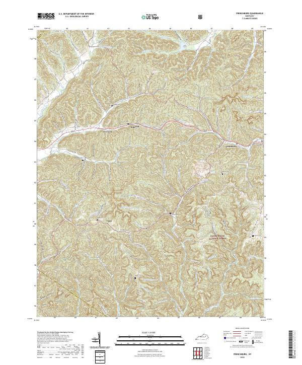 2022 Frenchburg2022 Print · USGSFrenchburg and the surrounding Menifee County hollows are captured here during a period of modern stability. Genealogists can trace local ancestry through numerous remote burial sites like Fagan Cem and Patrick Cem or along family-named ridges like Amos Ridge.
 - 2022 Map of Ezel, 2022 Print
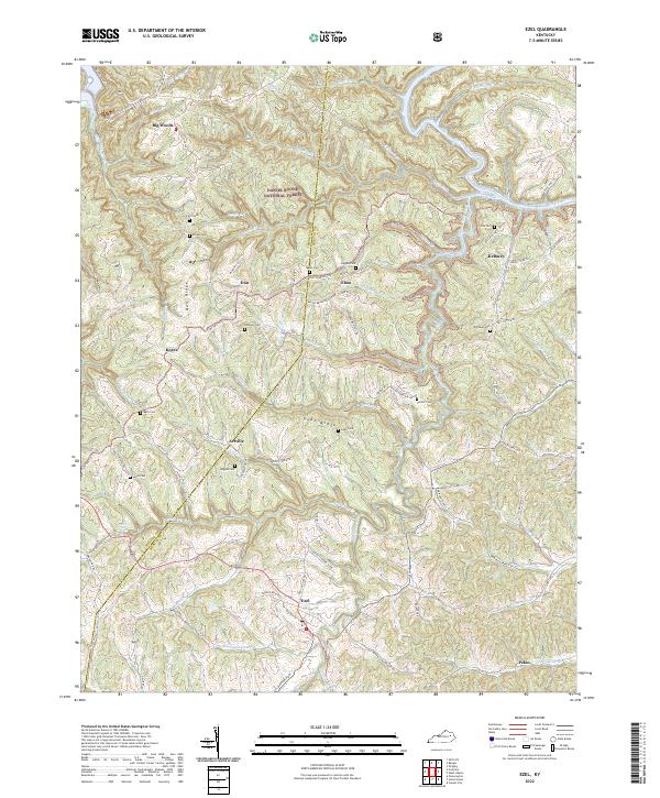 2022 Ezel2022 Print · USGSThe Licking River valley in eastern Kentucky is shown here in the early 2020s, dominated by forest and small rural hamlets. Family historians can trace several burial sites including Sexton Cem and Whitaker Cem near the communities of Ezel and Kellacey.
 - 2022 Map of Hazel Green, 2022 Print
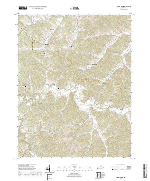 2022 Hazel Green2022 Print · USGSSettled along the winding Red River in the early twenty-first century, this area of Wolfe County maintains its rural character. Genealogists can trace family heritage through sites like Osborne Family Cem, Pieratt Cem, and the community of Stillwater.
 - 2022 Map of Scranton, 2022 Print
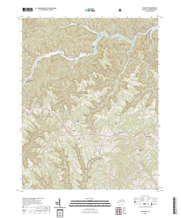 2022 Scranton2022 Print · USGSMenifee County's ridge-and-hollow terrain is captured here in the early twenty-first century, showcasing the rural communities and forest lands of eastern Kentucky. Researchers can locate many local family landmarks, including Ingram Cem, Denniston Cem, and settlements like Wellington and Scranton.
 - 2022 Map of Slade, 2022 Print
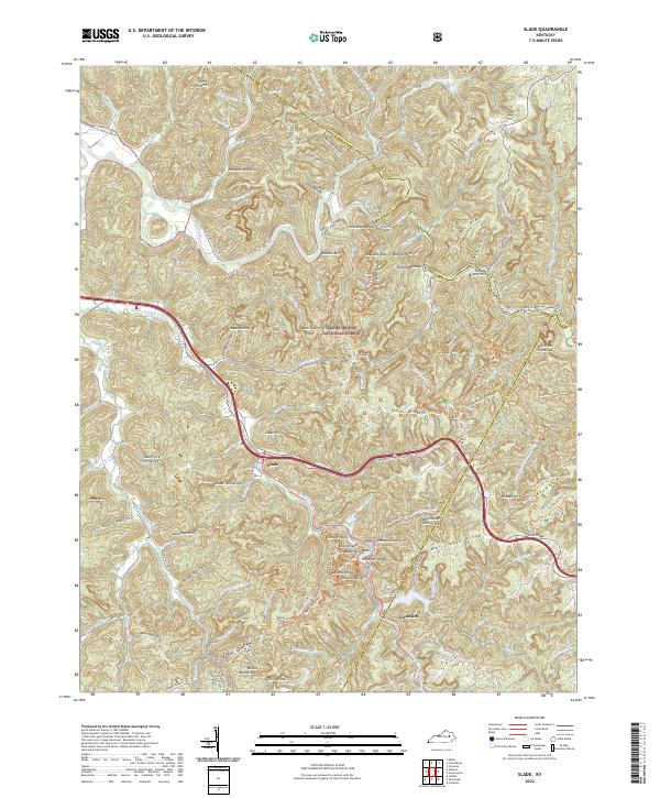 2022 Slade2022 Print · USGSThe Red River Gorge comes into sharp focus during the 2020s, showing the intersection of Daniel Boone National Forest and the community of Slade. Outdoor researchers and geologists can trace numerous stone features like Double Arch, Ravens Window, and the Nada Arches.
 - 2022 Map of Salt Lick, 2022 Print
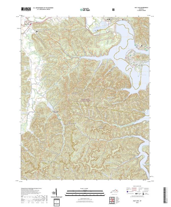 2022 Salt Lick2022 Print · USGSThe foothills of eastern Kentucky are preserved here in the early twenty-first century as the Licking River valley transitions into a forest of ridges and hollows. You can trace family burial grounds at Carey Hill Cem, explore the legacy of Clear Creek Furnace, and follow the long path of the Sheltowee Trace Trl.
 - 2022 Map of Pomeroyton, 2022 Print
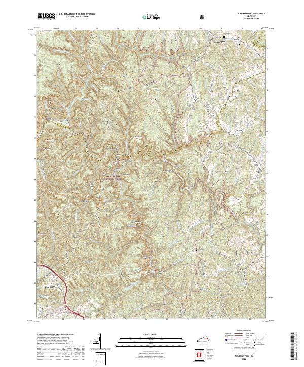 2022 Pomeroyton2022 Print · USGSThe northern edge of the Daniel Boone National Forest comes into sharp focus here in the early twenty-first century. Researchers can locate family roots at Pomeroyton Cem or trace landmarks like Cloud Splitter, Sky Bridge, and Rock Bridge Arch.
 - 2022 Map of Bangor, 2022 Print
 2022 Bangor2022 Print · USGSThe ridges of eastern Kentucky are captured here in the twenty-first century, showing the intersection of the Daniel Boone National Forest and local hamlets. Trace family roots at Mount Hope Cem or Roll-Alfrey Cem while exploring the hollows around Bangor.
End of results
Showing maps 1-10 of 10
Top cities of Menifee County
Frequently asked questions
- What are the different types of historical maps available for Menifee County?
- What is the oldest map of Menifee County?
- Where can I purchase historical maps of Menifee County for my home or office?
- Where can I download high-res historical maps of Menifee County?
- Are there historical topographic maps available for Menifee County?
- Is there historical aerial imagery available for Menifee County?
- Where are historical maps of Menifee County sourced from?