1960s Maps of Morgan County, Kentucky
Explore 13 historic maps of Morgan County from the 1960s. These maps offer a rare glimpse into what life looked like during the 1960s — showing old roads, neighborhoods, homes, and landmarks that have changed or disappeared over time.
Whether you're researching your family's past, planning a metal detecting trip, or studying how Morgan County's landscape evolved across the 1960s, these high-resolution maps are a powerful tool for exploring the history of this region.
- Focus on a specific era: All maps on this page are from the 1960s, giving you a focused view of this time period.
- See what’s changed: Compare century-old streets, trails, and buildings to today's modern landscape using overlays and satellite layers.
- Research with precision: Use these maps for genealogy, historical research, land use analysis, or educational projects.
- View, download, or print: Maps are fully viewable online in high resolution, and can be downloaded or printed for your own records.
Start exploring Morgan County's history through authentic maps from the 1960s. This is your window into the past.
Morgan County, KY maps
(13)- 1960 Map of Jenkins
 1960 Jenkins1960 Print · USGSEastern Kentucky and the West Virginia borderlands are captured at a mid-century peak of the coal and rail era. Trace the industrial corridors of the Chesapeake and Ohio RR through mountain hubs like Hazard and Jenkins.
 - 1960 Map of Huntington
 1960 Huntington1960 Print · USGSThe tri-state river valley thrived in the late fifties as a hub of heavy industry and Appalachian rail transit. Genealogists and historians can trace the connection between river towns like Ashland and Portsmouth or locate family homesteads near Coleman Ridge.
 - 1962 Map of Redbush, 1964 Print
 1962 Redbush1964 Print · USGSJohnson and Lawrence counties are shown during a period of active energy extraction in the early sixties. Researchers can trace rural lineages through local landmarks like Win Po, the Martha Pool gas fields, and Point Pleasant Ch.3 unique versions available
 - 1962 Map of Sandy Hook, 1964 Print
 1962 Sandy Hook1964 Print · USGSSandy Hook and the surrounding hollows of Elliott County are captured here in the early sixties. Genealogists and historians can trace family-named locations such as Neal Howard Creek and find rural landmarks like Carter Sch or Bell City.4 unique versions available
 - 1962 Map of Salyersville North, 1964 Print
 1962 Salyersville North1964 Print · USGSMagoffin County in the early sixties shows a landscape of deep hollows and ridge-top communities tied to the Licking River. Researchers can trace rural landmarks like the Beech Grove Sch, Buffalo Ch, and the family-named Franklin Cem.3 unique versions available
 - 1962 Map of Dingus, 1964 Print
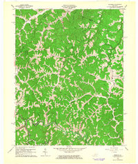
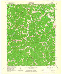
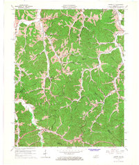
 1962 Dingus1964 Print · USGSMorgan County in the early sixties remains a landscape of deep hollows and ridge-top cemeteries connected by the waters of Paint Creek. Researchers can trace family history through local landmarks like White Oak Sch and the Strip Mine or Oil Well sites.4 unique versions available
 - 1962 Map of Oil Springs, 1964 Print
 1962 Oil Springs1964 Print · USGSIn the early sixties, the rugged intersection of Johnson and Magoffin counties was a landscape of remote post offices and ridge-top lookouts. Genealogists can trace old homesteads near Manila PO or locate the Stuffley Knob Lookout Tower and Pigeon Sch in the deep hollows.3 unique versions available
 - 1962 Map of Isonville, 1964 Print
 1962 Isonville1964 Print · USGSThe hill country of Elliott County appears here in the early sixties, showing a landscape defined by deep hollows and creek-bed settlements. Genealogists and researchers can trace family landmarks like Fraley Chapel, Peters Hill, and the old Roscoe Sch.3 unique versions available
 - 1965 Map of White Oak, 1967 Print
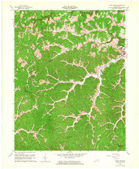
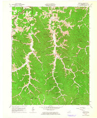
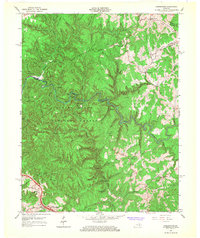
 1965 White Oak1967 Print · USGSMagoffin and Morgan Counties in the mid-1960s reveal a landscape shaped by coal mining and narrow river valleys. Researchers can trace rural life through the Hensley Sch, the community of Wonnie, and the numerous strip mines along the Licking River.
 - 1965 Map of Seitz, 1967 Print
 1965 Seitz1967 Print · USGSThe hill country of eastern Kentucky in the mid-sixties is shown here just as new parkways began to cut through the isolated hollows of Magoffin County. Genealogists and researchers can locate family landmarks such as the Cutuno Burton Cem, Wagers Sch, and the community of Seitz.2 unique versions available
 - 1965 Map of Cannel City, 1967 Print
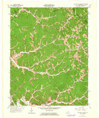
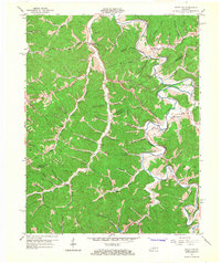
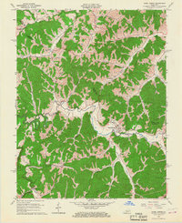
 1965 Cannel City1967 Print · USGSThe Cumberland Plateau of Morgan and Wolfe Counties is shown here in the mid-sixties as the PARKWAY began to modernize the region. Genealogists can trace family names and small hubs like Cannel City, Salem (Buskirk PO), and Mize along with numerous hilltop oil wells.3 unique versions available
 - 1965 Map of Hazel Green, 1967 Print
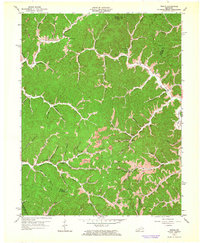
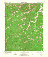
 1965 Hazel Green1967 Print · USGSThe Red River Valley in the mid-1960s reveals a rural landscape defined by narrow hollows and ridge-line communities along the Morgan and Wolfe County line. Researchers can locate specific family-named landmarks and institutions like the Hazel Green Academy, Flat Rock Ch, and early Oil Wells.3 unique versions available
 - 1966 Map of Pomeroyton, 1968 Print
 1966 Pomeroyton1968 Print · USGSThe Red River Gorge area comes to life in the mid-sixties, highlighting the rugged settlement patterns of Wolfe and Menifee Counties. Trace local landmarks like the Dessie Scott Childrens Home, Calaboose Sch, and geological wonders from Sky Bridge to Tower Rock.4 unique versions available
End of results
Showing maps 1-13 of 13
Top cities of Morgan County
Frequently asked questions
- What are the different types of historical maps available for Morgan County?
- What is the oldest map of Morgan County?
- Where can I purchase historical maps of Morgan County for my home or office?
- Where can I download high-res historical maps of Morgan County?
- Are there historical topographic maps available for Morgan County?
- Is there historical aerial imagery available for Morgan County?
- Where are historical maps of Morgan County sourced from?