Old Maps of Morgan County, Kentucky for Hiking & Exploration
Hike through history with 140 historic maps of Morgan County. Explore old trails, ghost towns, and forgotten backroads — perfect for outdoor adventurers and local explorers.
- Rediscover forgotten places: Map out old mining camps, roads, and footpaths that no longer exist on modern maps.
- Layer with modern tools: Combine with LiDAR or satellite views to plan hikes through historical terrain.
- Made for exploration: Popular among hikers, overlanders, and local history lovers.
Use these maps to find adventure and explore the hidden past of Morgan County.
Morgan County, KY maps
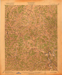
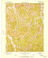
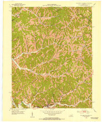
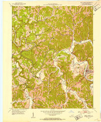
(140)- 1886 Map of Prestonsburg
 1886 Prestonsburg1886 Print · USGSEastern Kentucky's river-and-rail economy is captured here in the late nineteenth century as steam power reached deep into the mountains. Genealogists can trace family homesteads near Prestonburgh, Paintsville, and early settlements like Peach Orchard or Boon's Camp.
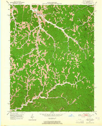
 - 1889 Map of Salyersville, 1949 Print
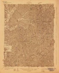
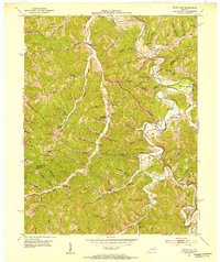
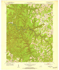
 1889 Salyersville1949 Print · USGSEastern Kentucky at the close of the nineteenth century reveals a complex landscape of river-valley settlements and highland hollows. Genealogists can trace early homesteads and communities like Salyersville, Hazel Green, and Jackson along the winding Licking River and Quicksand Creek.
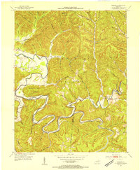
 - 1891 Map of Salyersville
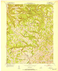
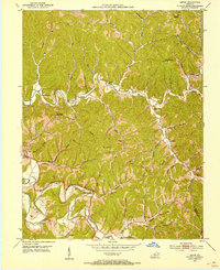
 1891 Salyersville1891 Print · USGSEastern Kentucky's rugged plateau is captured in the late nineteenth century as small river towns and remote hollows defined the region. Genealogists can trace family roots through mountain settlements like Salyersville, Hazel Green, and Maytown along the Licking River.2 unique versions available
 - 1892 Map of Prestonsburg
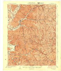
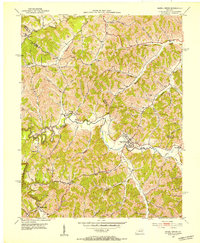
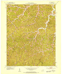
 1892 Prestonsburg1892 Print · USGSEastern Kentucky is shown in the late nineteenth century as a landscape of river-centered trade and early mountain settlement. Genealogists and historians can trace family-named locations like Laynesville, Oil Spring, and the post office at Eden (Inez P.O.).4 unique versions available
 - 1892 Map of Beattyville
 1892 Beattyville1892 Print · USGSThe Kentucky River and its headwaters define this late nineteenth-century survey of the rugged Cumberland Plateau. Researchers can trace the early industrial sites of Estill Furnace and Fitchburg Furnace alongside the path of the Kentucky Union Railroad.6 unique versions available
 - 1899 Map of Salyersville
 1899 Salyersville1899 Print · USGSEastern Kentucky's mountain communities were well-established along the winding river forks at the turn of the century. Genealogists and local historians can trace family-named landmarks and old settlements like Hazel Green, Ezel, and West Liberty along the Licking River.4 unique versions available
 - 1915 Map of Paintsville
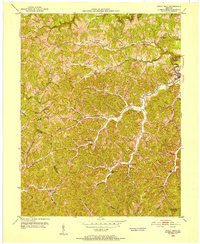
 1915 Paintsville1915 Print · USGSEastern Kentucky during the first World War is captured here as the river-and-rail economy takes hold. Genealogists can trace family names through dozens of rural school districts and communities like Flatgap, Van Lear, and Staffordsville.
 - 1917 Map of Paintsville
 1917 Paintsville1917 Print · USGSEastern Kentucky during the first World War is meticulously documented here, showing the densely packed hollows of Johnson County. Genealogists can trace family roots through numerous numbered schools and rural settlements like Oil Springs, Flat Gap, and Hager Hill PO Johnson Sta.3 unique versions available
 - 1929 Map of Morehead
 1929 Morehead1929 Print · USGSRowan and Morgan counties were centers of rail and clay production when this late-1920s survey was conducted. Local historians can locate early post offices like Elliottville PO (Hogtown) and trace the paths of the Chesapeake and Ohio through the Clack Mtn Tunnel.
 - 1935 Map of Morehead
 1935 Morehead1935 Print · USGSIn the mid-1930s, the mountain hollows around Morehead were connected by a dense network of country schools and the Chesapeake and Ohio railroad. Trace family sites at Blairs Mills PO, Zilpo, and the tunnels through Clack Mountain.
 - 1950 Map of Isonville, 1952 Print
 1950 Isonville1952 Print · USGSMid-century Elliott County is mapped here during a period of active rural life and early oil exploration. Researchers can trace ancestral locations through numerous schools like Fairview Sch and landmarks including Peters Hill Lookout Tower and Isonville.
 - 1950 Map of Sandy Hook, 1952 Print
 1950 Sandy Hook1952 Print · USGSThe hills of Elliott County were home to a dense network of valley settlements and country schools in the early fifties. Genealogists can trace family-named landmarks and rural hubs like Sandy Hook, Redwine, and Fannin Sch.
 - 1950 Map of Lenox, 1953 Print
 1950 Lenox1953 Print · USGSMorgan County in the early fifties is captured here through its intricate river valleys and remote ridge-top settlements. Researchers can locate numerous family-named landmarks like Adkins Cem, the community at Cottle Bend, and the historic Gordon Ford.
 - 1951 Map of Cannel City, 1952 Print
 1951 Cannel City1952 Print · USGSThe Morgan and Wolfe County borderlands come to life in the early fifties, showing a landscape defined by narrow hollows and ridge-top knobs. Genealogists can locate family landmarks like Wells Cem or trace the old post offices at Buskirk (P O) and Insko (PO).
 - 1951 Map of White Oak, 1953 Print
 1951 White Oak1953 Print · USGSMagoffin and Morgan counties are shown in the early fifties as traditional rural life met the growing extraction industry. Genealogists can locate family landmarks like Millard Cem and Patrick Cem or early schoolhouses such as Trace Fork Sch.
 - 1951 Map of Ezel, 1953 Print
 1951 Ezel1953 Print · USGSMorgan County is shown in the early fifties as a landscape of deep hollows and high timber within the Cumberland National Forest. Researchers can trace old family names and community centers through sites like Ezel, Broke Leg Falls, and Whites Branch Sch.2 unique versions available
 - 1951 Map of Hazel Green, 1953 Print
 1951 Hazel Green1953 Print · USGSHazel Green and the surrounding hollows of Wolfe and Morgan counties are shown here in the early fifties. Local historians can trace the foundations of these communities through landmarks like the Hazel Green Academy, the Flat Rock Ch, and the Sandfield Sch.
 - 1951 Map of Dingus, 1953 Print
 1951 Dingus1953 Print · USGSThe Morgan County backcountry in the early fifties reveals a network of tight-knit hollows defined by the coal and creek-bottom economy. Researchers can trace family history through numerous rural landmarks like Peddler Gap Sch, Lenton Ch, and the Daniel Cem.
 - 1951 Map of Salyersville North, 1953 Print
 1951 Salyersville North1953 Print · USGSMagoffin County was a landscape of remote mountain schoolhouses and family cemeteries in the early fifties. Local historians can trace dozens of rural landmarks, from Salyersville on the Licking River to the numerous Oil Wells and the Rockhouse Ch in the northern hollows.
 - 1951 Map of Pomeroyton, 1953 Print
 1951 Pomeroyton1953 Print · USGSThe winding Red River corridor defines this 1950s look at Wolfe County, Kentucky. Genealogists and local historians can locate early homesteads and trace rural life around the settlements of Pomeroyton and Valeria.2 unique versions available
 - 1951 Map of Lenox, 1953 Print
 1951 Lenox1953 Print · USGSMorgan County's river valleys and ridgelines are captured here in the early fifties, showing a rural landscape organized around its creeks and hollows. Genealogists can locate family landmarks like Cottle Cem, Patton Cem, and the crossing at Gordon Ford.2 unique versions available
 - 1951 Map of Seitz, 1953 Print
 1951 Seitz1953 Print · USGSMagoffin County at mid-century reveals a landscape of isolated hollows and creek-side communities before major modernization. Genealogists can trace family landmarks and schools like Puncheon Cem, Wagers Sch, and the settlements at Seitz and Netty.
 - 1951 Map of West Liberty, 1953 Print
 1951 West Liberty1953 Print · USGSMorgan County life centered on the winding Licking River during the early fifties, showing a tightly knit network of ridge-top farms and valley settlements. Genealogists can locate family landmarks such as Grassy Valley Ch and numerous burial sites like Henry Cem or Fugitt Cem.2 unique versions available
 - 1951 Map of Lee City, 1965 Print
 1951 Lee City1965 Print · USGSWolfe County in the early fifties is captured here as a landscape of tight-knit hollows and ridge-line communities. Genealogists and local historians can trace family locations through numerous landmarks like Wheel Rim (Elam Cem), Magoffin Institute, and Lee City.
 - 1953 Map of Bangor, 1954 Print
 1953 Bangor1954 Print · USGSRowan County in the early fifties is defined by the winding Licking River and the small upland communities of the Cumberland National Forest. Researchers can locate several rural schools like Cave Branch Sch and unusual landmarks such as Poppin Rock Tunnel.2 unique versions available
Showing maps 1-25 of 140
Top cities of Morgan County
Frequently asked questions
- What are the different types of historical maps available for Morgan County?
- What is the oldest map of Morgan County?
- Where can I purchase historical maps of Morgan County for my home or office?
- Where can I download high-res historical maps of Morgan County?
- Are there historical topographic maps available for Morgan County?
- Is there historical aerial imagery available for Morgan County?
- Where are historical maps of Morgan County sourced from?