2020s Maps of Russell County, Kentucky
Explore 13 historic maps of Russell County from the 2020s. These maps offer a rare glimpse into what life looked like during the 2020s — showing old roads, neighborhoods, homes, and landmarks that have changed or disappeared over time.
Whether you're researching your family's past, planning a metal detecting trip, or studying how Russell County's landscape evolved across the 2020s, these high-resolution maps are a powerful tool for exploring the history of this region.
- Focus on a specific era: All maps on this page are from the 2020s, giving you a focused view of this time period.
- See what’s changed: Compare century-old streets, trails, and buildings to today's modern landscape using overlays and satellite layers.
- Research with precision: Use these maps for genealogy, historical research, land use analysis, or educational projects.
- View, download, or print: Maps are fully viewable online in high resolution, and can be downloaded or printed for your own records.
Start exploring Russell County's history through authentic maps from the 2020s. This is your window into the past.
Russell County, KY maps
(13)- 2022 Map of Creelsboro, 2022 Print
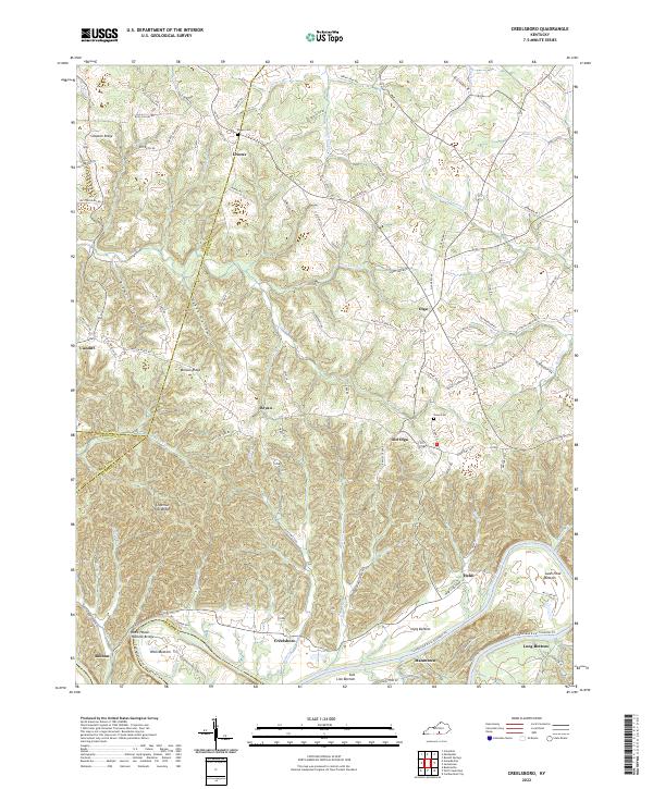 2022 Creelsboro2022 Print · USGSThe Kentucky riverlands near the Cumberland come alive in this recent survey. Researchers can locate the Rock House Natural Bridge or trace family lineages near Old Olga and the Ragen Cem.
 - 2022 Map of Amandaville, 2022 Print
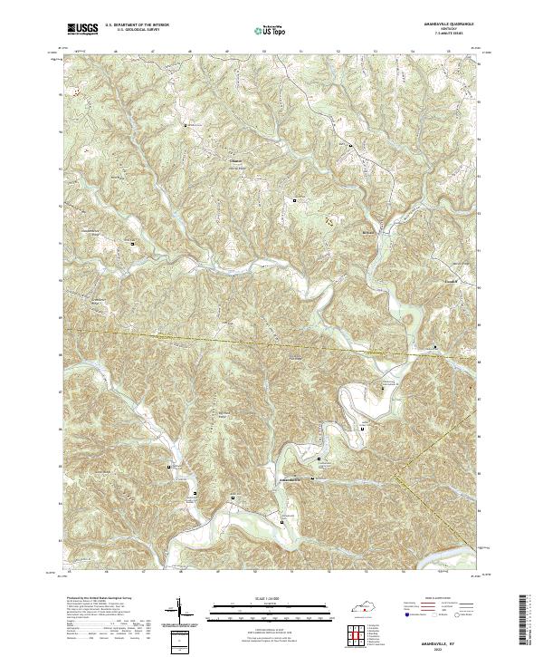 2022 Amandaville2022 Print · USGSAdair and Cumberland Counties in the early 2020s remain defined by their winding creek bottoms and high ridges. Genealogists can trace family legacies at Amandaville Cem, Duvall Cem, and many numbered sites along the Cumberland River.
 - 2022 Map of Mill Springs, 2022 Print
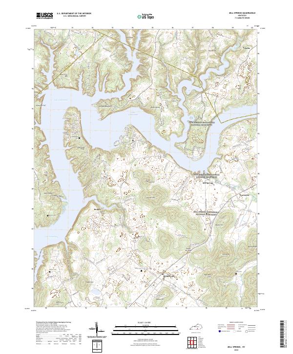 2022 Mill Springs2022 Print · USGSWayne County and the shores of Lake Cumberland are shown here in the 2020s, dominated by Civil War sites. You can trace the boundaries of the Mill Springs Battlefield National Monument or locate family burial grounds like Cumberland Cem and Norman Cem.
 - 2022 Map of Jabez, 2022 Print
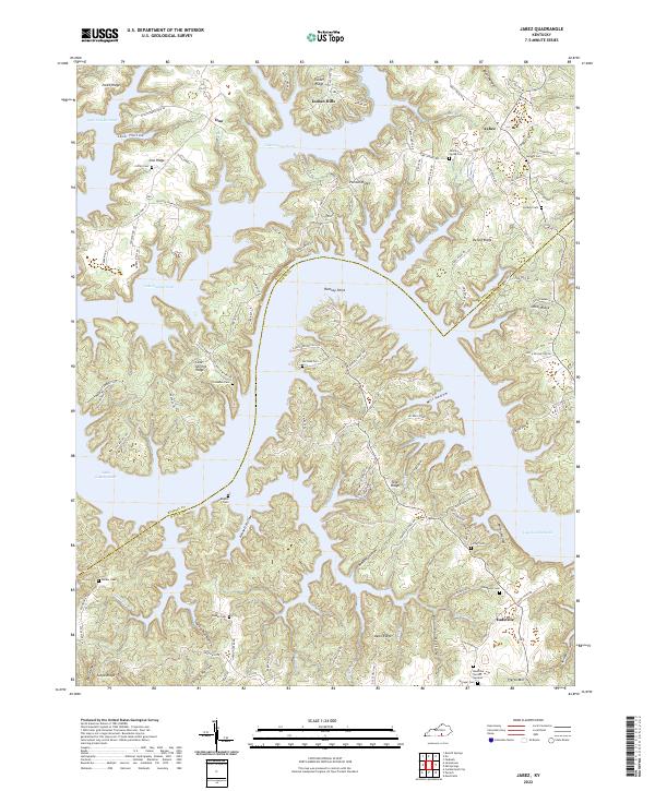 2022 Jabez2022 Print · USGSWayne and Russell counties are captured in this modern survey as the waters of Lake Cumberland weave through the hilly Kentucky terrain. Researchers can trace family history through numerous local sites like Eadsville, Stringer Cem, and Rogers Cem.
 - 2022 Map of Phil, 2022 Print
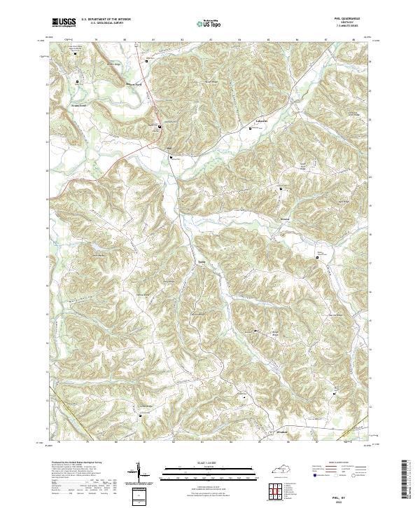 2022 Phil2022 Print · USGSIn the early twenty-first century, this pocket of Casey County remains defined by the winding Green River and its network of ridges. Genealogists can trace family roots through numerous small burial sites like Jones Graveyard, Carson Cem, and Williams Cem.
 - 2022 Map of Faubush, 2022 Print
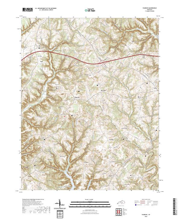 2022 Faubush2022 Print · USGSPulaski County near the Russell County line comes into focus in this recent survey of the Kentucky uplands. Researchers can trace family homesteads and local landmarks like Cooks Chapel Cemetery, Old Brown Knob, and the settlement of Faubush.
 - 2022 Map of Eli, 2022 Print
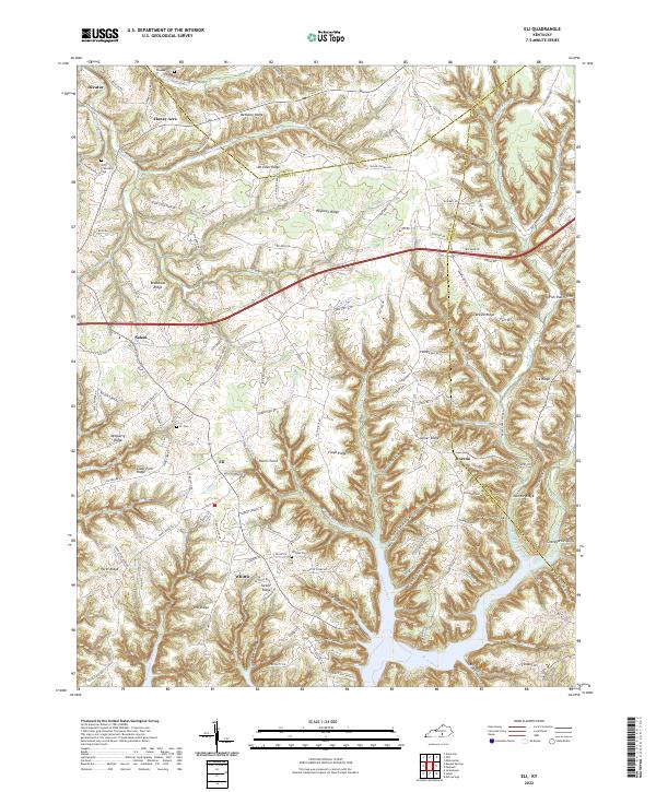 2022 Eli2022 Print · USGSRussell County's high ridges and the deep inlets of Lake Cumberland are captured here in the early twenty-first century. Genealogists can trace family landmarks and burial sites like Whittle Cem and the Old Friendship Cem among the hollows of Eli and Dorena.
 - 2022 Map of Dunnville, 2022 Print
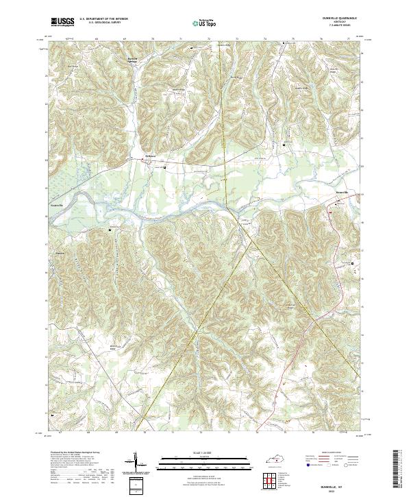 2022 Dunnville2022 Print · USGSAdair and Casey counties meet along the Green River in this modern survey of the Kentucky hills. Genealogists can trace family names at Thomastown Cem and Austin Cem or explore settlements like Dunnville and Pellyton.
 - 2022 Map of Montpelier, 2022 Print
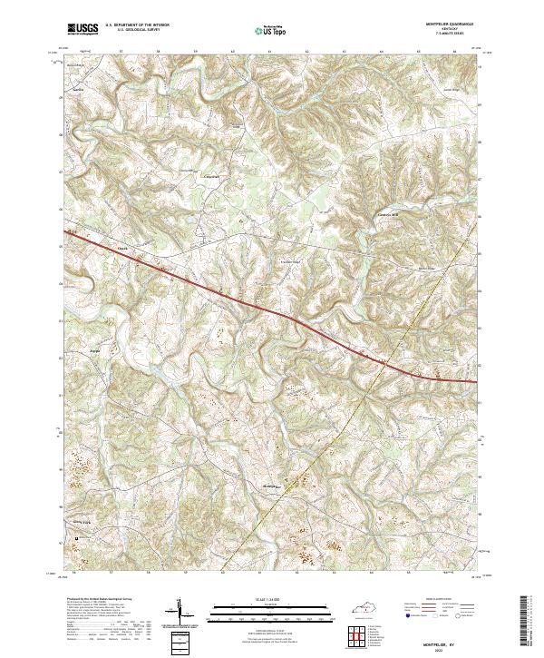 2022 Montpelier2022 Print · USGSAdair County's rural heartland is shown here in the modern era, where ridge-top communities and creek-side settlements still define the landscape. Local history researchers can trace family landmarks like Wesley Chapel, Gentrys Mill, and Tavern Spring Cem among the many winding hollows.
 - 2022 Map of Jamestown, 2022 Print
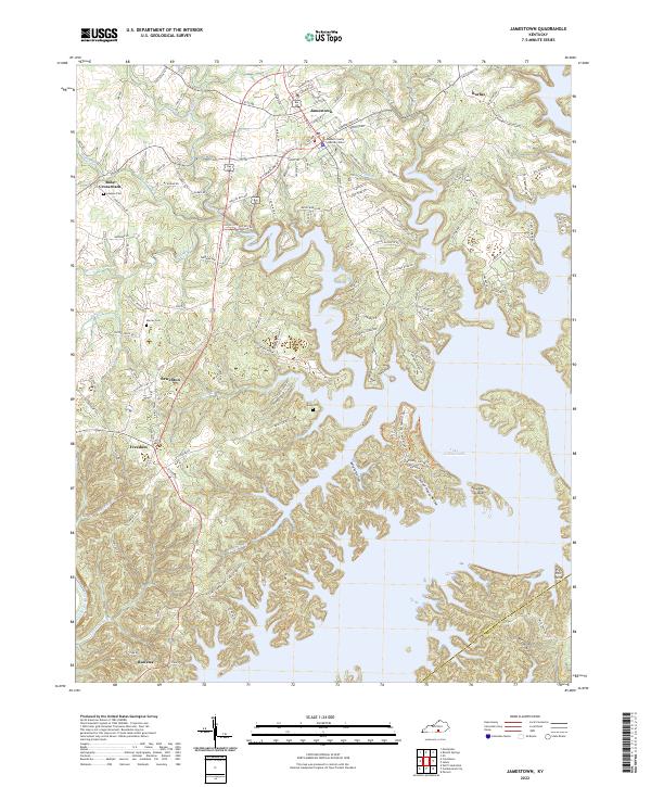 2022 Jamestown2022 Print · USGSJamestown and the northern reaches of Lake Cumberland are shown here in the early 2020s, highlighting the area's intricate shoreline and rural crossroads. Researchers can trace family roots at Keen Cemetery or explore the civic layout of Jamestown and Sewellton.
 - 2022 Map of Cumberland City, 2022 Print
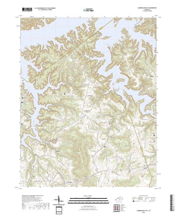 2022 Cumberland City2022 Print · USGSClinton County's rolling ridge country and the shores of Lake Cumberland appear here in the early twenty-first century. Genealogists can locate family landmarks such as McWhorter Cem, Walnut Grove Church, and the rural settlement of Cumberland City.
 - 2022 Map of Wolf Creek Dam, 2022 Print
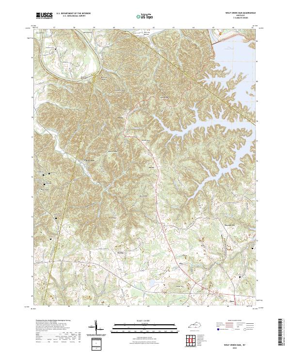 2022 Wolf Creek Dam2022 Print · USGSClinton and Russell counties appear here in the early 2020s, showing the intersection of ridge-top living and the deep Cumberland River valley. Researchers can locate family landmarks like the Reeder-Family Cem and the distinctive Seventy Six Falls near the old settlement of Seventy-Six.
 - 2023 Map of Russell Springs, 2023 Print
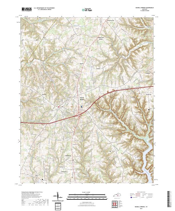 2023 Russell Springs2023 Print · USGSRussell County during the early twenty-first century reveals a landscape shaped by the Cumberland Parkway and the proximity of Lake Cumberland. Researchers can trace rural lineages through family landmarks like Hillcrest Cem and settlements such as Webbs Cross Roads and Fonthill.
End of results
Showing maps 1-13 of 13
Top cities of Russell County
Frequently asked questions
- What are the different types of historical maps available for Russell County?
- What is the oldest map of Russell County?
- Where can I purchase historical maps of Russell County for my home or office?
- Where can I download high-res historical maps of Russell County?
- Are there historical topographic maps available for Russell County?
- Is there historical aerial imagery available for Russell County?
- Where are historical maps of Russell County sourced from?